Download
Preview
Add to list
More
8.0 km
~2 hrs 38 min
615 m
Loop
“Experience Swiss history and alpine splendor on the Illgau loop trail, a medium-difficulty hiker's delight.”
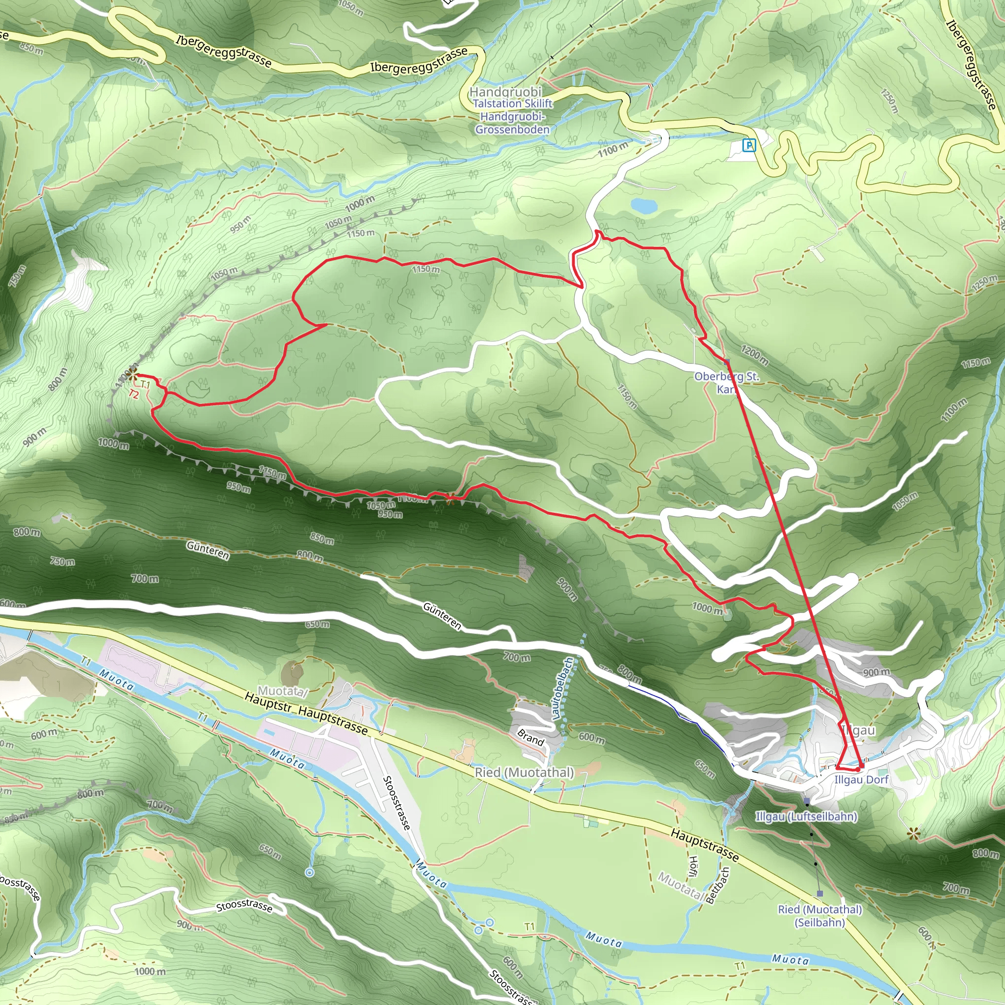
Embarking on the Illgau - St Karl - Fallenflue - Illgau trail, hikers will find themselves exploring the picturesque landscapes near Schwyz, Switzerland. This loop trail spans approximately 8 kilometers (about 5 miles) and features an elevation gain of around 600 meters (roughly 1968 feet), offering a medium difficulty level that is suitable for hikers with some experience.
Getting to the Trailhead To reach the starting point of the trail, travelers can either drive or use public transportation. For those driving, the trailhead is accessible from the town of Schwyz, which is well-connected by roads. Parking is available in the vicinity of the trailhead. If opting for public transport, hikers can take a bus from Schwyz's main station to Illgau, stepping off at the last stop, which is conveniently close to the trail's starting point.
The Hike Itself As you begin your hike, the initial ascent is a steady climb through lush meadows and alpine forests, offering glimpses of the surrounding peaks. The trail is well-marked, and hikers can use the HiiKER app to navigate the route confidently.
After approximately 2 kilometers (1.24 miles), you'll reach the small hamlet of St. Karl, which is known for its charming chapel. This area provides a serene spot to rest and enjoy the tranquility of the Swiss countryside.
Historical Significance The region is steeped in history, with the nearby town of Schwyz giving its name to the country. The area played a pivotal role in the formation of the Swiss Confederation, and hikers will be walking in the footsteps of the early Swiss patriots.
Flora and Fauna Continuing the ascent, the trail offers opportunities to observe the diverse flora and fauna of the region. Keep an eye out for local wildlife such as chamois and marmots, and during the spring and summer months, the meadows are adorned with a variety of wildflowers.
The Summit and Descent Upon reaching the summit of Fallenflue, hikers are rewarded with panoramic views of the Mythen peaks and Lake Lucerne. The summit, sitting at an elevation of around 1,500 meters (4,921 feet), is the perfect vantage point for breathtaking photographs.
The descent back to Illgau is less steep, winding through alpine pastures and offering a different perspective of the valley below. As you complete the loop, the quaint village of Illgau welcomes hikers back, signaling the end of the trail.
Preparation and Safety Before setting out, ensure you have appropriate gear, including sturdy hiking boots, weather-appropriate clothing, and sufficient water and snacks. Always check the weather forecast in advance, as mountain weather can be unpredictable.
Remember, while the trail is not considered highly difficult, the elevation gain and distance require a reasonable level of fitness. It's advisable to start early in the day to allow plenty of time to complete the hike at a comfortable pace.
By following these guidelines and being prepared, hikers can fully enjoy the natural beauty and historical significance of the Illgau - St Karl - Fallenflue - Illgau trail.
Comments and Reviews
User comments, reviews and discussions about the Illgau - St Karl - Fallenflue - Illgau, Switzerland.
average rating out of 5
0 rating(s)

