Download
Preview
Add to list
More
15.8 km
~2 days
1087 m
Multi-Day
“Experience the essence of the Swiss Alps on the scenic Muottas Muragl to Alp Languard trail, a journey through history and breathtaking landscapes.”
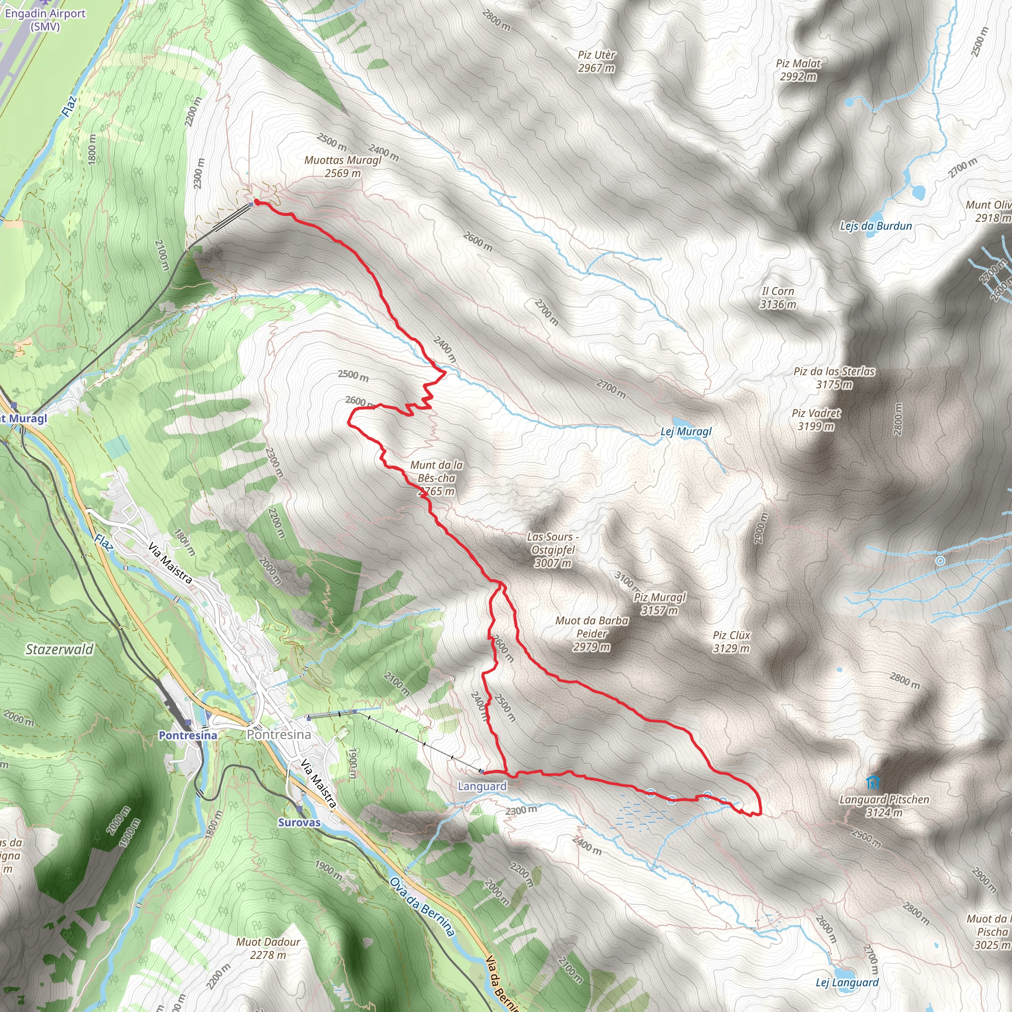
Embarking on the Muottas Muragl to Alp Languard trail, hikers will find themselves traversing approximately 16 kilometers (about 10 miles) of diverse landscapes with an elevation gain of around 1000 meters (3280 feet). This loop trail, nestled near Maloja in Switzerland, offers a medium difficulty rating and promises a rewarding experience for those with a moderate level of fitness.
Getting to the Trailhead
To reach the starting point of the hike, adventurers can either drive or use public transportation. For those opting for public transport, the nearest significant landmark is the Muottas Muragl funicular station, which is easily accessible from the St. Moritz train station. From there, the funicular provides a direct route to the trailhead, offering a scenic ascent before the hike even begins. If driving, parking is available near the funicular station, allowing for a convenient transition from vehicle to trail.
The Hike Itself
As you set out from the trailhead, the path leads you through a picturesque alpine environment, with the first section ascending through a forested area. The scent of pine and the sound of rustling leaves accompany hikers as they make their way upwards. After emerging from the treeline, the trail opens up to reveal stunning panoramic views of the Engadin valley and the surrounding peaks.
Continuing on, the path meanders through alpine meadows dotted with wildflowers during the summer months. The vibrant colors and the gentle hum of pollinating insects add to the serene atmosphere of the hike. As you progress, keep an eye out for local wildlife, including marmots, chamois, and ibexes, which are often spotted in this region.
Cultural and Historical Significance
The Engadin valley is steeped in history, with the trail offering glimpses into the past. The region has been a crossroads of cultures for centuries, and hikers may encounter historical landmarks such as ancient stone cairns and remnants of old shepherd's huts. These historical markers serve as a testament to the human presence in this landscape, dating back to when these paths were used for trade and communication.
Navigating the Trail
For navigation purposes, HiiKER is an excellent tool to ensure you stay on the right path. The app provides detailed maps and waypoints, which are particularly useful for the sections of the trail that may be less clearly marked. It's advisable to download the trail map on HiiKER before setting out, as cell service can be spotty in the mountains.
Final Ascent and Descent
As the trail approaches its highest point, the ascent becomes more challenging, with some steep sections that require careful footing. Upon reaching the peak, hikers are rewarded with breathtaking views of the Bernina Range. The descent towards Alp Languard is gentler, with switchbacks easing the way down. This alpine pasture is a perfect spot for a rest or a picnic, with the Languard hut offering refreshments and a chance to refuel.
Return to the Trailhead
Completing the loop, the trail gradually descends back towards the starting point. The final stretch allows for reflection on the natural beauty and historical richness experienced along the way. As the Muottas Muragl funicular comes back into view, hikers can take pride in having completed a trail that encapsulates the essence of the Swiss Alps.
Preparation and Safety
Before embarking on this hike, ensure you are well-prepared with appropriate gear, including sturdy hiking boots, weather-appropriate clothing, and sufficient water and food. Always check the weather forecast in advance, as mountain conditions can change rapidly. Remember to respect the natural environment and stay on marked trails to preserve the delicate alpine ecosystem.
Comments and Reviews
User comments, reviews and discussions about the Muottas Muragl to Alp Languard, Switzerland.
average rating out of 5
0 rating(s)

