Download
Preview
Add to list
More
311.7 km
~9 days
4922 m
Multi-Day
“Traverse Switzerland's beauty and history on a 312-kilometer hike from Basel to Geneva.”
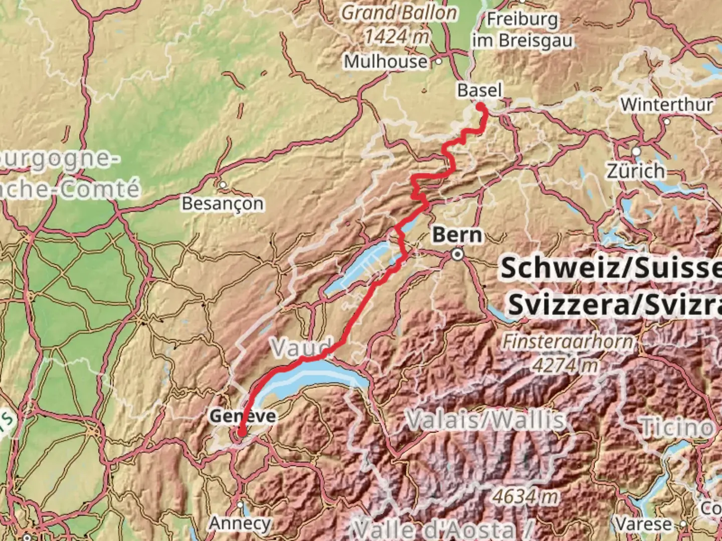
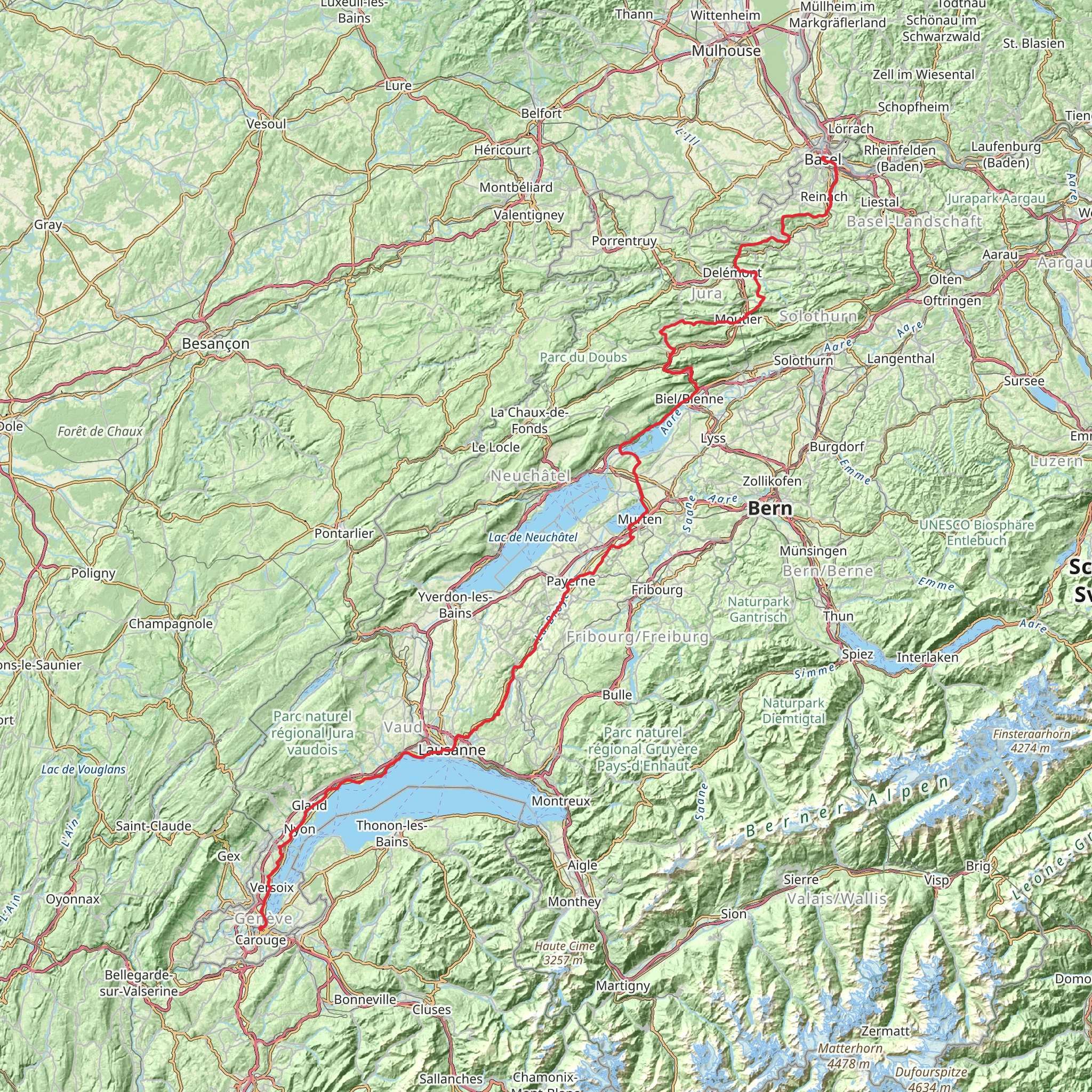
Embarking on the Camino Basel-Geneva via Biel, hikers will traverse approximately 312 kilometers (about 194 miles) across the diverse landscapes of Switzerland, with an elevation gain of around 4900 meters (approximately 16,076 feet). This point-to-point trail is a medium-difficulty journey that begins near the vibrant city of Basel.
Getting to the Trailhead
To reach the starting point near Basel, hikers can utilize the city's extensive public transportation network. From the Basel SBB railway station, one can take a bus or tram to the outskirts of the city, where the trailhead is located. For those driving, parking is available in the vicinity of the trailhead, which is typically near the St. Jakob-Park stadium.
The Journey Through History and Nature
As you set out from Basel, the trail meanders through the rolling Jura Mountains, offering a mix of pastoral landscapes and forested paths. The initial stages of the hike are characterized by gentle ascents and descents, allowing hikers to acclimate to the journey ahead.
Cultural Landmarks and Historical Sites
The Camino Basel-Geneva is rich in cultural heritage, passing through medieval towns and alongside ancient ruins. One of the early highlights is the Roman town of Augusta Raurica, located roughly 10 kilometers (about 6 miles) from Basel. Here, hikers can explore well-preserved amphitheaters and temples, gaining insight into Switzerland's Roman past.
Continuing on, the trail approaches the city of Biel/Bienne, situated at the 100-kilometer (62-mile) mark. This bilingual city is nestled at the foot of the Jura Mountains and is known for its watchmaking industry. The old town of Biel, with its charming streets and historical buildings, provides a perfect rest stop.
Natural Splendors and Wildlife
Beyond the urban landscapes, the Camino Basel-Geneva cuts through the Chasseral Regional Park. This section, with its high meadows and panoramic views, is a haven for wildlife enthusiasts. Keep an eye out for native birds of prey, such as the red kite, soaring above the ridgelines.
As the trail descends from the Jura Mountains, it skirts the shores of Lake Neuchâtel and Lake Geneva. These lakeside paths offer tranquil settings and opportunities to spot waterfowl and other aquatic species.
Navigating the Trail
Hikers can rely on HiiKER to navigate the trail, ensuring they stay on the correct path and can plan their stops accordingly. The app provides detailed maps and waypoints, which are essential for the longer, more remote sections of the hike.
Preparing for the Hike
Given the trail's length and varied terrain, it's important to prepare adequately. Hikers should pack layers to accommodate the changing weather conditions, especially in the higher elevations of the Jura Mountains. Sturdy hiking boots are a must, as the trail can be rocky and uneven in places.
Access to Supplies and Accommodations
Throughout the journey, there are numerous towns and villages where hikers can resupply and find accommodations. It's advisable to book lodgings in advance, particularly during the peak hiking season.
End of the Trail
The trail concludes in the cosmopolitan city of Geneva, where hikers can celebrate their accomplishment. Geneva's international airport and well-connected train station provide convenient options for onward travel or return trips.
Comments and Reviews
User comments, reviews and discussions about the Camino Basel-Geneva via Biel, Switzerland.
3.75
average rating out of 5
4 rating(s)
