Download
Preview
Add to list
More
933.5 km
~46 days
8833 m
Multi-Day
“Embark on the Camino Aragones, a historic trek rich in culture and Pyrenean splendor.”
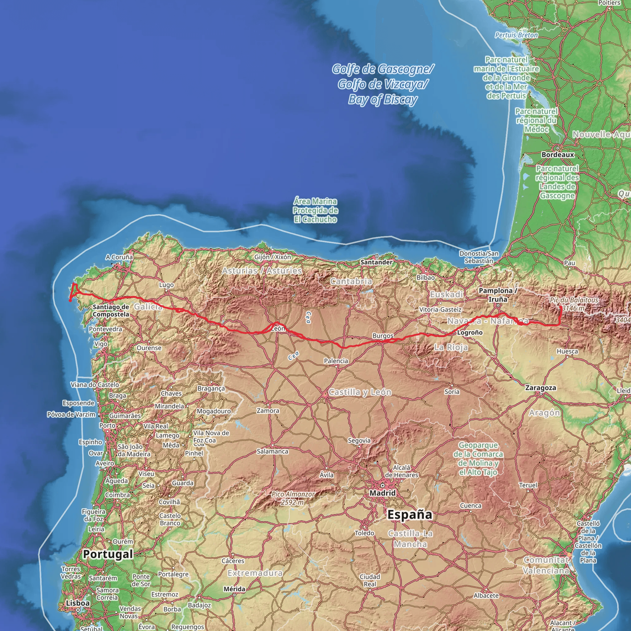
The Camino Aragones is a historic and scenic route that stretches approximately 934 kilometers (about 580 miles) with an elevation gain of around 8800 meters (approximately 28,870 feet). This point-to-point trail begins near the quaint village of Aisa in Spain, nestled in the Pyrenees mountains, and is part of the larger network of Camino de Santiago pilgrimage routes.
Getting to the Trailhead
To reach the starting point of the Camino Aragones, hikers can fly into Zaragoza or Pamplona and take public transportation or drive to Aisa. From Zaragoza, one can take a bus or train to Jaca, a nearby town, and then a taxi or local bus to Aisa. If driving, take the A-23 and N-330 to Jaca, followed by the local roads to Aisa, where the trailhead is located.
Trail Overview
The trail meanders through the diverse landscapes of the Aragon region, offering a mix of high mountain passes, rolling hills, and historic villages. The Camino Aragones is considered to have a medium difficulty rating, making it accessible to hikers with a reasonable level of fitness and experience.
Historical Significance
The Camino Aragones has deep historical roots, serving as a medieval pilgrimage route to the shrine of the apostle Saint James the Great in the cathedral of Santiago de Compostela in Galicia. The trail is dotted with ancient monasteries, churches, and landmarks that reflect its religious and cultural importance.
Landmarks and Nature
As hikers embark on this journey, they will encounter the Monastery of San Juan de la Peña, a historic site perched on a cliff edge with stunning views and rich history. The trail also passes through the city of Jaca, known for its Romanesque cathedral and the 11th-century fortification, the Citadel of Jaca.
The path continues through the verdant valleys of the Pyrenees, with opportunities to spot wildlife such as the majestic Griffon vulture soaring above or the elusive Pyrenean chamois on the rocky outcrops. The trail crosses several rivers and streams, providing refreshing spots to rest and enjoy the natural beauty.
Navigation and Preparation
Hikers should prepare for varying weather conditions, especially in the higher elevations where temperatures can drop significantly. It's essential to carry appropriate gear, including waterproof clothing, a good pair of hiking boots, and layers for warmth.
For navigation, the HiiKER app is an invaluable tool for following the Camino Aragones. It provides detailed maps and trail information that can help hikers stay on track and be aware of upcoming terrain changes or points of interest.
Accommodation and Resupply Points
Along the Camino Aragones, there are numerous albergues (pilgrim hostels), guesthouses, and hotels that cater to hikers. These accommodations offer a place to rest, often with communal dining areas where one can enjoy local cuisine and meet fellow travelers.
Resupply points are frequent in the towns and villages along the route, allowing hikers to stock up on food, water, and other essentials. It's advisable to plan ahead and know the distances between these points to ensure you carry enough supplies, especially when crossing more remote sections of the trail.
Conclusion
The Camino Aragones is a trail rich in history, culture, and natural beauty, offering a unique experience for hikers looking to embark on a long-distance journey through the heart of Spain. With proper preparation and an adventurous spirit, this trail promises to be a memorable adventure.
Comments and Reviews
User comments, reviews and discussions about the Camino Aragones, Spain.
5.0
average rating out of 5
3 rating(s)

