Download
Preview
Add to list
More
9.9 km
~2 hrs 10 min
123 m
Loop
“Explore the diverse 10 km Mill Pond, Blue Star, and Prairie Loop near York County, South Carolina.”
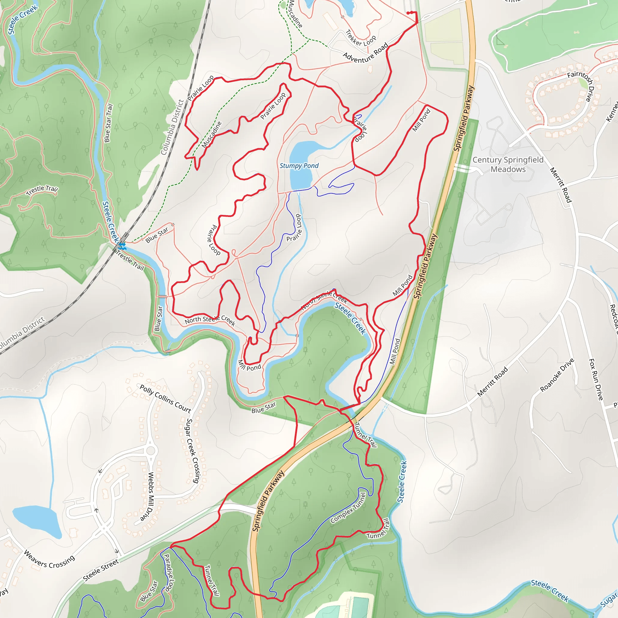
Starting your adventure near York County, South Carolina, the Mill Pond, Blue Star, and Prairie Loop offers a delightful 10 km (6.2 miles) journey with an elevation gain of approximately 100 meters (328 feet). This loop trail is rated medium in difficulty, making it suitable for moderately experienced hikers.
Getting There To reach the trailhead, you can drive or use public transport. If driving, head towards the nearest significant landmark, the Anne Springs Close Greenway, located at 104 Adventure Road, Fort Mill, SC 29715. From there, follow local signage to the trailhead. For those using public transport, the nearest bus stop is at the Fort Mill Parkway, from where you can take a short taxi ride or a rideshare service to the trailhead.
Trail Overview The trail begins with a gentle ascent, leading you through a lush forested area. The first section, known as the Mill Pond Loop, is approximately 3 km (1.9 miles) long and features a serene pond surrounded by towering trees. This area is perfect for birdwatching, so keep an eye out for local species such as the Carolina Wren and the Eastern Bluebird.
Blue Star Section As you transition into the Blue Star section, the trail becomes slightly more challenging with a few steeper inclines. This part of the trail is around 4 km (2.5 miles) long and offers stunning views of the surrounding landscape. The Blue Star section is named after the Blue Star Memorial Highway, a tribute to the U.S. Armed Forces. Along this stretch, you'll encounter several historical markers and plaques that provide insight into the region's military history.
Prairie Loop The final section, the Prairie Loop, is approximately 3 km (1.9 miles) and features open meadows and grasslands. This area is rich in wildflowers during the spring and summer months, making it a picturesque segment of the hike. The prairie is also home to various wildlife, including white-tailed deer and red foxes. The trail here is relatively flat, providing a relaxing end to your hike.
Navigation and Safety For navigation, it's highly recommended to use the HiiKER app, which provides detailed maps and real-time updates. The trail is well-marked, but having a reliable navigation tool ensures you stay on track. Be sure to carry enough water, wear sturdy hiking boots, and check the weather forecast before heading out.
Points of Interest - **Mill Pond**: A tranquil spot perfect for a short break and some birdwatching. - **Historical Markers**: Located along the Blue Star section, these provide fascinating insights into the area's military history. - **Prairie Meadows**: Ideal for photography, especially during the wildflower season.
This trail offers a mix of forest, historical landmarks, and open meadows, making it a diverse and enriching hiking experience.
What to expect?
Activity types
Comments and Reviews
User comments, reviews and discussions about the Mill Pond, Blue Star and Prairie Loop, South Carolina.
4.46
average rating out of 5
69 rating(s)

