Download
Preview
Add to list
More
107.9 km
~5 days
1350 m
Multi-Day
“Embark on the Borders Abbeys Way, a scenic 108 km loop steeped in history and natural splendor.”
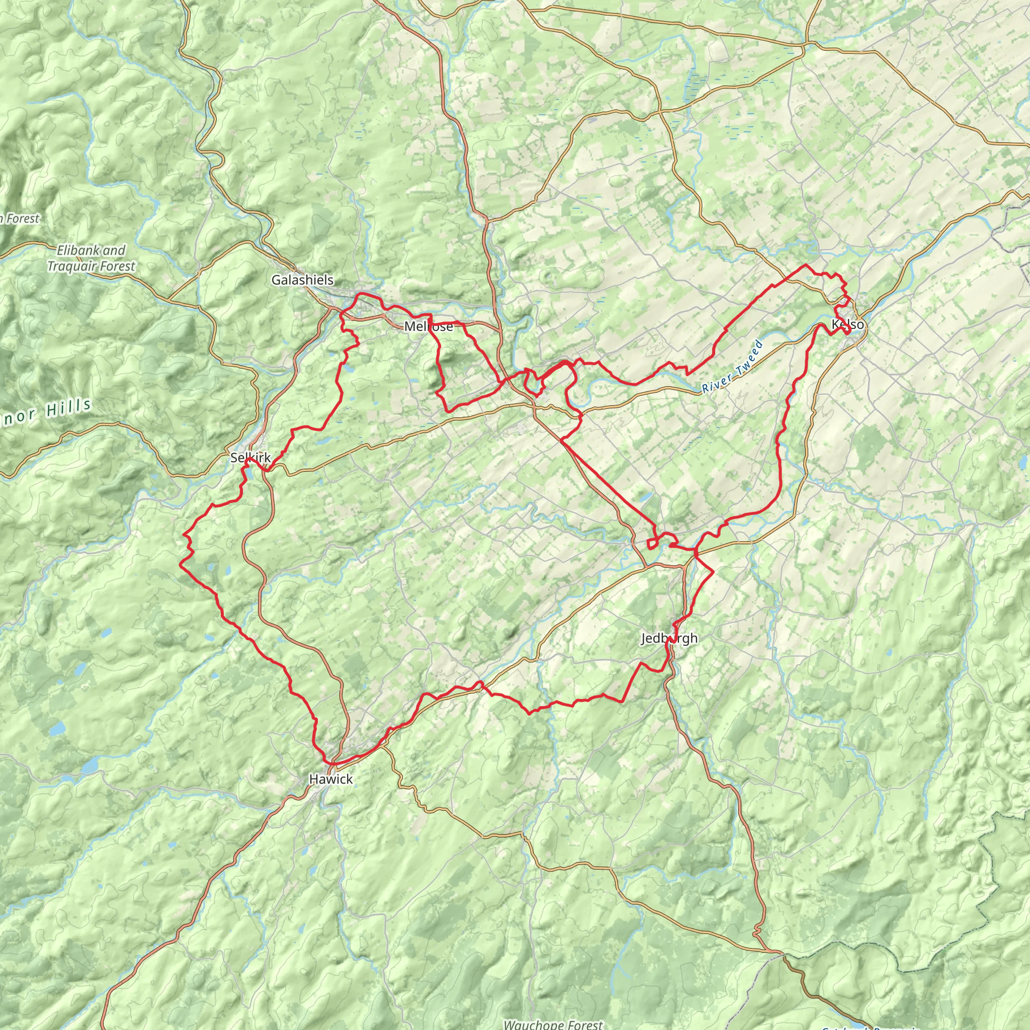
The Borders Abbeys Way is a captivating loop trail that spans approximately 108 kilometers (about 67 miles) with an elevation gain of around 1300 meters (approximately 4265 feet), encircling the heart of the Scottish Borders. This medium-difficulty hike offers a unique blend of natural beauty, historical architecture, and serene countryside.
Getting to the Trailhead
The trailhead is conveniently located near the historical town of Melrose, which is accessible by public transport or car. If you're traveling by train, the nearest station is Tweedbank, just a few miles from Melrose. From there, you can catch a bus or taxi to the trailhead. By car, Melrose is well-connected via the A68 and A7 roads, with parking available in the town center.
Navigating the Trail
As you embark on the Borders Abbeys Way, HiiKER is an invaluable tool for navigation, ensuring you stay on the right path and don't miss any of the significant landmarks along the way. The trail is well-marked, but having a digital map can provide peace of mind and additional information about the terrain ahead.
Historical Significance and Landmarks
The trail takes its name from the historic abbeys that punctuate the route: Melrose, Dryburgh, Kelso, and Jedburgh. Each of these magnificent ruins dates back to the 12th century and offers a glimpse into the region's monastic past. Melrose Abbey, known for its intricate stone carvings and as the rumored resting place of Robert the Bruce's heart, is a highlight not to be missed.
Natural Beauty and Wildlife
As you traverse the Borders Abbeys Way, you'll be treated to the rolling hills of the Southern Uplands, tranquil riverbanks, and lush woodlands. The River Tweed, a constant companion on the trail, is one of Scotland's great salmon rivers, and you may catch sight of anglers in pursuit of the elusive fish. Keep an eye out for the rich birdlife, including herons, kingfishers, and oystercatchers.
Trail Experience
The trail is divided into five main sections, each offering a different experience. The terrain varies from flat riverside walks to gentle hill climbs, with the Eildon Hills providing some of the more challenging ascents. The highest point of the trail is at Wideopen Hill, sitting at 368 meters (1207 feet), where hikers are rewarded with panoramic views of the surrounding countryside.
Accommodation and Resupply Points
Along the way, there are numerous towns and villages where you can find accommodation, ranging from cozy bed and breakfasts to more luxurious hotels. Resupply points are plentiful, with local shops and eateries in each of the main towns, allowing you to sample local Scottish produce.
Seasonal Considerations
The Borders Abbeys Way can be hiked year-round, but the best conditions are typically from April to October. During the spring and summer months, the landscape is alive with color, and the weather is more conducive to hiking. However, always be prepared for the unpredictable Scottish weather by packing waterproof gear and layers.
Safety and Preparation
Before setting out, ensure you have appropriate footwear and clothing for the varied terrain and weather conditions. It's also wise to carry a first aid kit, plenty of water, and snacks. Check the forecast, and inform someone of your itinerary. Remember that while the trail is not overly strenuous, it does require a reasonable level of fitness due to its length and some hilly sections.
By preparing adequately and respecting the natural environment, your journey along the Borders Abbeys Way will be a memorable exploration of Scotland's rich heritage and stunning landscapes.
What to expect?
Activity types
Comments and Reviews
User comments, reviews and discussions about the Borders Abbeys Way, Scotland.
4.53
average rating out of 5
32 rating(s)

