Download
Preview
Add to list
More
77.6 km
~5 days
2337 m
Multi-Day
“Trek the scenic Great Route of Santa Maria, a historical and diverse 78-km Azorean adventure.”
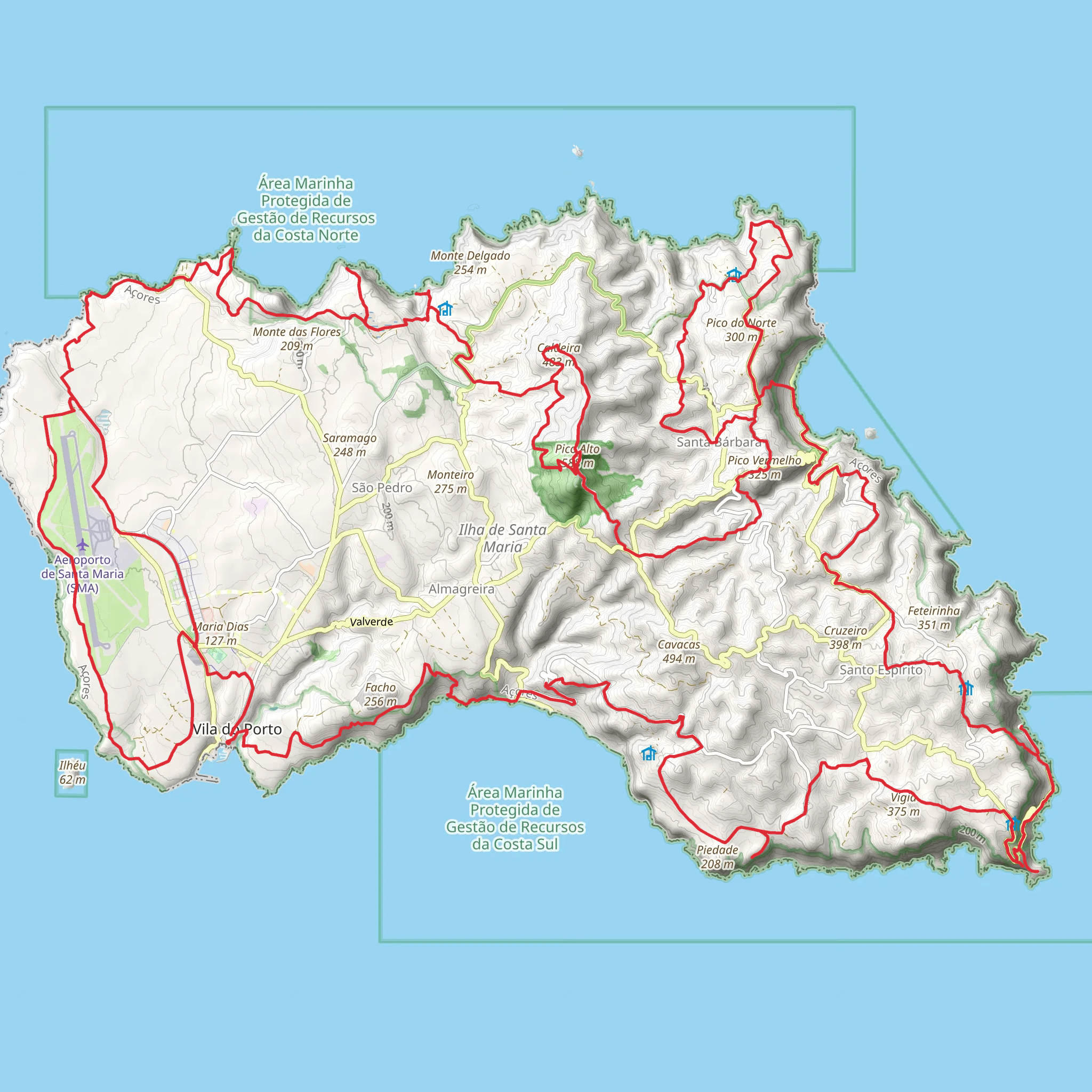
Embarking on the Great Route of Santa Maria, hikers will traverse approximately 78 kilometers (about 48.5 miles) of varied terrain, with an elevation gain of around 2300 meters (approximately 7546 feet). This loop trail, which begins near the historical town of Vila do Porto on the island of Santa Maria in the Azores, Portugal, offers a medium difficulty rating and is a showcase of the island's natural beauty and cultural heritage.
Getting to the Trailhead
To reach the trailhead, visitors can fly into Santa Maria Airport, which is a short distance from Vila do Porto. From there, either a rental car or local taxi service can be used to arrive at the starting point of the hike. Public transportation options are limited, so arranging a car or taxi in advance is advisable.
Navigating the Trail
The trail can be navigated using the HiiKER app, which provides detailed maps and GPS coordinates to ensure hikers stay on the correct path. The loop can be completed in sections or as a multi-day trek, with various entry and exit points along the route for those looking to customize their experience.
Historical Significance and Landmarks
As hikers set out from Vila do Porto, they will be walking through areas steeped in history. The town itself is the oldest in the Azores, and along the trail, one may encounter remnants of old settlements and terraced fields that tell the story of past agricultural practices. The route also passes by the iconic São Lourenço Bay, a place of stunning natural beauty and historical importance due to its use as a sheltered harbor during the Age of Discovery.
Natural Wonders and Wildlife
The trail offers a diverse range of landscapes, from coastal cliffs and lush forests to dry grasslands and volcanic features. The island's unique geology is on full display, with impressive volcanic craters and ancient lava flows. The flora and fauna are equally diverse, with endemic species such as the Santa Maria Goldcrest and the Azores Woodpigeon. Hikers should be prepared for varying weather conditions, as the island's climate can change rapidly.
Trail Sections and Elevation
The trail can be divided into several sections, each with its own character and challenges. The initial ascent from Vila do Porto will take hikers through rural countryside before reaching the higher elevations of Pico Alto, the island's highest point at 587 meters (1926 feet). From there, the trail descends towards the northern coast, offering panoramic views of the Atlantic Ocean.
Preparation and Safety
Hikers should be well-prepared with appropriate gear, including sturdy hiking boots, weather-resistant clothing, and sufficient water and food supplies. It's also important to inform someone of your hiking plans and expected return time. Always check the weather forecast before setting out and be prepared for the trail's medium difficulty rating, which includes steep ascents and descents.
Conservation and Respect
The Great Route of Santa Maria crosses through sensitive ecosystems. Hikers are encouraged to practice Leave No Trace principles, respecting wildlife and minimizing their impact on the environment. Staying on marked trails and disposing of waste properly will help preserve the beauty of the island for future visitors.
By following these guidelines and being prepared for the journey, hikers can fully enjoy the splendor and historical richness of the Great Route of Santa Maria.
Comments and Reviews
User comments, reviews and discussions about the Great Route of Santa Maria, Portugal.
4.0
average rating out of 5
1 rating(s)

