Download
Preview
Add to list
More
39.2 km
~2 days
96 m
Multi-Day
“Embark on a historical and scenic 24-mile hike from Valley Forge to Philadelphia's heart on the Schuylkill River Trail.”
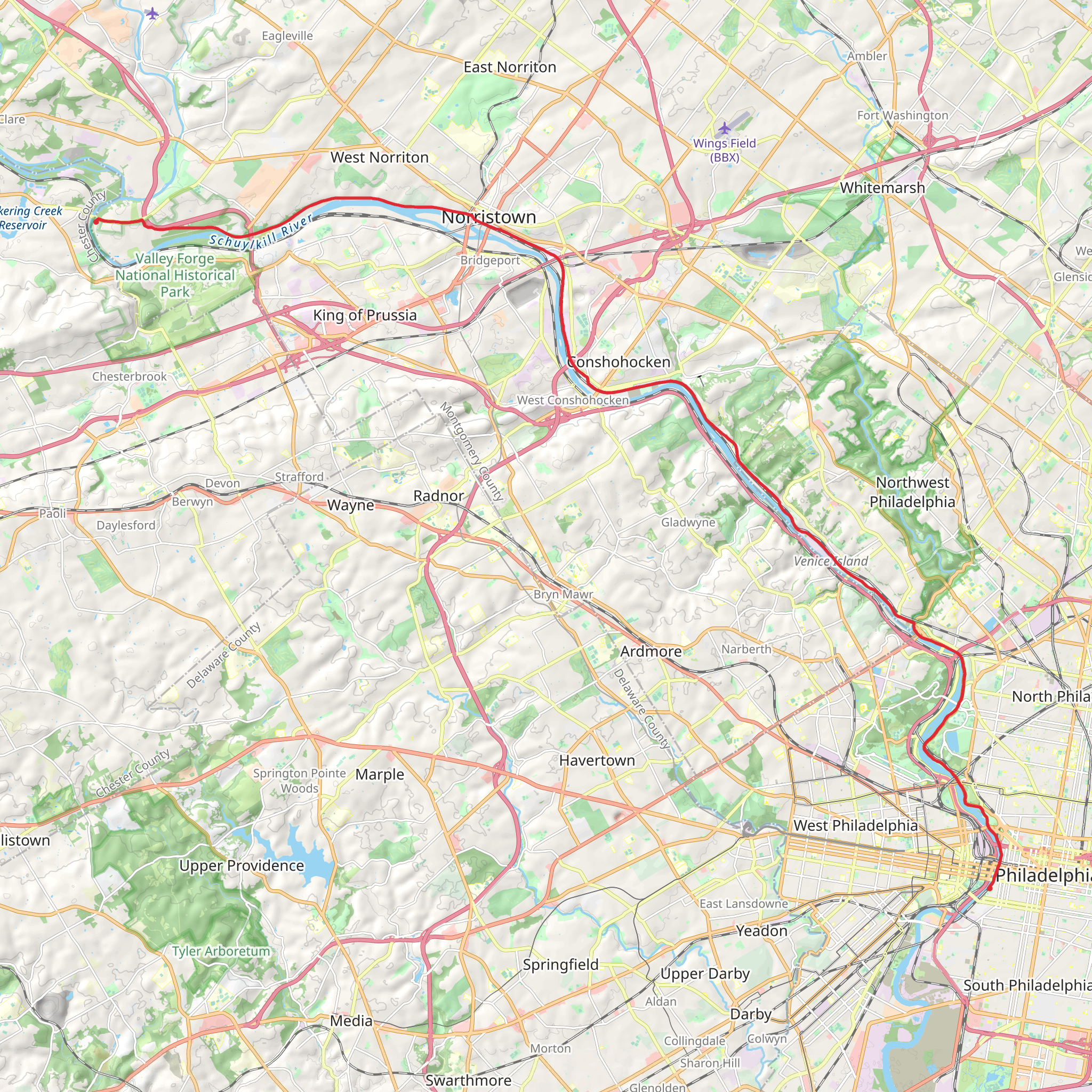
The Schuylkill River Trail unfurls along the banks of its namesake river, offering hikers a scenic journey through southeastern Pennsylvania. This approximately 39 km (24 miles) point-to-point trail begins near Montgomery County, close to the historical Valley Forge National Historical Park, and stretches all the way to the vibrant heart of Philadelphia.
Getting to the Trailhead To reach the starting point near Montgomery County, hikers can drive and park at the Betzwood Picnic Area, which is accessible via Trooper Road in Valley Forge. For those opting for public transportation, regional rail services from Philadelphia to Norristown Transportation Center followed by a short bus ride can bring you close to the trailhead. From there, a brief walk will lead you to the beginning of your adventure.
Navigating the Trail The trail itself is well-maintained and primarily paved, making it accessible for hikers of various skill levels, though it is rated medium due to its length. The elevation gain is negligible, providing a relatively flat path that is also popular among cyclists and runners. For precise navigation, hikers can rely on the HiiKER app, which provides detailed maps and waypoints to ensure you stay on the right path.
Historical Significance and Landmarks As you embark on the trail, you'll be walking in the footsteps of history. The area around Valley Forge is steeped in American Revolutionary War lore, where the Continental Army braved the harsh winter of 1777-1778. Hikers can take a detour to explore the historical park and its monuments.
Continuing along the trail, you'll encounter the iconic Philadelphia Museum of Art, which is approximately 32 km (20 miles) from the start. This landmark is not only famous for its vast collection of art but also for the 'Rocky Steps' leading up to its entrance.
Nature and Wildlife The Schuylkill River Trail is enveloped by lush greenery and offers serene river views. As you traverse this path, keep an eye out for local wildlife such as birds, deer, and other small mammals that inhabit the river's corridor. The changing seasons bring a dynamic backdrop to the trail, with vibrant autumn foliage and blooming wildflowers in the spring.
Amenities and Points of Interest Along the way, there are several rest stops, parks, and amenities. One notable area is the Schuylkill Banks Boardwalk, around 38 km (23.5 miles) into the hike, which extends over the river and provides stunning views of the Philadelphia skyline.
Safety and Preparation Before setting out, ensure you have adequate water and snacks, as the trail's length can take several hours to complete. Wear comfortable footwear and dress appropriately for the weather. It's also wise to check the trail conditions and any alerts on the HiiKER app, especially after heavy rains, as parts of the trail may flood.
Remember, the Schuylkill River Trail is a shared space, so be courteous to other users. Keep to the right, pass on the left, and signal if you're on a bike. With its combination of natural beauty, historical significance, and urban connectivity, the Schuylkill River Trail offers a unique hiking experience that showcases the diversity of the Pennsylvania landscape.
What to expect?
Activity types
Comments and Reviews
User comments, reviews and discussions about the Schuylkill River Trail, Pennsylvania.
4.67
average rating out of 5
9 rating(s)

