Download
Preview
Add to list
More
105.2 km
~6 days
2410 m
Multi-Day
“Trek through Pennsylvania's history and beauty on the scenic, medium-difficulty Laurel Highlands Trail.”
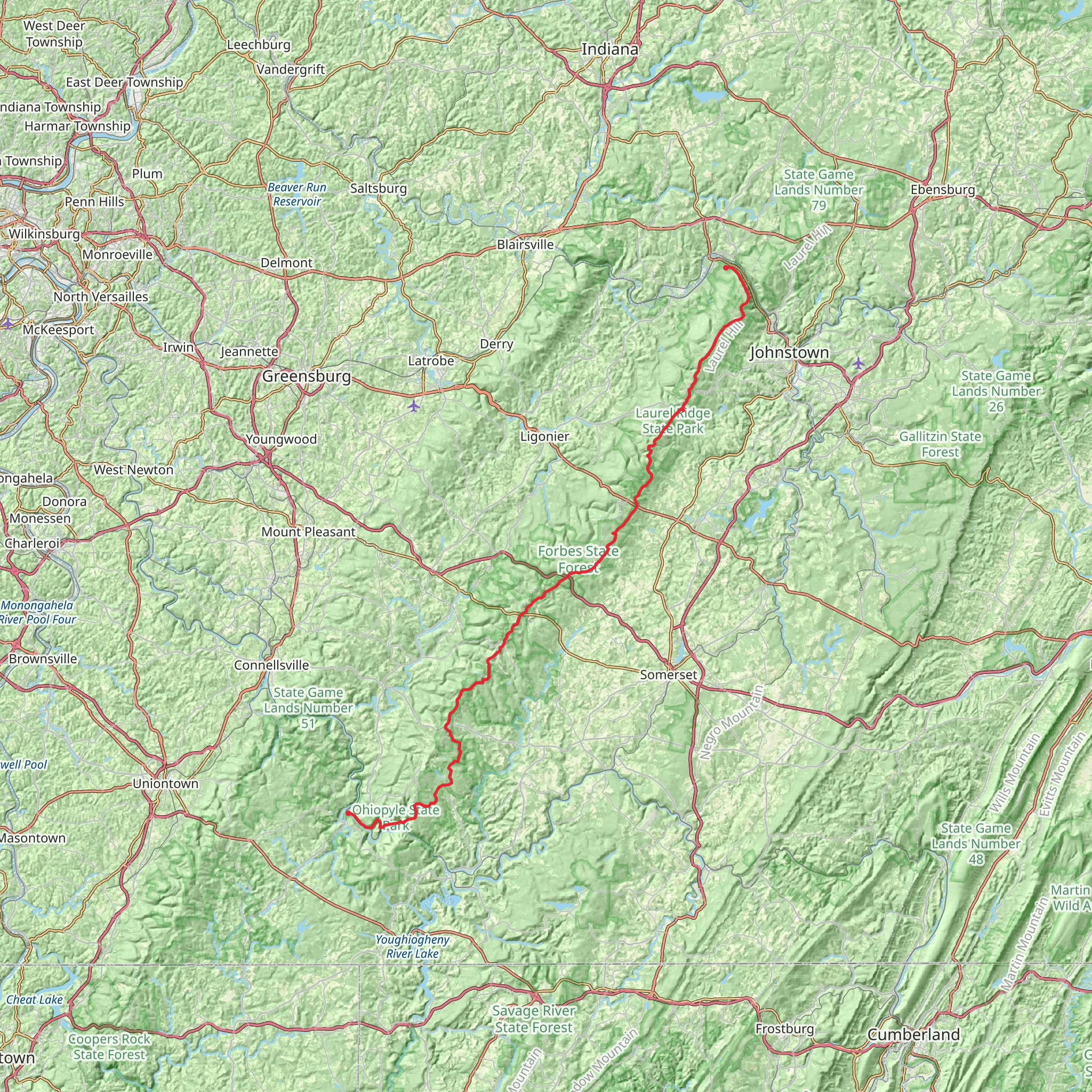
Spanning approximately 105 kilometers (65 miles) and with an elevation gain of around 2400 meters (7874 feet), the Laurel Highlands Trail is a point-to-point trek that offers a medium difficulty rating for hikers. It begins near Ohiopyle, Fayette County, Pennsylvania, and winds its way through the scenic ridges of the Laurel Highlands, culminating at the Conemaugh Gorge near Johnstown.
Getting to the Trailhead
To reach the southern terminus of the Laurel Highlands Trail, hikers can drive to Ohiopyle State Park, which is the nearest landmark to the starting point. For those relying on public transportation, options are limited, but regional bus services may offer routes close to the area, from where a taxi or ride-sharing service can be used to reach the park.
Trail Overview
The trail is well-marked with yellow blazes and mileage markers, making navigation straightforward. Hikers can download maps and use the HiiKER app for additional navigation support. The path itself is a mix of rugged terrain, including rocky sections, smooth dirt paths, and occasional road crossings.
Key Sections and Landmarks
- Ohiopyle State Park to Maple Summit Road (0-19 km / 0-12 miles): The trail begins with a moderate ascent through dense forests, offering occasional views of the Youghiogheny River Gorge. This section includes the impressive 60-foot Ohiopyle Falls.
- Maple Summit Road to Seven Springs Mountain Resort (19-50 km / 12-31 miles): As hikers progress, they'll encounter the Beam Rocks overlook, providing expansive views. This segment also passes by the popular ski resort, which is a great place to rest or resupply.
- Seven Springs to Route 30 (50-70 km / 31-43 miles): This stretch includes the highest point on the trail, with an elevation of 2,980 feet at Laurel Ridge. The trail here is characterized by hemlock groves and rhododendron thickets.
- Route 30 to Conemaugh Gorge (70-105 km / 43-65 miles): The final leg descends into the Conemaugh Gorge, with its historical significance tied to the early coal and steel industries of Pennsylvania. The trail ends near the Johnstown Flood National Memorial, commemorating the 1889 flood disaster.
Flora and Fauna
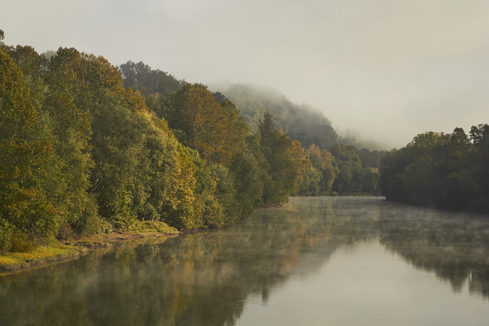
The Laurel Highlands Trail traverses diverse ecosystems, home to a variety of wildlife including white-tailed deer, black bears, and numerous bird species. The area is also known for its wildflowers, especially the mountain laurel for which the region is named, typically blooming in late spring.
Preparation and Considerations
Hikers should be prepared for variable weather conditions and pack accordingly. Water sources are available at designated overnight areas, but purification is recommended. Camping is permitted only in designated areas, and reservations are required. It's important to leave no trace to preserve the natural beauty of the trail.
Historical Significance
The Laurel Highlands region is steeped in history, with the trail passing near several sites of historical importance, such as Fort Necessity National Battlefield, which marks the beginning of the French and Indian War. The trail's end near the site of the Johnstown Flood serves as a poignant reminder of one of the worst disasters in American history.
Conclusion
By providing a mix of challenging terrain, breathtaking vistas, and historical context, the Laurel Highlands Trail offers an enriching experience for hikers looking to explore the natural and historical tapestry of Pennsylvania.
What to expect?
Activity types
Comments and Reviews
User comments, reviews and discussions about the Laurel Highlands Trail, Pennsylvania.
4.75
average rating out of 5
16 rating(s)

