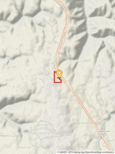
8.9 km
~1 hrs 51 min
52 m
“Explore scenic landscapes and rich history on the accessible, picturesque Pendleton and Umatilla River Parkway.”
Starting near Umatilla County, Oregon, the Pendleton and Umatilla River Parkway is an out-and-back trail that stretches approximately 9 kilometers (around 5.6 miles) with no significant elevation gain, making it a relatively flat and accessible hike. The trailhead is conveniently located near the Pendleton Round-Up Grounds, a well-known landmark in the area.
### Getting There For those traveling by car, you can park at the Pendleton Round-Up Grounds, which is easily accessible from Interstate 84. If you prefer public transport, the nearest bus stop is at the Pendleton Transit Center, located about 1.5 kilometers (approximately 1 mile) from the trailhead. From there, it's a short walk to the starting point.
### Trail Overview The trail meanders along the Umatilla River, offering picturesque views of the waterway and surrounding landscapes. The path is well-maintained and primarily composed of packed dirt and gravel, making it suitable for hikers of all skill levels. Given its medium difficulty rating, it's a great option for families and casual hikers looking for a scenic outing.
### Points of Interest - Pendleton Round-Up Grounds: As you start your hike, you'll pass by the historic Pendleton Round-Up Grounds, home to one of the oldest and most famous rodeos in the United States. Established in 1910, this site is a significant cultural landmark in the region. - Umatilla River: The trail closely follows the Umatilla River, providing ample opportunities to spot local wildlife such as deer, beavers, and various bird species. Keep an eye out for bald eagles and ospreys, which are often seen fishing in the river. - McKay Creek National Wildlife Refuge: About 4 kilometers (2.5 miles) into the hike, you'll come across the McKay Creek National Wildlife Refuge. This area is a haven for birdwatchers, with over 200 species of birds recorded. The refuge also features wetlands and riparian habitats that are crucial for local wildlife.
### Historical Significance The region around the Umatilla River has a rich history, deeply rooted in Native American culture. The Umatilla, Cayuse, and Walla Walla tribes have lived in this area for thousands of years. The river itself was a vital resource for these communities, providing water, food, and transportation routes. As you hike, you'll be walking through lands that have been significant to these tribes for generations.
### Navigation To ensure you stay on track, consider using the HiiKER app, which provides detailed maps and real-time navigation assistance. This can be particularly useful for first-time visitors to the area.
### Preparation Tips - Footwear: Given the flat terrain, comfortable walking shoes or light hiking boots are recommended. - Water and Snacks: There are no facilities along the trail, so bring enough water and snacks to keep you energized. - Weather: The trail is exposed in many areas, so check the weather forecast and dress accordingly. Sunscreen and hats are advisable during the summer months. - Wildlife: While the trail is generally safe, always be mindful of your surroundings and respect local wildlife. Keep a safe distance and avoid feeding animals.
This trail offers a blend of natural beauty, wildlife viewing, and historical significance, making it a rewarding experience for anyone looking to explore the scenic landscapes of Umatilla County.
Reviews
User comments, reviews and discussions about the Pendleton and Umatilla River Parkway, Oregon.
5.0
average rating out of 5
9 rating(s)


