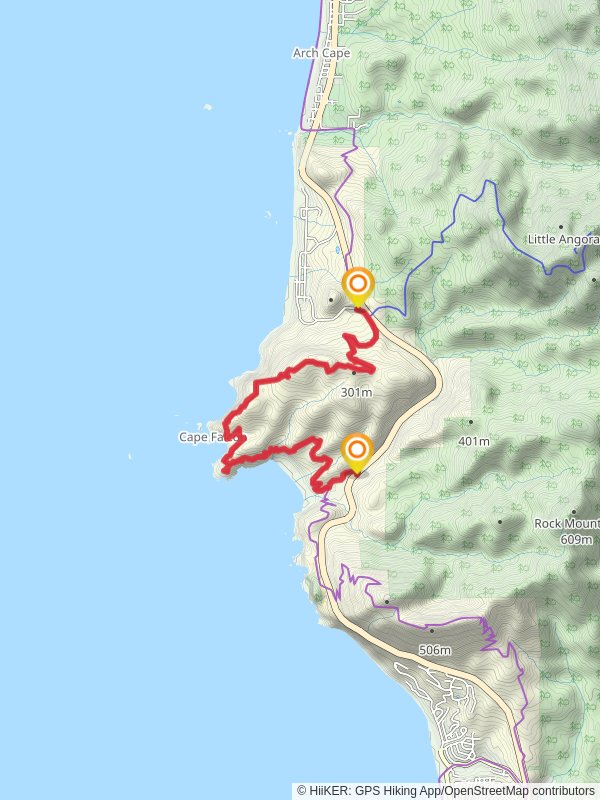
9.5 km
~2 hrs 37 min
433 m
“The Arch Cape to Cape Falcon Trail blends lush coastal forests, stunning ocean views, and historical significance.”
Starting near Tillamook County, Oregon, the Arch Cape to Cape Falcon Trail spans approximately 10 kilometers (6.2 miles) with an elevation gain of around 400 meters (1,312 feet). This point-to-point trail is estimated to be of medium difficulty, making it suitable for moderately experienced hikers.
### Getting There
To reach the trailhead, you can drive or use public transportation. If driving, head towards the town of Arch Cape, Oregon. The nearest significant landmark is the Arch Cape Tunnel on U.S. Route 101. For those using public transport, the nearest bus stop is in Cannon Beach, from where you can take a taxi or rideshare to the trailhead.
### Trail Overview
The trail begins near the Arch Cape Tunnel and immediately immerses you in the lush coastal forest. The first section of the trail is relatively gentle, allowing you to acclimate to the surroundings. As you progress, the trail starts to ascend, offering glimpses of the Pacific Ocean through the dense foliage.
### Significant Landmarks and Nature
Around the 2-kilometer (1.2-mile) mark, you'll encounter the first significant viewpoint, offering panoramic views of the ocean and the rugged coastline. This is a great spot for a short break and some photography.
Continuing on, the trail meanders through old-growth Sitka spruce and western hemlock trees. Keep an eye out for local wildlife, including black-tailed deer and various bird species such as the northern spotted owl and marbled murrelet. The forest floor is often carpeted with ferns and moss, adding to the trail's enchanting atmosphere.
### Historical Significance
This region holds historical significance as it was once inhabited by the Tillamook people, a Native American tribe known for their fishing and basket-weaving skills. The trail itself follows part of the route used by early settlers and explorers, adding a layer of historical depth to your hike.
### Elevation Gain and Terrain
As you approach the 5-kilometer (3.1-mile) mark, the trail becomes steeper, with switchbacks helping to manage the elevation gain. This section can be challenging, especially if the trail is wet, so good hiking boots are recommended. The total elevation gain of around 400 meters (1,312 feet) is mostly concentrated in this middle section.
### Reaching Cape Falcon
The final stretch of the trail leads you to Cape Falcon, a dramatic headland offering stunning views of the coastline and the ocean. On clear days, you can see as far as Tillamook Head to the north and Neahkahnie Mountain to the south. This is an excellent spot to rest, have a snack, and take in the breathtaking scenery.
### Navigation and Safety
For navigation, it's advisable to use HiiKER, which provides detailed maps and real-time updates. The trail is well-marked, but having a reliable navigation tool can enhance your hiking experience and ensure you stay on track.
### Wildlife and Flora
Throughout the hike, you'll encounter a variety of flora and fauna. The coastal forest is home to numerous plant species, including salal, Oregon grape, and sword fern. Wildlife sightings are common, so keep your camera ready but maintain a respectful distance from any animals you encounter.
### Final Tips
Given the trail's coastal location, weather can be unpredictable. It's wise to bring layers, including a waterproof jacket. Also, pack enough water and snacks, as there are no facilities along the trail. The trail can be muddy, especially after rain, so sturdy, waterproof hiking boots are recommended.
This hike offers a perfect blend of natural beauty, historical significance, and moderate physical challenge, making it a rewarding experience for those who undertake it.
Reviews
User comments, reviews and discussions about the Arch Cape to Cape Falcon Trail, Oregon.
5.0
average rating out of 5
18 rating(s)


