Download
Preview
Add to list
More
85.4 km
~6 days
4314 m
Multi-Day
“The Mark O Hatfield Trail offers a rigorous trek through Oregon's stunning landscapes, steeped in natural and historical richness.”
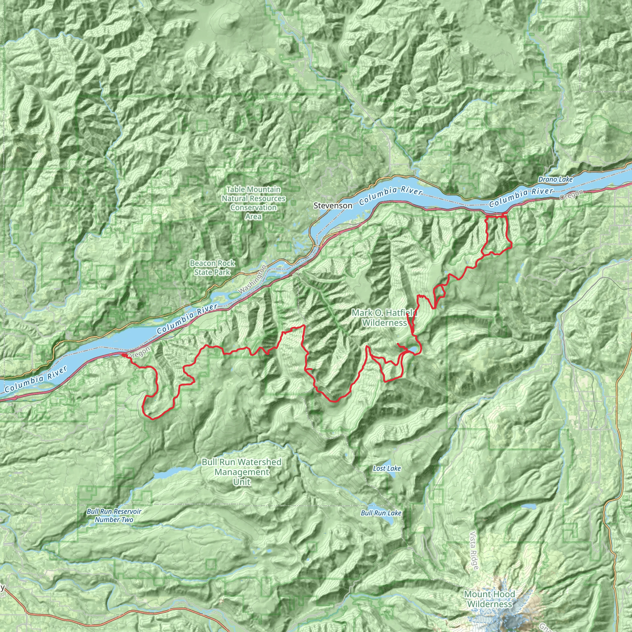
Spanning approximately 85 kilometers (about 53 miles) with an elevation gain of around 4300 meters (approximately 14,107 feet), the Mark O Hatfield Trail is a challenging point-to-point hike that begins near Multnomah County, Oregon. This trail is not for the faint of heart, as it is estimated to be difficult due to its length and significant elevation changes.
Getting to the Trailhead
To reach the trailhead, hikers can drive to the western terminus near Multnomah County. If you're coming from Portland, you can take the I-84 E and exit for Multnomah Falls, where parking is available. Public transport options include taking a bus from Portland to Multnomah Falls, which is the nearest landmark to the trailhead.
Navigating the Trail
Hikers should be prepared with a reliable navigation tool like HiiKER to help stay on track. The trail is well-marked in most sections, but due to its length and remote areas, having a digital map can be invaluable, especially in areas where the trail may become less distinct.
Landmarks and Scenery
As you embark on the Mark O Hatfield Trail, you'll be treated to a diverse array of scenery, including dense forests, rushing waterfalls, and expansive views of the Columbia River Gorge. One of the first significant landmarks is the iconic Multnomah Falls, which you'll encounter early in your hike. This towering waterfall is one of the tallest in the United States and is a sight to behold.
Further along the trail, you'll pass through the historic Oneonta Gorge, known for its unique slot canyon formation. The trail also takes you up to high vantage points like Devil's Rest and Angel's Rest, offering breathtaking panoramic views of the surrounding landscape.
Flora and Fauna
The trail traverses through several ecological zones, so hikers can expect to see a wide variety of plant and animal life. The dense forests are home to old-growth Douglas fir and western red cedar, and the underbrush is filled with ferns and wildflowers, especially vibrant in the spring and early summer.
Wildlife sightings may include deer, elk, and a variety of bird species. It's important to remember that this is black bear and cougar territory, so hikers should be knowledgeable about how to safely encounter wildlife.
Historical Significance
The trail is named after Mark O. Hatfield, a former governor and U.S. senator from Oregon who was instrumental in the preservation of the state's natural beauty. The Columbia River Gorge itself is a historical treasure, with Native American tribes having inhabited the area for thousands of years. The trail also passes by several points of interest related to the early pioneer history and the construction of the Historic Columbia River Highway.
Preparation and Planning
Given the trail's difficulty, hikers should be well-prepared with adequate supplies, including water, food, and layers of clothing to adjust to the changing temperatures at different elevations. It's also wise to inform someone of your hiking plans and expected return time due to the remote nature of parts of the trail.
The best times to hike the Mark O Hatfield Trail are late spring through early fall when the weather is more predictable, and the trail conditions are generally better. However, hikers should always check the weather forecast and trail conditions before setting out, as the area can experience sudden changes in weather.
Remember, this is a long-distance hike that typically takes several days to complete, so plan your overnight stops accordingly. There are designated camping areas along the trail, but make sure to follow Leave No Trace principles to preserve the beauty and integrity of the trail for future hikers.
What to expect?
Activity types
Comments and Reviews
User comments, reviews and discussions about the Mark O Hatfield Trail, Oregon.
4.5
average rating out of 5
6 rating(s)

