Download
Preview
Add to list
More
526.8 km
~30 days
11375 m
Multi-Day
“Embark on a majestic 327-mile trek through Oregon's volcanic wonders and alpine splendors on the PCT.”
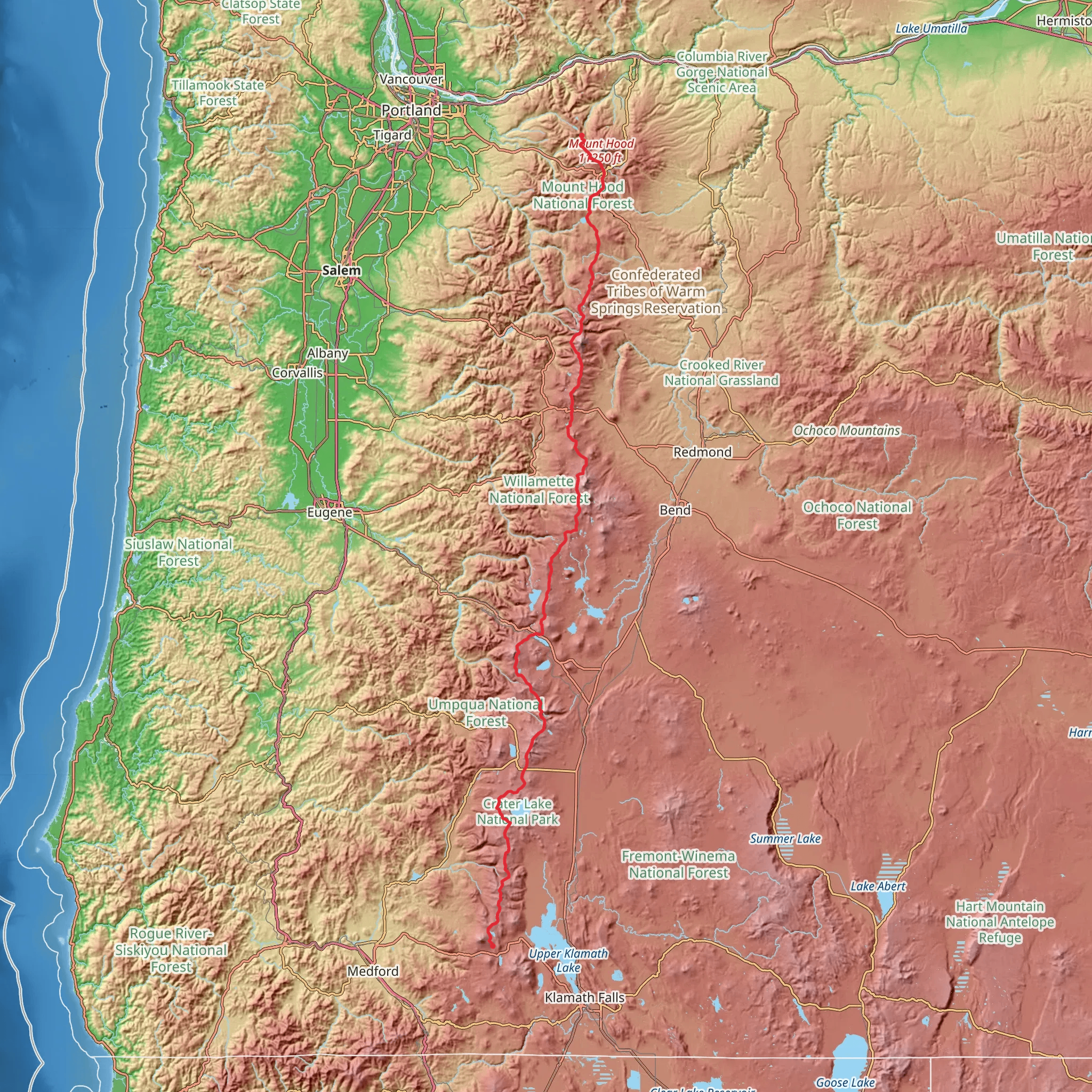
Spanning approximately 327 miles (527 km) with an elevation gain of around 37,073 feet (11,300 meters), the Pacific Crest Trail section from Mount Hood to Mount McLoughlin offers an immersive and challenging hiking experience through the diverse landscapes of Oregon. This point-to-point trail is renowned for its breathtaking vistas, alpine meadows, and volcanic scenery.
Getting to the Trailhead The northern trailhead is located near Clackamas County, Oregon, close to the iconic Timberline Lodge on Mount Hood. For those driving, the lodge can be reached by taking Highway 26 to Timberline Highway, which leads directly to the lodge. Public transportation options are limited, but during the summer months, a shuttle service may be available from nearby towns to Timberline Lodge.
Navigating the Trail Hikers can rely on the HiiKER app for detailed maps and navigation assistance throughout their journey. The trail is well-marked with the iconic PCT trail markers, but having a digital tool like HiiKER can be invaluable for planning your daily mileage and locating campsites or water sources.
Mount Hood to Olallie Lake The initial segment of the trail descends from the alpine environment of Mount Hood, passing through dense forests and crossing numerous streams. After approximately 50 miles (80 km), hikers reach the serene Olallie Lake, a perfect spot for an overnight stay or a refreshing swim.
Olallie Lake to Three Fingered Jack Continuing south, the trail meanders through the Mount Jefferson Wilderness, offering views of the rugged peaks of the Cascade Range. This section includes a challenging climb up and around Three Fingered Jack, an ancient volcano that presents a striking figure against the skyline. The trail skirts the western edge of the mountain, providing dramatic views of the eroded volcanic core.
Three Fingered Jack to the Three Sisters The trail then approaches the iconic Three Sisters, a trio of volcanic peaks that are among the most photographed landmarks on the PCT. This area is characterized by its stark lava fields, alpine meadows, and glacial lakes. The trail passes close to South Sister, the tallest of the three, and offers an optional side trip to summit this impressive peak.
Three Sisters to Mount Thielsen After leaving the Three Sisters Wilderness, the trail crosses into the Diamond Peak Wilderness and then the Mount Thielsen Wilderness. The terrain here is a mix of dense forest and open ridgelines, with Mount Thielsen's distinctive horn-like peak serving as a beacon for hikers.
Mount Thielsen to Mount McLoughlin The final stretch to Mount McLoughlin includes a descent into the Sky Lakes Wilderness, known for its numerous alpine lakes and ponds. Mount McLoughlin itself is a shield volcano that offers a challenging summit attempt for those wishing to extend their adventure. The southern trailhead is located near the mountain, marking the end of this epic section of the PCT.
Wildlife and Nature Throughout the hike, you'll encounter a variety of wildlife, including black bears, deer, and a plethora of bird species. The trail also traverses several distinct ecological zones, from the lush old-growth forests of the lower elevations to the subalpine and alpine environments of the higher peaks.
Historical Significance The region is steeped in history, with the volcanic landscape shaped by millions of years of geological activity. Native American tribes have lived in this area for thousands of years, and the trail itself is a testament to the pioneering spirit of the early settlers and explorers who traversed these mountains.
Preparation and Planning Given the trail's difficulty rating and length, hikers should be well-prepared with appropriate gear, including durable footwear, weather-appropriate clothing, and a reliable means of water purification. Resupply points are few and far between, so careful planning is essential. It's also important to be aware of the snow conditions, especially early in the hiking season, as snowfields can persist on the higher elevations well into the summer.
By preparing adequately and respecting the natural environment, hikers can look forward to an unforgettable journey along one of the most scenic sections of the Pacific Crest Trail.
Comments and Reviews
User comments, reviews and discussions about the Pacific Crest Trail - Mount Hood To Mount Mcgloughlin, Oregon.
4.46
average rating out of 5
13 rating(s)

