Download
Preview
Add to list
More
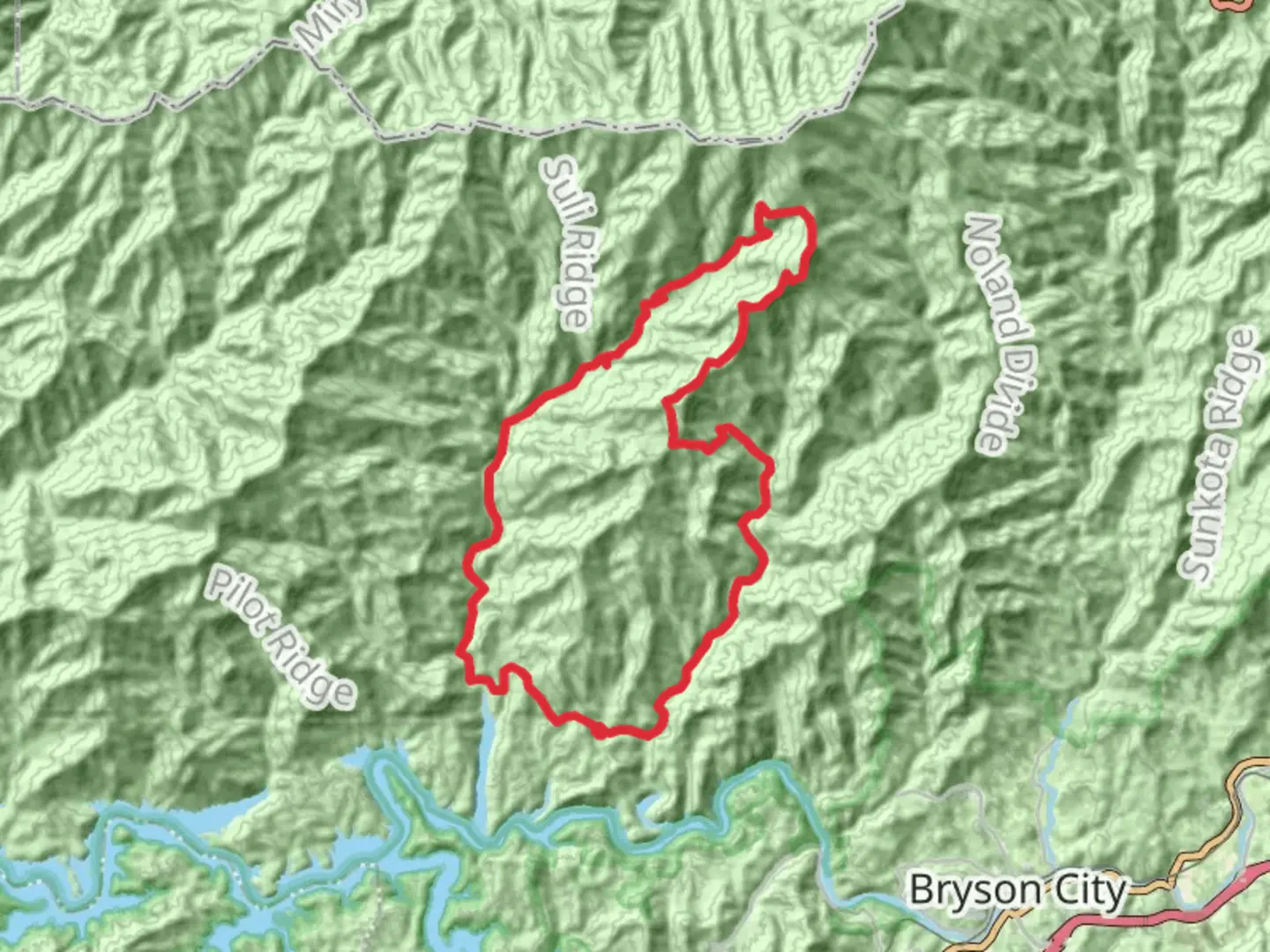
41.8 km
~2 day
1859 m
Loop
“Trek the diverse Forney Creek Loop for historic, aquatic, and panoramic Smoky Mountain splendors.”
Embarking on the Lakeshore, Forney Creek, and Andrews Bald Loop Trail, hikers will traverse a diverse landscape that encapsulates the essence of the Great Smoky Mountains National Park. The trailhead is conveniently located near Swain County, North Carolina, close to the Clingmans Dome parking area, which is the highest point in Tennessee and a popular destination in the park.Getting to the TrailheadTo reach the starting point of the hike, visitors can drive to the end of Clingmans Dome Road, which is accessible from Newfound Gap Road (US-441). The road to Clingmans Dome is typically open from April to November, weather permitting. For those relying on public transportation, options are limited, and a private shuttle or taxi service may be necessary from nearby towns such as Cherokee or Bryson City.Trail OverviewThe loop covers approximately 42 kilometers (26 miles) and includes an elevation gain of around 1800 meters (5900 feet), offering a medium difficulty rating that is suitable for hikers with some experience. The trail is a combination of picturesque lake views, dense forest, and high-elevation balds, providing a rich experience of the park's varied ecosystems.Navigating the TrailHikers can utilize the HiiKER app for detailed navigation throughout the hike. The trail begins by descending towards the shores of Fontana Lake, where the path meanders along the water's edge. This section offers serene views of the lake and opportunities to spot local wildlife, such as deer and various bird species.Historical SignificanceThe area is steeped in history, with remnants of early 20th-century settlements and logging operations visible along the Lakeshore Trail portion. Hikers will encounter old homesites, cemeteries, and other artifacts that speak to the region's past before it became part of the national park.Forney Creek and High Elevation ChangesAs the trail turns away from the lake and follows Forney Creek, the ascent begins. This portion of the hike is characterized by the sound of rushing water and the lush greenery of the forest. The trail crosses several streams, so waterproof footwear is recommended.Andrews BaldThe highlight of the loop is the climb to Andrews Bald, a high-elevation grassy bald that offers panoramic views of the surrounding mountains. The bald is approximately 16 kilometers (10 miles) from the trailhead and is the perfect spot for a rest and a picnic. The bald is especially beautiful in June when the flame azaleas and rhododendrons are in bloom.Descent and ReturnAfter enjoying the vistas from Andrews Bald, hikers will complete the loop by descending back to the trailhead. This section can be steep and rocky, so careful footing is necessary.Flora and FaunaThroughout the hike, the diversity of plant life is evident, with a mix of hardwood forests and coniferous trees. Wildlife sightings may include black bears, so hikers should be bear-aware and know how to safely store food and dispose of waste.Preparation and SafetyDue to the length and varied terrain of the trail, hikers should be well-prepared with appropriate gear, including a map, compass, and the HiiKER app for navigation. It's important to carry enough water and food, as well as layers of clothing to adapt to changing weather conditions at higher elevations.Seasonal ConsiderationsThe best time to hike this loop is from late spring to early fall when the road to Clingmans Dome is open. Hikers should be aware of the possibility of snow and ice at higher elevations, particularly outside of the summer months.

What to expect?
Activity types
Comments and Reviews
User comments, reviews and discussions about the Lakeshore, Forney Creek and Andrews Bald Loop Trail, North Carolina.
average rating out of 5
0 rating(s)