Download
Preview
Add to list
More
37.6 km
~3 days
1233 m
Multi-Day
“Embark on a scenic journey through history and biodiversity on the Standing Indian Mountain Loop.”
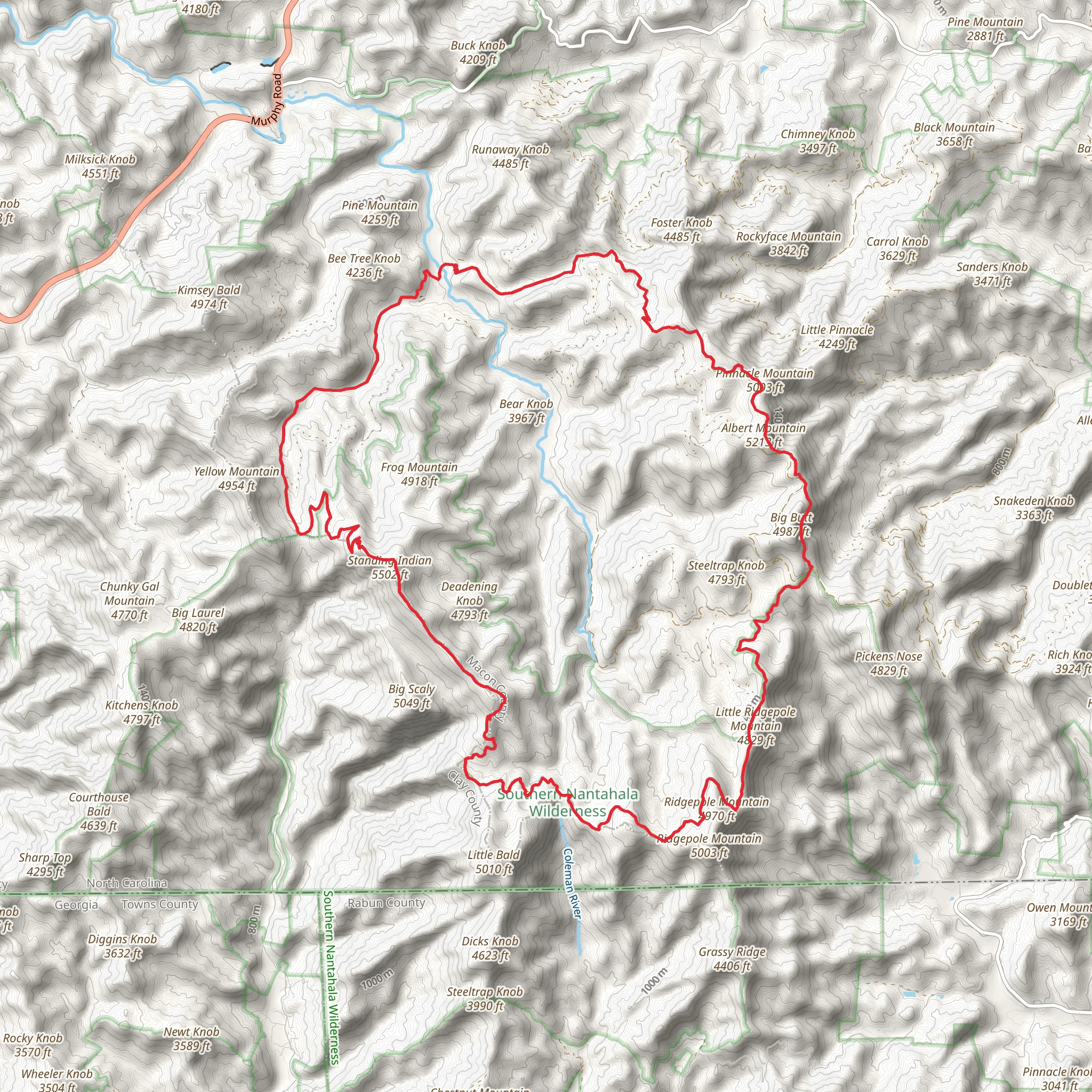
Embarking on the Standing Indian Mountain Loop, hikers will traverse approximately 38 kilometers (about 23.6 miles) of varied terrain with an elevation gain of around 1200 meters (nearly 3937 feet). This loop, nestled in the Nantahala National Forest near Macon County, North Carolina, is a challenging adventure that rewards with stunning vistas and a rich tapestry of flora and fauna.
Getting to the Trailhead
The trailhead is accessible by car, located off Forest Service Road 67 near the Standing Indian Campground. From the nearest town of Franklin, North Carolina, take US Highway 64 West for about 12 miles to Old Murphy Road (SR 1448). Turn right and follow the signs for Wallace Gap, after which you'll turn left onto Forest Service Road 67. The trailhead is about 7 miles down this road, with parking available near the Backcountry Information Center.
The Hike Itself
The loop can be tackled in either direction, but many choose to hike clockwise for a more gradual ascent. Starting from the Backcountry Information Center, the trail meanders through dense hardwood forests, crossing streams and offering occasional glimpses of the surrounding mountains.
#### Kimsey Creek to Standing Indian Summit
The initial segment, following Kimsey Creek, is a gentle introduction to the trail's beauty, with mossy banks and the soothing sounds of flowing water. After about 4.8 kilometers (3 miles), the trail intersects with the Appalachian Trail (AT), where the climb becomes more pronounced. Hikers will ascend Standing Indian Mountain, the highest point on the loop at 1689 meters (5545 feet). The summit provides panoramic views of the Blue Ridge Mountains, a perfect reward for the climb.
#### Appalachian Trail to Long Branch Trail
Continuing on the AT, the trail follows the ridge, offering more vistas. This section is rich in biodiversity, with opportunities to spot wildlife such as deer, black bears, and a variety of bird species. After approximately 19 kilometers (12 miles), hikers will reach the junction with the Long Branch Trail.
#### Long Branch Trail to Finish
The descent via Long Branch Trail is steep but scenic, with wildflowers and the chance to see the cascading Long Branch Falls. This final stretch of about 15 kilometers (9.3 miles) leads back to the trailhead, completing the loop.
Historical Significance
The region holds historical importance, with the Nantahala National Forest being part of the ancestral lands of the Cherokee people. The name "Nantahala" is derived from the Cherokee language, meaning "Land of the Noonday Sun," which reflects the deep gorges where the sun only reaches the ground at midday.
Preparing for the Hike
Given the trail's difficulty, hikers should be well-prepared with proper gear, including sturdy hiking boots, a map, and a compass. HiiKER is an excellent navigation tool to help keep on track. It's also essential to carry enough water and food, as the hike can take multiple days for some. Weather can change rapidly in the mountains, so layered clothing and rain gear are advisable.
Wildlife and Nature
The Standing Indian Mountain Loop is a haven for nature enthusiasts. The diverse ecosystems along the trail support a wide array of plant life, from towering oaks and hickories to rhododendrons and mountain laurels. The area is also part of the Southern Appalachian Man and the Biosphere Reserve, highlighting its ecological significance.
Conclusion
By providing a comprehensive overview of the Standing Indian Mountain Loop, hikers can better prepare for the challenges and delights of this remarkable trail. With its combination of natural beauty, wildlife, and historical depth, it's a hike that offers more than just physical exertion—it's an immersive journey through a storied landscape.
What to expect?
Activity types
Comments and Reviews
User comments, reviews and discussions about the Standing Indian Mountain Loop, North Carolina.
4.5
average rating out of 5
12 rating(s)

