Download
Preview
Add to list
More
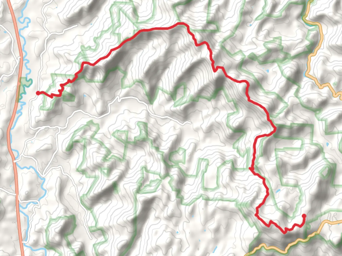
23.0 km
~1 day 1 hrs
1065 m
Point-to-Point
“The Scaly Mountain and Bartram Trail offers 23 kilometers of scenic hiking with rich biodiversity and historical landmarks.”
Starting near Macon County, North Carolina, the Scaly Mountain and Bartram Trail offers a point-to-point adventure spanning approximately 23 kilometers (14.3 miles) with an elevation gain of around 1000 meters (3280 feet). This trail is rated as medium difficulty, making it suitable for moderately experienced hikers.
Getting There To reach the trailhead, you can drive or use public transport. If driving, head towards the vicinity of Highlands, North Carolina. The nearest significant landmark is the Highlands Biological Station, located at 265 N 6th St, Highlands, NC 28741. From there, it's a short drive to the trailhead. Public transport options are limited, so driving is recommended.
Trail Overview The trail begins with a gentle ascent, allowing you to ease into the hike. As you progress, the terrain becomes more challenging, with steeper inclines and rocky sections. The first significant landmark you'll encounter is Jones Gap, approximately 5 kilometers (3.1 miles) in, where you can take a short break and enjoy the surrounding views.
Flora and Fauna The trail is rich in biodiversity. You'll traverse through dense hardwood forests, home to oak, hickory, and maple trees. In spring and summer, the trail is adorned with wildflowers like trillium and rhododendron. Keep an eye out for local wildlife, including white-tailed deer, black bears, and various bird species such as the Eastern Bluebird and Red-tailed Hawk.
Historical Significance The Bartram Trail is named after William Bartram, an 18th-century naturalist who explored the Southeastern United States. His travels and writings have left a lasting legacy, and this trail follows part of his original route. Historical markers along the trail provide insights into his journey and the region's history.
Key Landmarks - **Scaly Mountain**: Around the 10-kilometer (6.2 miles) mark, you'll reach Scaly Mountain. The summit offers panoramic views of the surrounding Blue Ridge Mountains. The climb is steep but rewarding, with an elevation gain of about 300 meters (984 feet) from the base. - **Raven Rock**: Approximately 15 kilometers (9.3 miles) into the hike, you'll come across Raven Rock. This large rock outcrop provides another excellent vantage point and a perfect spot for a lunch break.
Navigation Given the trail's length and varying terrain, it's advisable to use a reliable navigation tool like HiiKER. The app provides detailed maps, real-time GPS tracking, and important waypoints to ensure you stay on course.
Final Stretch The last segment of the trail descends gradually, leading you through more forested areas and past small streams. The endpoint is near the town of Franklin, North Carolina, where you can find amenities and transport options to return to your starting point or continue your journey.
Preparation Tips - **Water and Food**: Carry sufficient water and high-energy snacks. There are few reliable water sources along the trail. - **Clothing**: Wear layered clothing to adapt to changing weather conditions. Sturdy hiking boots are essential due to the rocky and uneven terrain. - **Safety**: Inform someone of your hiking plans and expected return time. Carry a basic first-aid kit and be aware of local wildlife.
This trail offers a blend of natural beauty, historical significance, and moderate physical challenge, making it a rewarding experience for those prepared to tackle its diverse landscapes.

What to expect?
Activity types
Comments and Reviews
User comments, reviews and discussions about the Scaly Mountain and Bartram Trail, North Carolina.
4.47
average rating out of 5
15 rating(s)