Download
Preview
Add to list
More
426.0 km
~21 days
7490 m
Multi-Day
“Embark on the historic Hume and Hovell Track to explore Australia's diverse landscapes and embrace a rewarding adventure.”
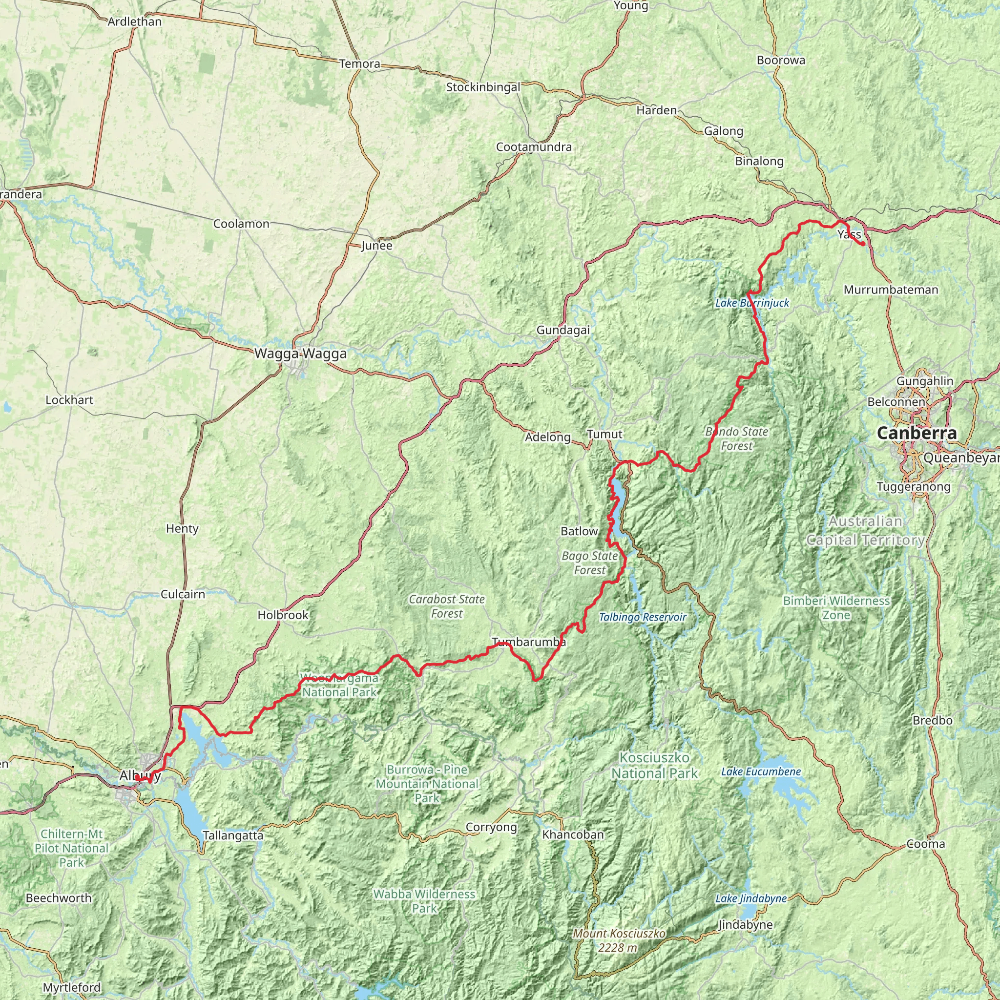
The Hume and Hovell Track is a long-distance walking trail that stretches approximately 426 kilometers (265 miles) and traverses a diverse range of landscapes, offering an elevation gain of around 7400 meters (24,278 feet). This point-to-point trail begins near the Yass Valley in New South Wales and winds its way to Albury, providing a medium difficulty rating that caters to hikers with some experience.
Getting to the Trailhead
To reach the starting point of the Hume and Hovell Track, you can drive or take public transport. If driving, head towards Cooma Cottage on the outskirts of Yass, which is the nearest significant landmark to the trailhead. For those relying on public transport, buses from Canberra to Yass are available, and from there, a taxi service can be used to reach the trailhead.
Trail Overview
As you embark on the Hume and Hovell Track, you'll be following in the footsteps of explorers Hamilton Hume and William H. Hovell, who undertook their expedition in 1824. The trail is steeped in historical significance, marking the route taken by these pioneers as they journeyed from Yass to Port Phillip near Melbourne.
Landmarks and Natural Beauty
The track meanders through a variety of terrains, including open farmland, dense forests, and rugged bushland. Hikers will encounter numerous streams and rivers, which are particularly refreshing during warmer months. Notable landmarks along the route include the cascading Paddy's River Falls, the serene Blowering Reservoir, and the majestic Buddong Falls.
Wildlife and Flora
The region is rich in biodiversity, and hikers may spot a variety of wildlife, such as kangaroos, wallabies, echidnas, and a plethora of bird species. The trail also offers a botanical feast with its display of native flora, including wildflowers in spring and the towering eucalyptus forests that are iconic to the Australian landscape.
Navigation and Preparation
For navigation, HiiKER is an excellent tool to use when planning and undertaking your hike on the Hume and Hovell Track. It's advisable to download maps and waypoints before setting out, as some sections of the trail may have limited mobile reception.
Hikers should be well-prepared with adequate supplies, as the trail passes through remote areas with limited access to amenities. It's essential to carry enough water, food, and appropriate gear for varying weather conditions. Additionally, be prepared for the physical demands of the trail, as the elevation gain can be challenging.
Accommodation and Camping
There are designated camping areas along the track, some equipped with basic facilities such as toilets and picnic tables. For those seeking more comfort, accommodation options are available in towns near the trail, such as Tumut and Talbingo.
Safety and Regulations
Always check for any park regulations and weather conditions before starting your hike. It's crucial to inform someone of your plans and expected return, especially when tackling more isolated sections of the trail. Be mindful of fire danger ratings and adhere to any restrictions, particularly during the bushfire season.
By preparing adequately and respecting the natural environment, hikers can enjoy the historical and natural splendor of the Hume and Hovell Track, a journey that offers both a physical challenge and a rich cultural experience.
What to expect?
Activity types
Comments and Reviews
User comments, reviews and discussions about the Hume And Hovell Track, New South Wales.
4.75
average rating out of 5
4 rating(s)

