Download
Preview
Add to list
More
7.0 km
~1 hrs 56 min
323 m
Loop
“Embark on a captivating 7 km journey through diverse wildlife, historical sites, and panoramic vistas near Taos, NM.”
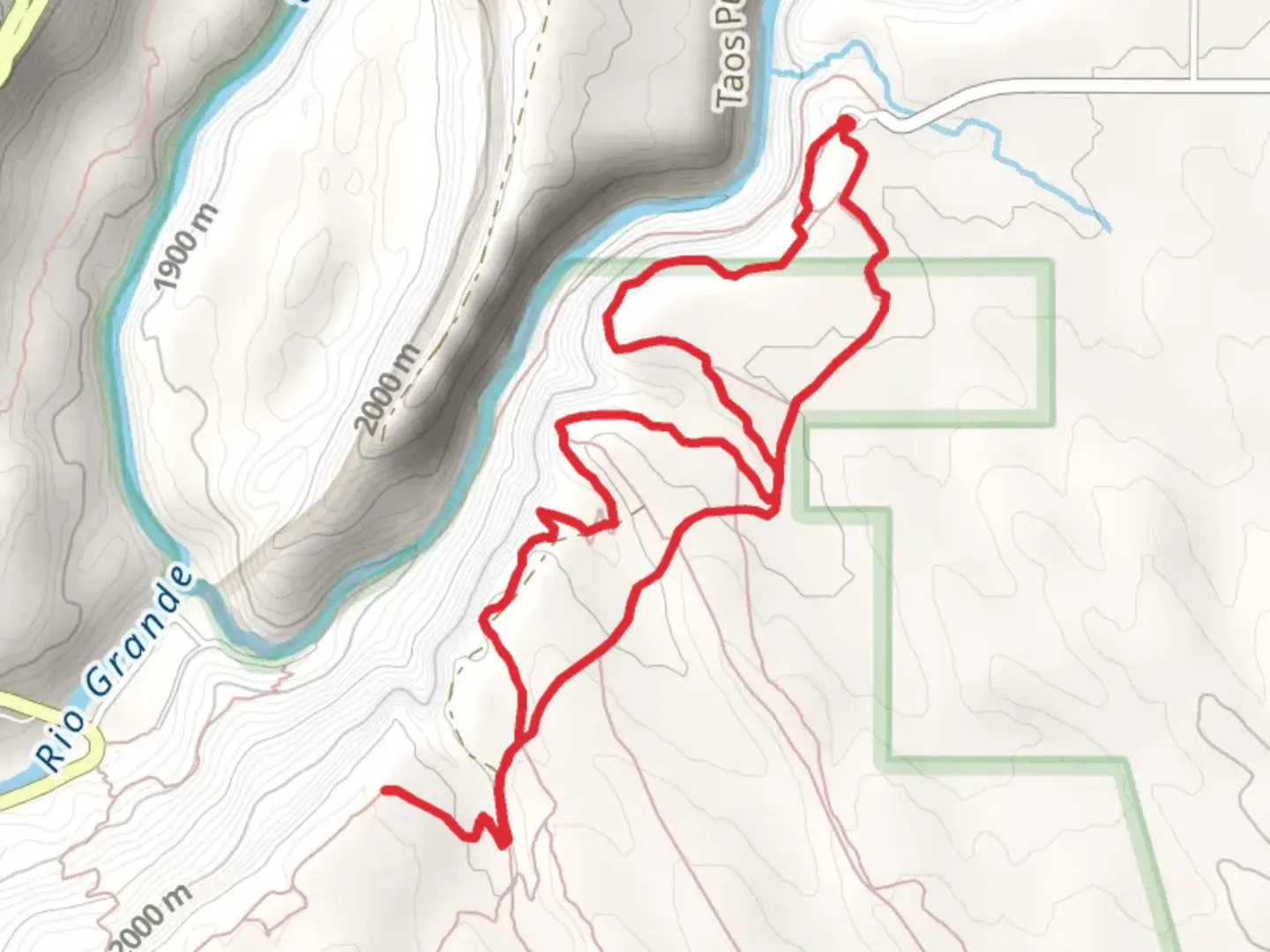
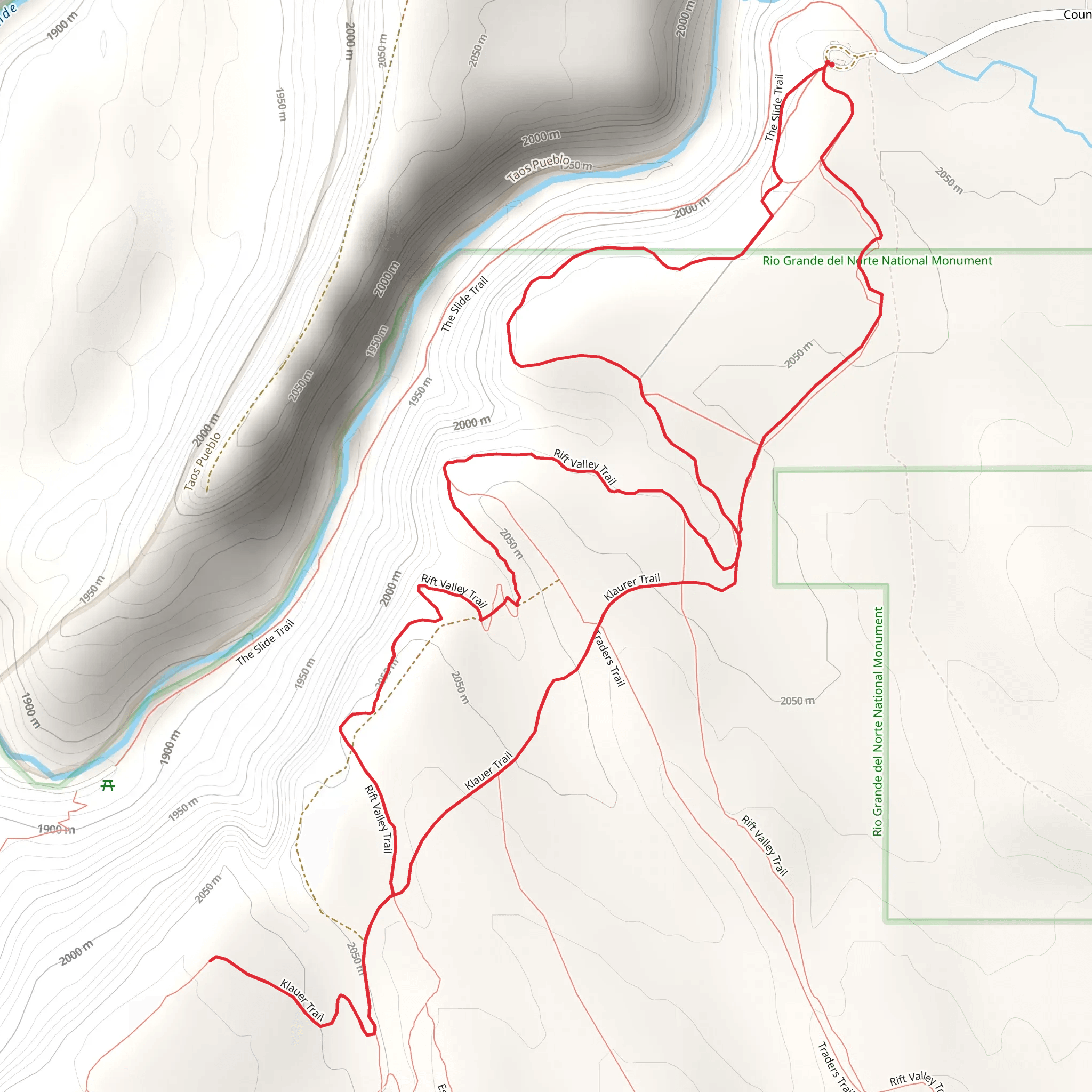
Starting your adventure near Taos County, New Mexico, the Rift Valley Trail and Klaurer Trail loop offers a captivating 7 km (approximately 4.3 miles) journey with an elevation gain of around 300 meters (984 feet). This medium-difficulty trail provides a blend of natural beauty, historical significance, and diverse wildlife, making it a rewarding experience for hikers.
Getting There To reach the trailhead, you can drive or use public transport. If driving, head towards the vicinity of Taos County, New Mexico. The nearest significant landmark is the Rio Grande Gorge Bridge, located about 10 miles (16 km) northwest of Taos. From there, follow the signs towards the trailhead parking area. For those using public transport, the Taos Express offers routes from Santa Fe and Albuquerque to Taos, where you can then take a local taxi or rideshare service to the trailhead.
Trail Navigation Utilize the HiiKER app for precise navigation and real-time trail updates. The app will guide you through the loop, ensuring you stay on track and can access important information about the trail conditions.
Trail Highlights The trail begins with a gentle ascent, offering panoramic views of the surrounding landscape. As you progress, you'll encounter a series of switchbacks that lead you higher into the terrain. At approximately 1.5 km (0.9 miles) into the hike, you'll reach a viewpoint overlooking the Rio Grande Gorge, a dramatic and picturesque sight that is perfect for a rest and photo opportunity.
Flora and Fauna The trail is rich with diverse plant life, including piñon pines, junipers, and various wildflowers, especially vibrant in the spring and early summer. Wildlife enthusiasts may spot mule deer, coyotes, and a variety of bird species such as red-tailed hawks and golden eagles. Keep an eye out for smaller creatures like lizards and rabbits that are common in this region.
Historical Significance This area holds significant historical value, with evidence of ancient Puebloan cultures that once inhabited the region. As you hike, you may come across petroglyphs and remnants of old dwellings, offering a glimpse into the lives of the indigenous people who lived here centuries ago.
Midpoint and Elevation Gain Around the 3.5 km (2.2 miles) mark, you'll reach the highest point of the trail, with an elevation gain of approximately 300 meters (984 feet). This section provides sweeping views of the Sangre de Cristo Mountains and the expansive desert landscape below. It's an ideal spot to take a break, hydrate, and enjoy the scenery.
Descent and Return The descent begins gradually, winding through a series of rocky outcrops and shaded areas. As you make your way back towards the trailhead, the path becomes more level, allowing for a leisurely finish to your hike. The loop concludes back at the starting point, where you can reflect on the diverse experiences and sights encountered along the way.
Safety and Preparation Ensure you are well-prepared with adequate water, sun protection, and sturdy hiking boots. The trail can be rocky and uneven in places, so proper footwear is essential. Check weather conditions before you set out, as the area can experience sudden changes in weather, particularly in the higher elevations.
By following these guidelines and using the HiiKER app for navigation, you'll be well-equipped to enjoy the Rift Valley Trail and Klaurer Trail loop, immersing yourself in the natural beauty and historical richness of this unique region.
What to expect?
Activity types
Comments and Reviews
User comments, reviews and discussions about the Rift Valley Trail and Klaurer Trail, New Mexico.
4.48
average rating out of 5
29 rating(s)
