Download
Preview
Add to list
More
41.5 km
~10 hrs 28 min
1302 m
Loop
“The Middle Fork, Skyline and West Fork Loop Trail offers breathtaking vistas and a challenging adventure for seasoned hikers.”
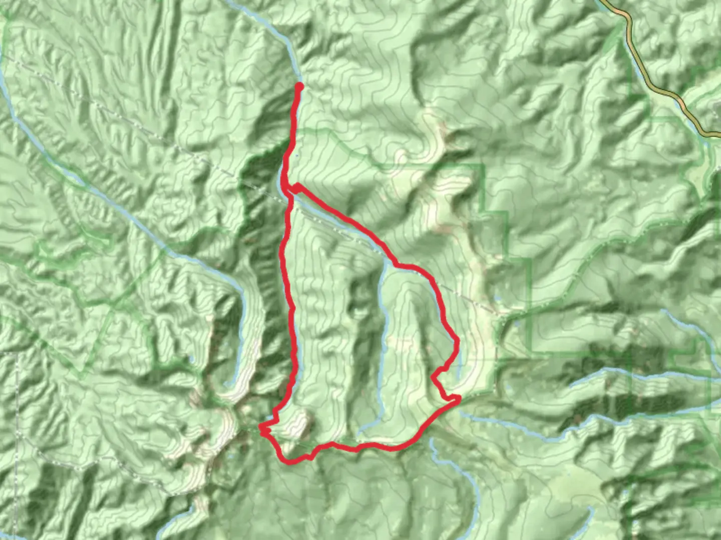
Nestled in the rugged beauty of Taos County, New Mexico, the Middle Fork, Skyline and West Fork Loop Trail offers a challenging yet rewarding adventure for seasoned hikers. Spanning approximately 42 kilometers (about 26 miles) with an elevation gain of around 1300 meters (approximately 4265 feet), this loop trail is known for its demanding terrain and breathtaking vistas.
Getting There
The trailhead is conveniently located near Taos County, making it accessible for those traveling by car or public transport. If you're driving, head towards the Carson National Forest, where the trail begins. For those relying on public transport, the nearest significant landmark is the town of Taos. From Taos, you can arrange a taxi or shuttle service to the trailhead, which is a popular starting point for many hikers exploring the region.
Trail Highlights
Middle Fork Section
The journey begins with the Middle Fork section, where hikers are immediately immersed in the lush landscapes of the Carson National Forest. This part of the trail is characterized by dense forests of ponderosa pine and aspen, providing ample shade and a serene atmosphere. As you progress, the trail follows the course of a gentle stream, offering opportunities to spot local wildlife such as mule deer and various bird species. Keep an eye out for the vibrant wildflowers that dot the landscape, especially during the spring and early summer months.
Skyline Section
Transitioning into the Skyline section, the trail ascends more steeply, offering panoramic views of the surrounding mountains. This is where the elevation gain becomes more pronounced, with the trail climbing steadily to offer breathtaking vistas of the Sangre de Cristo Mountains. The Skyline section is a photographer's dream, with sweeping views that stretch for miles. Be prepared for rocky terrain and ensure you have sturdy hiking boots for this part of the journey.
West Fork Section
As you enter the West Fork section, the trail begins to descend, leading hikers through a series of switchbacks that wind through alpine meadows and past cascading waterfalls. This section is particularly known for its diverse flora and fauna, with opportunities to see black bears and elk in their natural habitat. The sound of rushing water accompanies you as you make your way back towards the trailhead, providing a soothing backdrop to the final leg of your hike.
Historical Significance
The region surrounding the Middle Fork, Skyline and West Fork Loop Trail is steeped in history. The area was once home to the indigenous Taos Pueblo people, whose presence is still felt in the cultural richness of the region. As you hike, you'll be traversing lands that have been walked for centuries, offering a unique connection to the past. The nearby town of Taos is also known for its vibrant arts scene and historical landmarks, making it a worthwhile stop before or after your hike.
Navigation and Safety
Given the trail's difficulty rating, it's essential to come prepared with the right gear and navigation tools. HiiKER is an excellent resource for detailed maps and trail information, ensuring you stay on track throughout your journey. Weather conditions can change rapidly in the mountains, so pack layers and be prepared for sudden shifts in temperature. Additionally, carrying sufficient water and snacks is crucial, as the trail can be demanding and remote.
Embarking on the Middle Fork, Skyline and West Fork Loop Trail is a true adventure, offering a blend of natural beauty, challenging terrain, and historical intrigue. Whether you're drawn by the stunning landscapes or the rich cultural heritage, this trail promises an unforgettable experience for those ready to take on its challenges.

What to expect?
Activity types
Comments and Reviews
User comments, reviews and discussions about the Middle Fork, Skyline and West Fork Loop Trail, New Mexico.
average rating out of 5
0 rating(s)