Download
Preview
Add to list
More
105.1 km
~6 days
2943 m
Multi-Day
“Embark on the Skyline Trail for an epic, scenic hike through New Mexico's diverse and historic wilderness.”
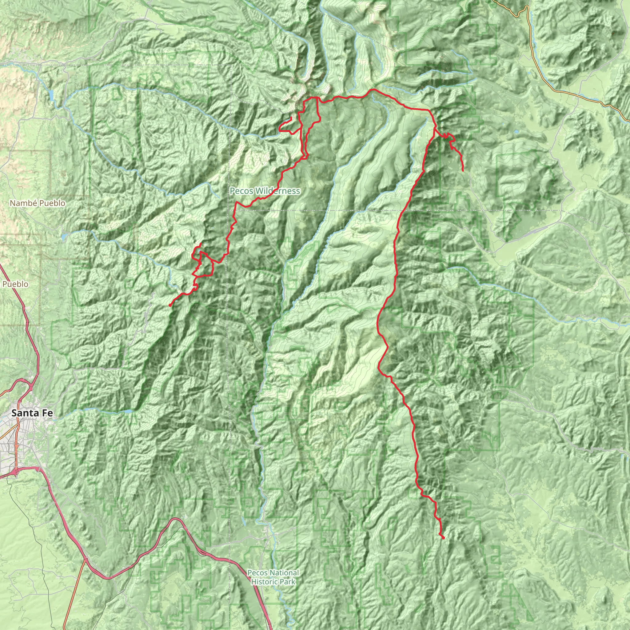
The Skyline Trail is a breathtaking journey that spans approximately 105 kilometers (65 miles) with an elevation gain of around 2900 meters (9500 feet), offering hikers a challenging yet rewarding experience. The trailhead is conveniently located near Santa Fe County, New Mexico, and can be accessed by car or public transportation. For those opting for public transport, the nearest bus stops are typically in Santa Fe, from where you can take a taxi or a rideshare to the trailhead.
Getting Started on the Skyline Trail
As you embark on the Skyline Trail, you'll traverse a variety of landscapes, including alpine meadows, dense forests, and rugged mountain terrain. The trail is a point-to-point hike, which means you'll start and finish at different locations, so planning for transportation back to your starting point is essential. Hikers can use the HiiKER app to navigate the trail and keep track of their progress.
Landmarks and Scenery
One of the most significant landmarks you'll encounter is the Santa Fe Baldy, a peak that stands at an elevation of 3,847 meters (12,622 feet). This is an excellent spot for panoramic views of the surrounding wilderness. As you continue, you'll pass serene mountain lakes, such as Lake Katherine and Spirit Lake, which are perfect for a restful break and to enjoy the reflections of the sky and trees on the water's surface.
Wildlife and Flora
The Skyline Trail is home to an array of wildlife, including elk, mule deer, and black bears. Birdwatchers will delight in the opportunity to spot various species, such as the Steller's jay and the mountain chickadee. The trail is also rich in flora, with wildflowers like the Indian paintbrush and aspen trees adding vibrant splashes of color to the landscape.
Historical Significance
The region around the Skyline Trail is steeped in history, with the area being a part of the ancestral homelands of several Indigenous tribes, including the Tewa, Tiwa, and Towa peoples. The trail itself may not have significant historical structures, but the land it traverses has been a part of the cultural and spiritual practices of these communities for centuries.
Preparation and Planning
Given the trail's medium difficulty rating, hikers should be in good physical condition and have some experience with long-distance hiking. It's essential to carry enough water, as sources along the trail may not be reliable or safe for drinking. Additionally, weather conditions can change rapidly at high elevations, so be prepared with appropriate clothing and gear.
Navigation and Safety
For navigation, the HiiKER app is a valuable tool for staying on track and being aware of upcoming terrain changes. Always let someone know your itinerary and expected return time. Given the presence of wildlife, it's wise to know how to store food properly and what to do in the unlikely event of an encounter with a bear.
Access to the Trailhead
To reach the trailhead by car, you'll drive towards Santa Fe National Forest, with the exact starting point being accessible via forest service roads. Parking is available near the trailhead, but it's advisable to arrive early during peak season to secure a spot.
By following these guidelines and being well-prepared, hikers can look forward to an unforgettable adventure on the Skyline Trail, surrounded by the natural beauty and grandeur of New Mexico's wilderness.
What to expect?
Activity types
Comments and Reviews
User comments, reviews and discussions about the Skyline Trail, New Mexico.
4.54
average rating out of 5
13 rating(s)

