Download
Preview
Add to list
More
6.0 km
~1 hrs 49 min
368 m
Loop
“Explore the Blue Dot and White Rock Canyon Rim Loop Trail for breathtaking views and rich historical landmarks.”
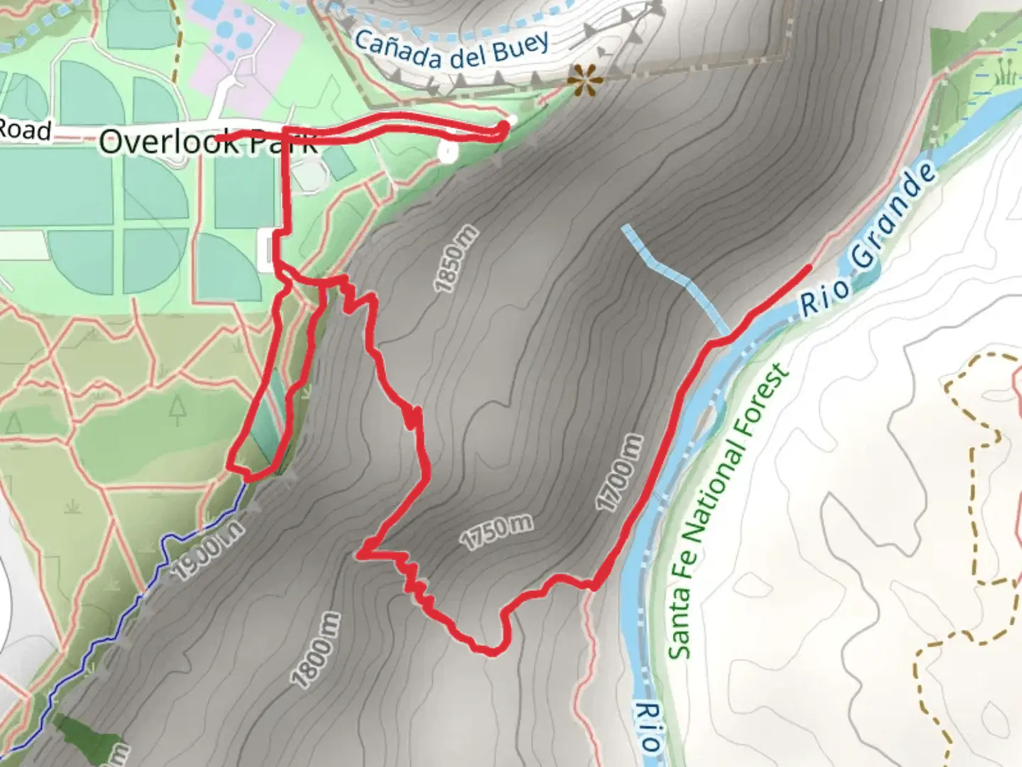
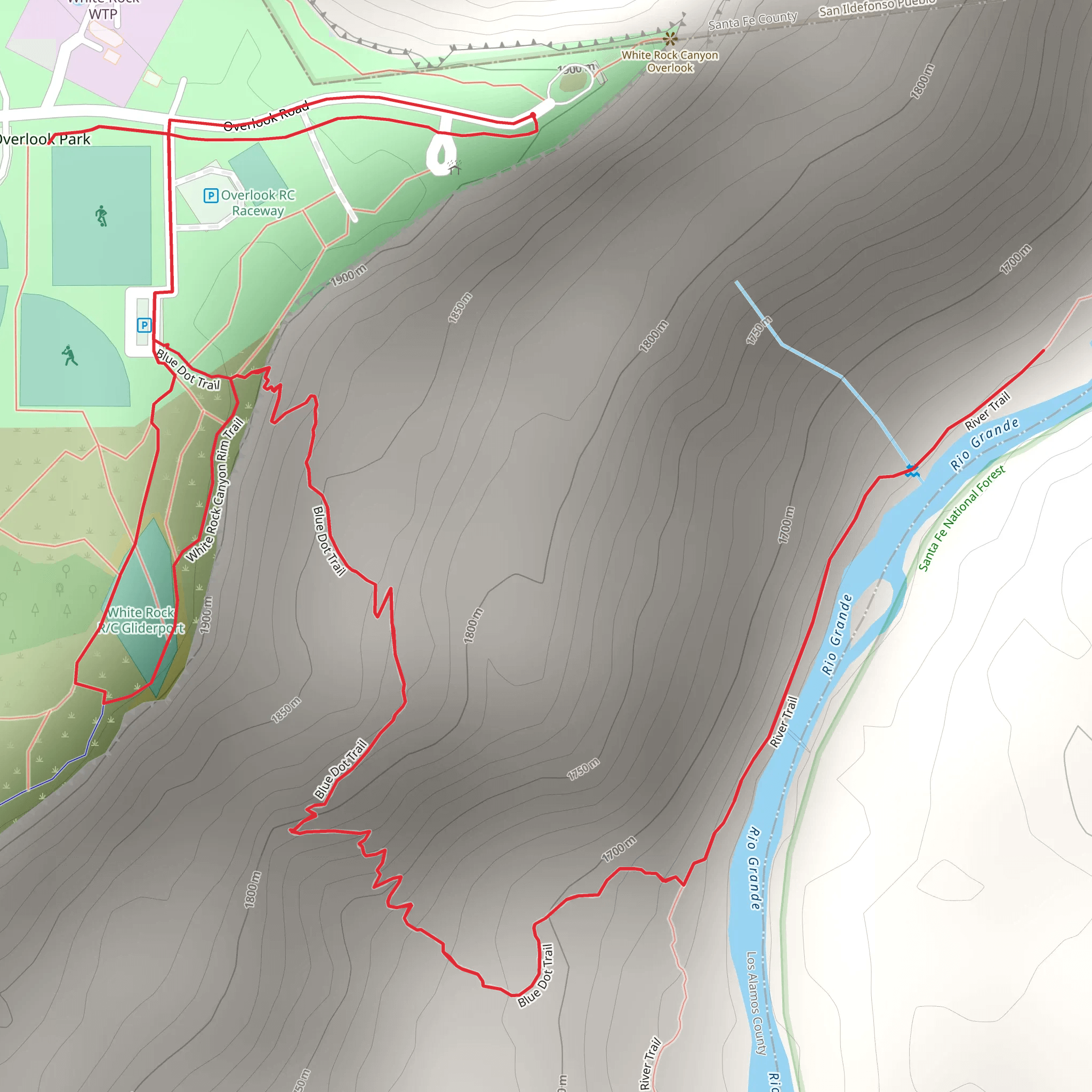
Starting your adventure near Los Alamos County, New Mexico, the Blue Dot and White Rock Canyon Rim Loop Trail offers a captivating 6 km (approximately 3.7 miles) journey with an elevation gain of around 300 meters (about 984 feet). This loop trail is rated medium in difficulty, making it suitable for moderately experienced hikers.
Getting There To reach the trailhead, you can drive or use public transportation. If driving, head towards the town of White Rock, New Mexico. The nearest significant landmark is the White Rock Visitor Center, located at 115 NM-4, White Rock, NM 87547. From there, it's a short drive to the trailhead. Public transport options include buses from Los Alamos to White Rock, with the nearest bus stop being at the White Rock Visitor Center.
Trail Overview The trailhead is easily accessible and well-marked. As you begin your hike, you'll descend into the canyon, following the Blue Dot Trail. This section is characterized by a steep descent, so be prepared for a challenging start. The trail is rocky and can be slippery, especially after rain, so sturdy hiking boots are recommended.
Significant Landmarks and Nature About 1.5 km (0.9 miles) into the hike, you'll reach the Rio Grande River. This is a great spot to take a break and enjoy the serene views of the river. The area is rich in wildlife, and you might spot various bird species, including hawks and eagles, as well as small mammals like squirrels and rabbits.
Continuing along the trail, you'll transition onto the White Rock Canyon Rim Trail. This section offers stunning panoramic views of the canyon and the surrounding mesas. The elevation gain here is gradual, making it a bit easier compared to the initial descent. The trail is well-marked, but it's always a good idea to have a navigation tool like HiiKER to ensure you stay on track.
Historical Significance The region around Los Alamos has a rich history, particularly related to the Manhattan Project during World War II. While hiking, you might come across remnants of old structures and artifacts from this era. The White Rock Canyon itself has been a significant area for Native American tribes for centuries, and you may see petroglyphs and other historical markers along the way.
Final Stretch As you approach the final 2 km (1.2 miles) of the loop, the trail begins to ascend back towards the starting point. This section can be quite strenuous due to the elevation gain, so take your time and enjoy the breathtaking views of the canyon and the Rio Grande below. The trail eventually loops back to the trailhead, completing your 6 km (3.7 miles) journey.
Tips for Hikers - Carry plenty of water, especially during the hotter months, as the trail can be quite exposed. - Wear sun protection, including a hat and sunscreen, as there is limited shade along the trail. - Be mindful of the weather, as conditions can change rapidly in this region. - Always inform someone of your hiking plans and expected return time.
This trail offers a mix of challenging terrain, stunning natural beauty, and historical intrigue, making it a rewarding experience for those who venture out to explore it.
What to expect?
Activity types
Comments and Reviews
User comments, reviews and discussions about the Blue Dot and White Rock Canyon Rim Loop Trail, New Mexico.
4.55
average rating out of 5
22 rating(s)
