Download
Preview
Add to list
More
36.9 km
~1 day 4 hrs
1215 m
Point-to-Point
“"Embark on the scenic, moderately challenging South Boundary Trail to Taos for breathtaking views and rich history."”
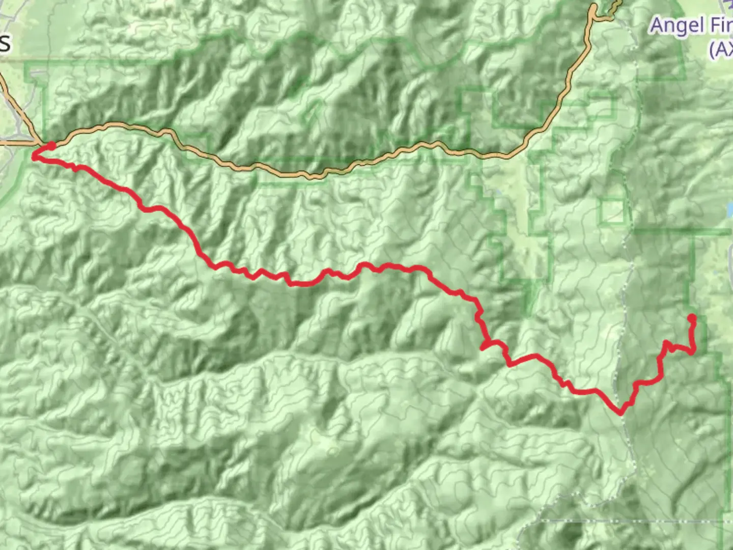
Starting near Colfax County, New Mexico, the South Boundary Trail to Taos stretches approximately 37 kilometers (23 miles) with an elevation gain of around 1200 meters (3937 feet). This point-to-point trail is rated as medium difficulty, making it suitable for moderately experienced hikers.
Getting There To reach the trailhead, you can drive or use public transportation. If driving, head towards Angel Fire, New Mexico, and park near the Angel Fire Resort. For those using public transport, the nearest major city is Taos, New Mexico. From Taos, you can take a local shuttle or taxi service to Angel Fire Resort.
Trail Overview The trail begins in the lush forests near Angel Fire, gradually ascending through mixed conifer and aspen groves. The initial 5 kilometers (3.1 miles) offer a gentle climb, gaining about 300 meters (984 feet) in elevation. This section is relatively shaded, providing a cool and refreshing start to your hike.
Mid-Trail Highlights As you progress, the trail opens up to expansive meadows around the 10-kilometer (6.2-mile) mark. Here, you can enjoy panoramic views of the Sangre de Cristo Mountains. This area is also a great spot for birdwatching, with species like the Mountain Bluebird and Red-tailed Hawk frequently spotted.
Continuing on, the trail becomes more challenging, with steeper inclines and rocky terrain. Around the 20-kilometer (12.4-mile) point, you'll encounter a significant climb, gaining approximately 400 meters (1312 feet) in elevation over a 5-kilometer (3.1-mile) stretch. This section can be strenuous, so take your time and stay hydrated.
Historical Significance The South Boundary Trail traverses lands that were historically inhabited by the Taos Pueblo people. The region is rich in cultural history, and you may come across ancient petroglyphs and remnants of old trading routes. It's important to respect these sites and leave them undisturbed.
Final Stretch The last 7 kilometers (4.3 miles) of the trail descend into the Taos Valley, offering stunning views of the Rio Grande Gorge. The descent is gradual, making for a pleasant end to your hike. You'll finish near the Taos Ski Valley, where you can find amenities like restrooms, food, and lodging.
Wildlife and Flora Throughout the hike, keep an eye out for local wildlife such as mule deer, black bears, and various bird species. The flora is equally diverse, with wildflowers like Indian Paintbrush and Lupine adding splashes of color to the landscape.
Navigation For navigation, it's highly recommended to use the HiiKER app, which provides detailed maps and real-time updates. This will help you stay on track and ensure a safe and enjoyable hike.
Preparation Tips Given the trail's length and elevation gain, it's crucial to be well-prepared. Carry sufficient water, snacks, and a first-aid kit. Weather can be unpredictable, so pack layers and rain gear. Trekking poles can also be helpful, especially during the steeper sections.
By following these guidelines and being mindful of the trail's natural and historical significance, you'll be well-prepared for an unforgettable hiking experience on the South Boundary Trail to Taos.

What to expect?
Activity types
Comments and Reviews
User comments, reviews and discussions about the South Boundary Trail to Taos, New Mexico.
4.25
average rating out of 5
8 rating(s)