Download
Preview
Add to list
More
29.0 km
~1 day 3 hrs
1614 m
Loop
“Embark on a scenic 29 km hike through the diverse landscapes and history of New Mexico's Sandia Mountains.”
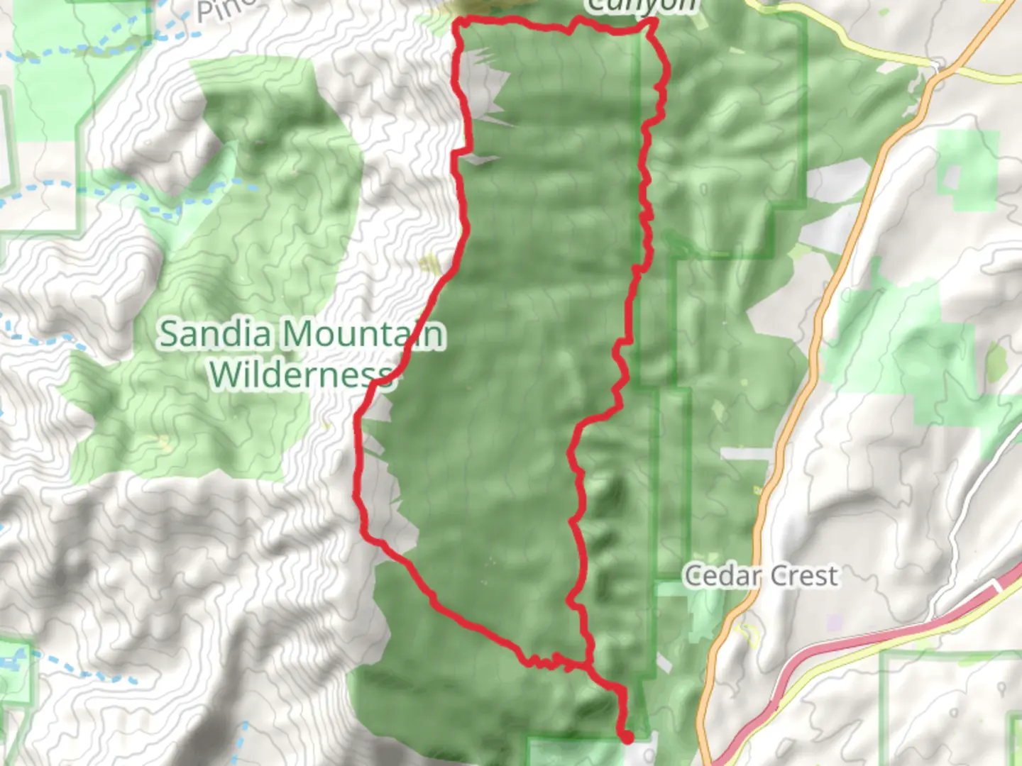
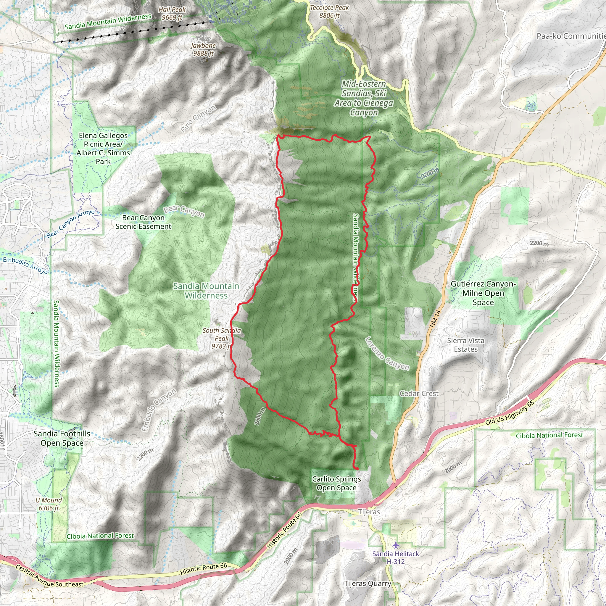
The South Crest, Faulty and Cienega Loop Trail is a captivating journey that spans approximately 29 kilometers (18 miles) and ascends roughly 1600 meters (5250 feet) in elevation. This loop trail is nestled near Bernalillo County, New Mexico, and offers a medium difficulty rating, making it accessible to hikers with a moderate level of experience.Getting to the Trailhead To reach the trailhead, you can drive to the Sandia Crest parking area, which is the most common starting point for the hike. If you're coming from Albuquerque, take the I-40 east to the NM-14 N/Cedar Crest exit. Follow NM-14 for about 6 miles, then turn left onto NM-536. Continue for another 14 miles until you reach the Sandia Crest parking area. For those relying on public transportation, check local schedules for any buses heading towards the Sandia Mountains and plan accordingly.Navigating the Trail Once at the trailhead, you can use HiiKER to help navigate the loop. The trail begins with a gradual ascent through a coniferous forest, offering hikers the chance to immerse themselves in the tranquility of the woods. As you climb, the vegetation transitions to include aspen groves, which can be particularly stunning during the fall when the leaves turn a vibrant yellow.Landmarks and Scenery The trail boasts several breathtaking overlooks that provide panoramic views of the surrounding landscape. One of the most notable is the South Sandia Peak, which you'll encounter after about 7 kilometers (4.3 miles) of hiking. Here, you can take in the vast expanse of the Rio Grande Valley and the distant mesas.Continuing on, the trail intersects with the Faulty Trail after approximately 11 kilometers (6.8 miles). This section is known for its geological features, including the fault line that gives the trail its name. The Faulty Trail portion is less traveled and offers a sense of solitude as well as the opportunity to spot local wildlife, such as mule deer and black bears.Cienega Canyon and Historical Significance As you loop back towards the starting point, the trail descends into Cienega Canyon. This area is lush with vegetation and features a stream that flows seasonally. The canyon has historical significance as well, with evidence of past human activity such as logging, which played a role in the development of the region.Flora and Fauna Throughout the hike, keep an eye out for the diverse flora and fauna that inhabit the area. The mixed forest is home to various bird species, including the Steller's jay and the mountain chickadee. Wildflowers add splashes of color along the trail in the spring and summer months.Preparation and Safety Before setting out, ensure you have enough water, as there are limited sources along the trail, and the high elevation can lead to quicker dehydration. Also, be prepared for changing weather conditions, as the mountains can bring unexpected temperature drops and storms. It's advisable to check the weather forecast and start your hike early in the day to avoid afternoon thunderstorms.Conclusion The South Crest, Faulty and Cienega Loop Trail offers a rich hiking experience with its varied landscapes, historical insights, and opportunities for wildlife viewing. With proper preparation and the use of navigation tools like HiiKER, hikers can enjoy a memorable adventure in the Sandia Mountains.
What to expect?
Activity types
Comments and Reviews
User comments, reviews and discussions about the South Crest, Faulty and Cienega Loop Trail, New Mexico.
4.56
average rating out of 5
18 rating(s)
