Mount Tom, Mount Hale, Mount Guyot and Ethan Pond Loop Trail
Download
Preview
Add to list
More
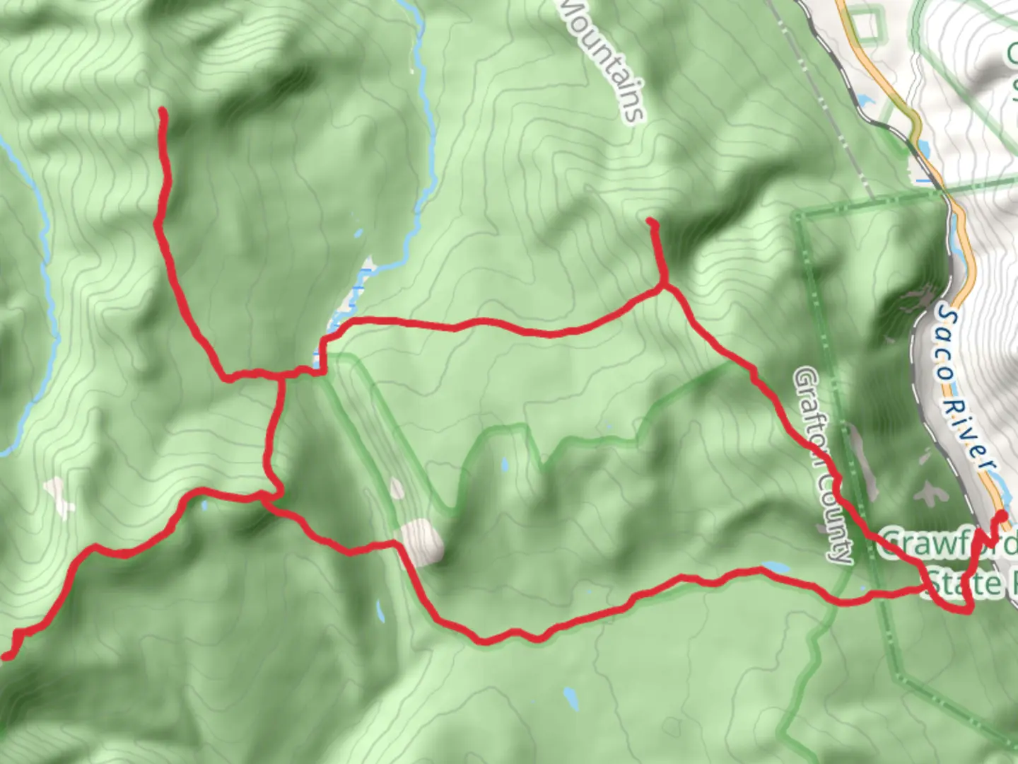
41.7 km
~2 day
2460 m
Loop
“Traverse lush forests and rugged peaks on New Hampshire's scenic 42-km Mount Tom-Hale-Guyot-Ethan Pond Loop.”
Embarking on the Mount Tom, Mount Hale, Mount Guyot, and Ethan Pond Loop Trail, hikers will traverse a diverse landscape that spans approximately 42 kilometers (26 miles) with an elevation gain of around 2400 meters (7874 feet). This loop trail, nestled near Carroll County, New Hampshire, offers a medium difficulty rating, making it accessible to hikers with a moderate level of experience.Getting to the TrailheadThe trailhead is conveniently located near the town of Carroll, New Hampshire. For those driving, parking is available at the trailhead, which can be reached by following local roads off of US Route 302. If you're using public transportation, the nearest bus stops are in the towns of Littleton or Lincoln, from which you can take a taxi or arrange a shuttle to the trailhead.Navigating the TrailTo navigate the trail, hikers can utilize the HiiKER app, which provides detailed maps and GPS coordinates to ensure you stay on the correct path. The loop can be tackled in either direction, but many choose to begin with Mount Tom for a gradual ascent.Mount Tom to Mount HaleThe initial segment to Mount Tom is a steady climb through dense forests, offering occasional glimpses of the surrounding White Mountains. After reaching the summit of Mount Tom, the trail descends slightly before climbing again towards Mount Hale. This section is approximately 10 kilometers (6.2 miles) and includes a mix of rocky terrain and soft forest floor.Mount Hale to Mount GuyotMount Hale's summit provides a sense of accomplishment before continuing towards Mount Guyot. This stretch, around 12 kilometers (7.5 miles), is where hikers will encounter the majority of the elevation gain. The path leads through old-growth forests and over brooks, with the flora and fauna changing as you ascend. Keep an eye out for local wildlife, including moose and black bears, while enjoying the vibrant wildflowers and bird songs.Mount Guyot to Ethan PondMount Guyot stands as a highlight of the loop with its stunning panoramic views. From here, the trail meanders towards Ethan Pond, covering roughly 10 kilometers (6.2 miles). This section is less strenuous, allowing hikers to appreciate the high alpine environment and the serene Ethan Pond, which is a perfect spot for a rest or a swim in the warmer months.Ethan Pond Loop CompletionThe final leg of the loop back to the trailhead is about 10 kilometers (6.2 miles) and is characterized by a gradual descent through mixed forests. The sounds of the nearby streams create a peaceful ambiance as you complete the journey.Historical SignificanceThe region is steeped in history, with the White Mountains playing a significant role in the logging industry of the 19th and early 20th centuries. The trails often follow old logging roads and rail lines, giving hikers a glimpse into the past. Conservation efforts have since transformed these areas into the recreational paths we enjoy today.Preparation and PlanningBefore setting out, ensure you have adequate supplies, including water, food, and layers for changing weather conditions. The weather in the White Mountains can be unpredictable, so it's essential to be prepared for anything from sunshine to rain or even snow, depending on the season. Also, remember to leave no trace and respect the natural environment to preserve it for future generations.By following these guidelines and preparing accordingly, hikers can look forward to an enriching experience on the Mount Tom, Mount Hale, Mount Guyot, and Ethan Pond Loop Trail.

What to expect?
Activity types
Comments and Reviews
User comments, reviews and discussions about the Mount Tom, Mount Hale, Mount Guyot and Ethan Pond Loop Trail, New Hampshire.
average rating out of 5
0 rating(s)