Download
Preview
Add to list
More
101.6 km
~6 days
3609 m
Multi-Day
“Embark on the Toiyabe Crest Trail, a 63-mile tapestry of history, wildlife, and breathtaking Nevada vistas.”
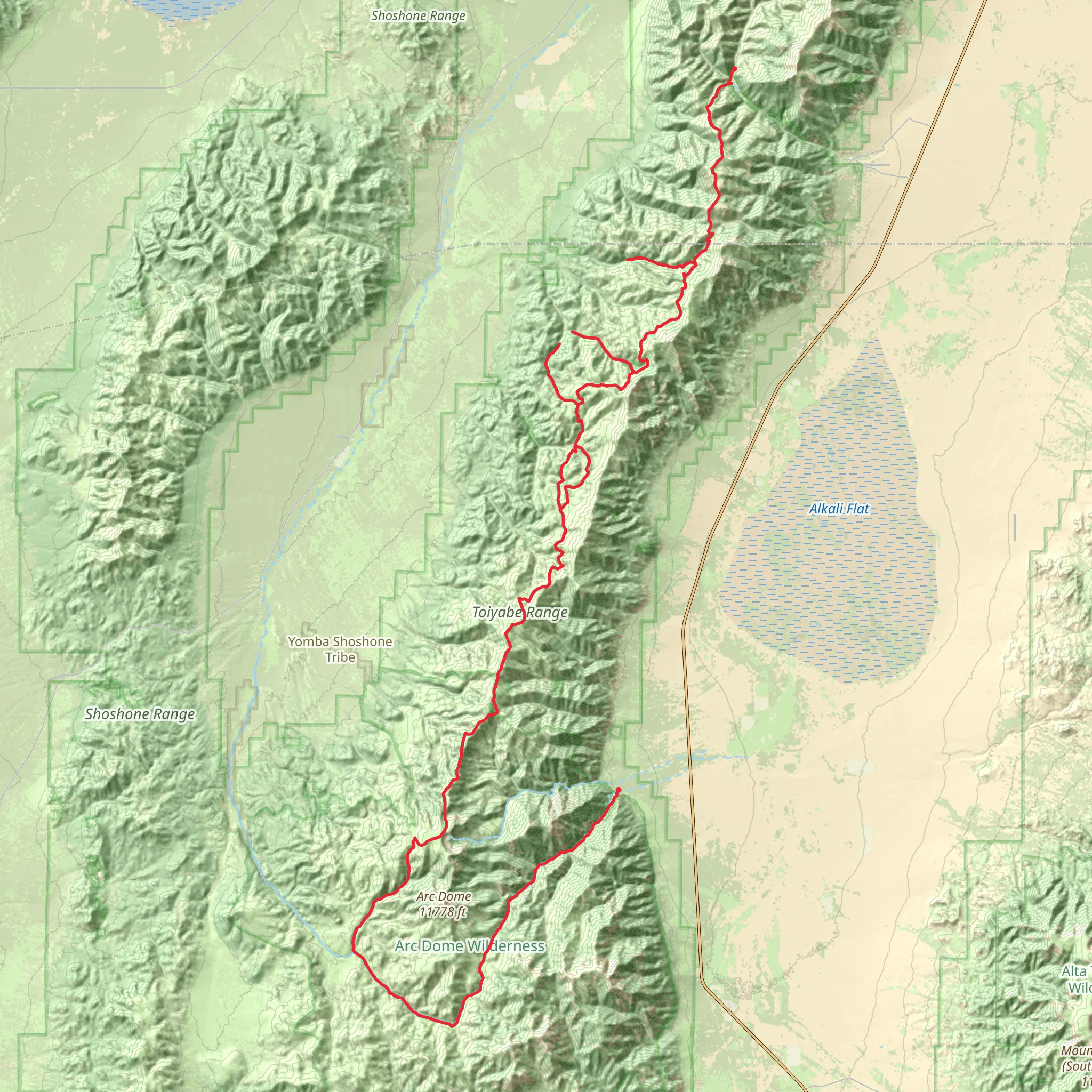
The Toiyabe Crest Trail, a hidden gem nestled in the vast expanse of central Nevada, offers an immersive experience into the heart of the Toiyabe Range. Stretching approximately 102 kilometers (63 miles), with an elevation gain of around 3,600 meters (11,800 feet), this point-to-point trail is a journey through diverse landscapes, from arid basins to lush alpine forests.
Getting to the Trailhead
The trailhead is located near Lander County, Nevada, and is most easily accessed by car. From the town of Carvers, take NV-376 to the signed turnoff for the Kingston Canyon Campground. This is the southern terminus of the trail and where your adventure begins. Public transport options are limited in this remote area, so arranging a shuttle or a drop-off is recommended for those not driving.
Navigating the Trail
The Toiyabe Crest Trail is well-marked in most sections, but due to its remote nature, it's essential to be prepared with reliable navigation tools. HiiKER is an excellent resource for trail maps and can help you stay on track throughout your hike.
Trail Experience
As you embark on the trail, the initial ascent is a steady climb, taking you through pinyon-juniper woodlands. The trail then transitions into higher elevations where aspen and mountain mahogany trees become more prevalent. Approximately 20 kilometers (12 miles) in, you'll reach the crest of the Toiyabe Range, where you'll be greeted with panoramic views that stretch across the valleys below.
Wildlife and Flora
The Toiyabe Crest Trail is a haven for wildlife enthusiasts. The range is home to a variety of animals, including mule deer, mountain lions, and a diverse array of bird species. Wildflowers bloom in the spring and early summer, painting the landscape with vibrant colors.
Historical Significance
The Toiyabe Range has a rich history, with the trail itself following paths once used by Native Americans and later by miners and ranchers. As you hike, you'll encounter remnants of this past, including old mining equipment and cabins that date back to the 19th and early 20th centuries.
Challenges and Considerations
The trail is rated as medium difficulty, but it's important to be prepared for the challenges of a high-elevation, backcountry hike. Weather can change rapidly, and snow can linger on the higher passes well into the summer months. Water sources are scarce, so carrying an adequate supply and a means of purification is crucial.
End of the Trail
The northern terminus of the Toiyabe Crest Trail is near the town of Ophir in Toiyabe National Forest. After descending from the crest, the trail winds through more forested areas and open meadows before concluding your journey. Arranging transportation from this end of the trail requires planning, as it is remote and not serviced by public transport.
Whether you're seeking solitude, a challenging hike, or an opportunity to explore the natural and historical wonders of Nevada, the Toiyabe Crest Trail is a rewarding experience for those prepared for its rigors.
What to expect?
Activity types
Comments and Reviews
User comments, reviews and discussions about the Toiyabe Crest Trail, Nevada.
4.64
average rating out of 5
11 rating(s)

