Download
Preview
Add to list
More
9.4 km
~2 hrs 1 min
86 m
Out and Back
“Embark on the tranquil Como Lake Trail, a scenic and historic 9 km Montana hike with minimal elevation.”
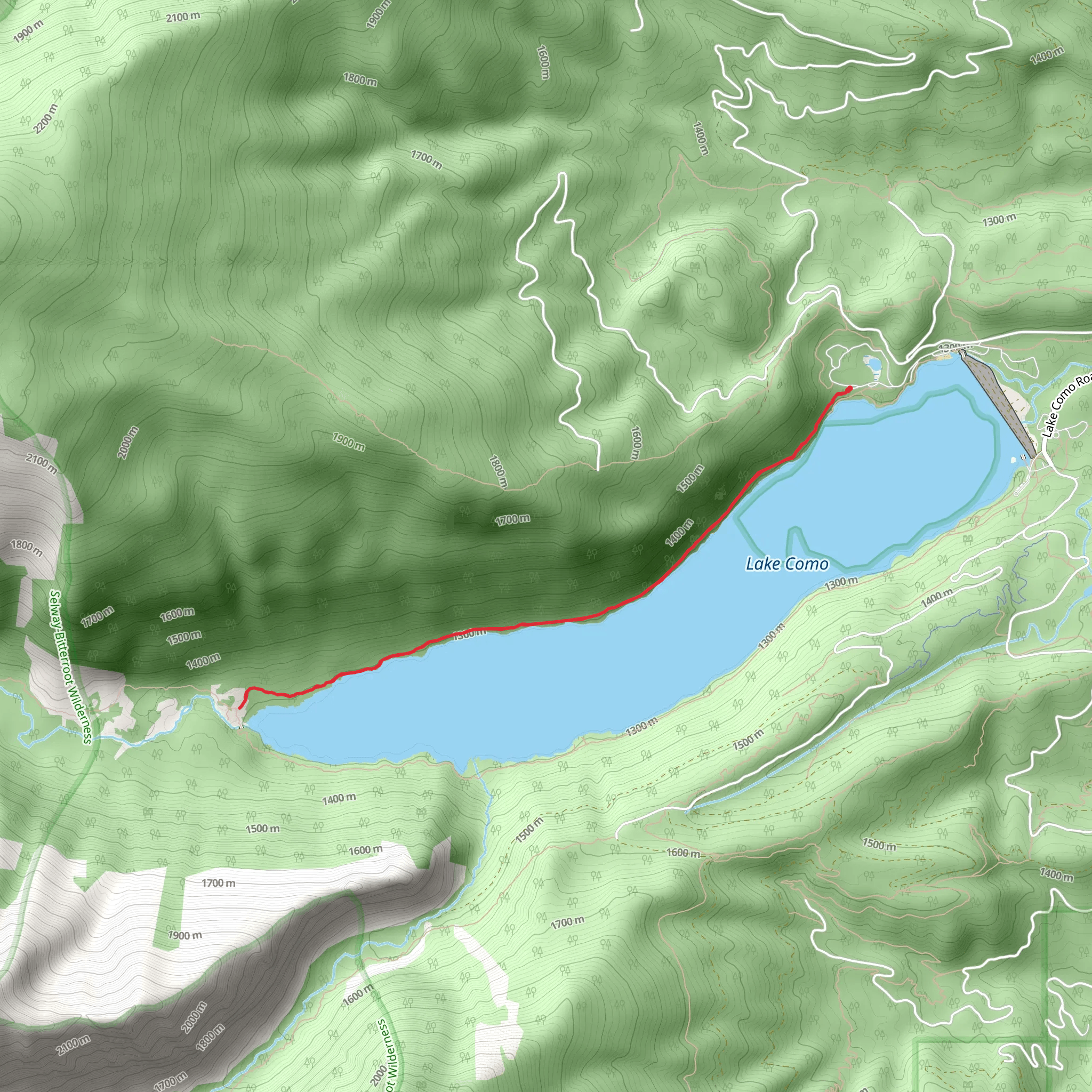
The Como Lake Trail, nestled in the Bitterroot Valley near Ravalli County, Montana, offers hikers a scenic journey through a diverse landscape. This out-and-back trail spans approximately 9 kilometers (5.6 miles) and, despite its medium difficulty rating, it has a minimal elevation gain, making it accessible to a wide range of hikers.
Getting to the Trailhead
To reach the trailhead, you can drive to the Lake Como Recreation Area, which is situated off Highway 93. From the town of Hamilton, Montana, head south for about 16 kilometers (10 miles) until you see signs for Lake Como. Turn west onto Lake Como Road and follow it for approximately 6.4 kilometers (4 miles) to the parking area. Public transport options are limited in this region, so driving is the most feasible option for accessing the trail.
Trail Experience
As you embark on the Como Lake Trail, you'll be greeted by the stunning views of Lake Como, framed by the majestic Bitterroot Mountains. The trail is well-maintained and marked, making navigation straightforward. Hikers can utilize the HiiKER app to track their progress and ensure they stay on the correct path.
The first section of the trail meanders along the northern shore of Lake Como, offering ample opportunities to take in the serene waters and surrounding peaks. Approximately 2 kilometers (1.2 miles) in, you'll encounter a small beach area, which is a perfect spot for a brief rest or a picnic.
Continuing on, the trail leads you through a mix of ponderosa pine forests and open meadows. Keep an eye out for the diverse wildlife in the area, including deer, elk, and a variety of bird species. The sound of the water and the rustling of leaves create a peaceful ambiance as you hike.
Historical Significance
The Bitterroot Valley holds a rich history, with the Como Lake area being part of the traditional lands of the Salish people. The region was later explored by Lewis and Clark in the early 19th century. As you hike, consider the long history of human presence in this area and the ways in which the landscape has been shaped over time.
Trail Conclusion
As you approach the end of the trail, you'll find yourself at the southern edge of the lake, which offers a different perspective and equally breathtaking views. After soaking in the scenery, you'll retrace your steps back to the trailhead. The round trip is around 9 kilometers (5.6 miles), and with the minimal elevation gain, most hikers complete the hike in about 3 to 4 hours.
Remember to pack out all trash, respect the natural environment, and consider the weather conditions before you set out, as the trail can be quite exposed in places. With its stunning lake views, gentle terrain, and rich history, the Como Lake Trail is a rewarding experience for hikers of all levels.
Comments and Reviews
User comments, reviews and discussions about the Como Lake Trail, Montana.
4.18
average rating out of 5
11 rating(s)

