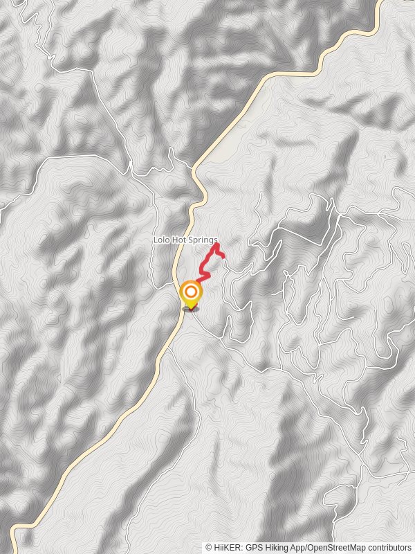
4.1 km
~1 hrs 6 min
181 m
“Discover a moderate 4 km trail near Missoula, blending scenic views, rich history, and abundant wildlife.”
Starting near Missoula County, Montana, this 4 km (approximately 2.5 miles) out-and-back trail offers a moderate hiking experience with an elevation gain of around 100 meters (328 feet). The trailhead is conveniently located near the intersection of Mullan Road and Flynn Lane, making it accessible by both car and public transport. If you're driving, there's ample parking available at the trailhead. For those using public transport, the nearest bus stop is at Mullan Road, serviced by Mountain Line Route 1, which runs frequently from downtown Missoula.
### Trail Overview
The trail begins with a gentle ascent through a mixed forest of ponderosa pine and Douglas fir, providing ample shade and a cool environment, especially during the warmer months. As you progress, the path becomes slightly steeper, but the well-maintained trail ensures a comfortable hike. Keep an eye out for the diverse flora, including wildflowers such as lupines and Indian paintbrush, which bloom in the spring and early summer.
### Significant Landmarks and Points of Interest
At approximately 1 km (0.6 miles) into the hike, you'll come across a small wooden bridge that crosses Mud Creek. This is a great spot to pause and enjoy the serene sound of flowing water. The creek is home to various species of fish and amphibians, so take a moment to observe the aquatic life.
Continuing along the trail, you'll reach a scenic overlook at around 2 km (1.2 miles). This vantage point offers stunning views of the surrounding Missoula Valley and the distant Bitterroot Mountains. It's an ideal location for a quick rest and some photography.
### Wildlife and Nature
The area is rich in wildlife, and it's not uncommon to spot deer, elk, and even the occasional black bear. Birdwatchers will be delighted by the variety of species, including bald eagles, ospreys, and various songbirds. Always carry a pair of binoculars and a camera to capture these moments.
### Historical Significance
The region around Mud Creek has a rich history, with evidence of Native American habitation dating back thousands of years. The Salish and Kootenai tribes once roamed these lands, and you might come across interpretive signs along the trail that provide insights into their way of life and the historical significance of the area.
### Navigation and Safety
For navigation, it's highly recommended to use the HiiKER app, which provides detailed maps and real-time updates. The trail is well-marked, but having a reliable navigation tool ensures you stay on track. Always carry sufficient water, snacks, and a basic first aid kit. The weather can change rapidly, so dressing in layers and carrying a rain jacket is advisable.
### Getting There
To reach the trailhead by car, head west on Mullan Road from downtown Missoula. After approximately 8 km (5 miles), turn right onto Flynn Lane. The trailhead parking area will be on your left after about 1 km (0.6 miles). For those using public transport, take Mountain Line Route 1 to the Mullan Road stop, then walk west along Mullan Road for about 1 km (0.6 miles) to reach Flynn Lane and the trailhead.
This trail offers a perfect blend of natural beauty, wildlife, and historical significance, making it a rewarding hike for both novice and experienced hikers.
Reviews
User comments, reviews and discussions about the Walk beside Mud Creek, Montana.
5.0
average rating out of 5
24 rating(s)


