Download
Preview
Add to list
More
7.8 km
~1 hrs 53 min
200 m
Out and Back
“Amity Creek via Superior Hiking Trail offers a scenic, moderately challenging hike with waterfalls, wildlife, and rich history.”
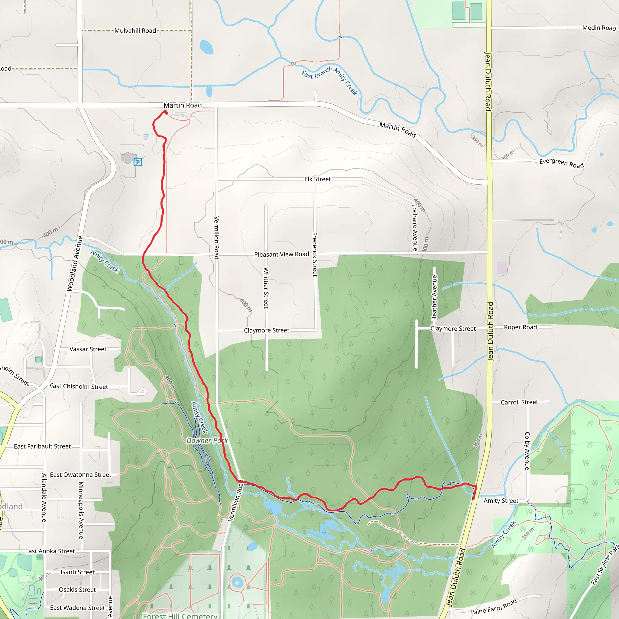
Starting near St. Louis County, Minnesota, the Amity Creek via Superior Hiking Trail offers an invigorating out-and-back hike spanning approximately 8 kilometers (around 5 miles) with an elevation gain of about 200 meters (656 feet). This trail is rated as medium difficulty, making it suitable for moderately experienced hikers.
Getting There To reach the trailhead, you can drive or use public transportation. If driving, head towards the nearest significant landmark, Lester Park, located in Duluth, Minnesota. From there, follow the signs to the Superior Hiking Trail access point. For those using public transport, the Duluth Transit Authority (DTA) offers bus services that can get you close to Lester Park, from where you can walk to the trailhead.
Trail Navigation For navigation, it's highly recommended to use the HiiKER app, which provides detailed maps and real-time updates. This will help you stay on track and ensure you don't miss any key points of interest along the way.
Trail Highlights The trail begins with a gentle ascent through a dense forest of maple, birch, and pine trees. As you progress, you'll encounter Amity Creek, which runs parallel to the trail for a significant portion. The sound of flowing water adds a serene backdrop to your hike.
Significant Landmarks At approximately 1.5 kilometers (0.9 miles) in, you'll come across the first significant landmark: the Amity Creek Falls. This picturesque waterfall is a great spot for a short break and some photography. The falls are particularly impressive in the spring when the water flow is at its peak.
Continuing along the trail, you'll reach a series of wooden bridges that cross over the creek. These bridges offer stunning views of the water below and are perfect for birdwatching. Keep an eye out for local species such as the American Goldfinch and the Pileated Woodpecker.
Elevation Gain The trail's elevation gain is gradual but noticeable. Around the 4-kilometer (2.5-mile) mark, you'll reach the highest point of the hike, offering panoramic views of the surrounding forest and distant Lake Superior. This is an excellent spot to pause and take in the scenery before beginning your descent.
Flora and Fauna The trail is rich in biodiversity. In the spring and summer months, you'll find a variety of wildflowers, including Trillium and Lady Slippers. The forest is also home to white-tailed deer, red foxes, and occasionally, black bears. Always practice safe wildlife viewing by keeping a respectful distance and not feeding the animals.
Historical Significance The Superior Hiking Trail, including the Amity Creek section, has historical significance as it follows routes used by Native American tribes and early European settlers. The trail itself is part of a larger network that spans over 300 miles along the North Shore of Lake Superior, offering a glimpse into the region's rich cultural and natural history.
Final Stretch As you make your way back, the descent offers a different perspective of the landscape, with the late afternoon sun casting long shadows through the trees. The return journey allows you to revisit the landmarks and perhaps notice details you missed on the way up.
This hike is a rewarding experience, offering a mix of natural beauty, wildlife, and a touch of history, making it a must-do for anyone visiting the Duluth area.
What to expect?
Activity types
Comments and Reviews
User comments, reviews and discussions about the Amity Creek via Superior Hiking Trail, Minnesota.
4.48
average rating out of 5
31 rating(s)
