Download
Preview
Add to list
More
43.1 km
~8 hrs 45 min
87 m
Point-to-Point
“Explore Minnesota's serene landscapes and rich history on the accessible Scenic Highway Southeast Trail.”
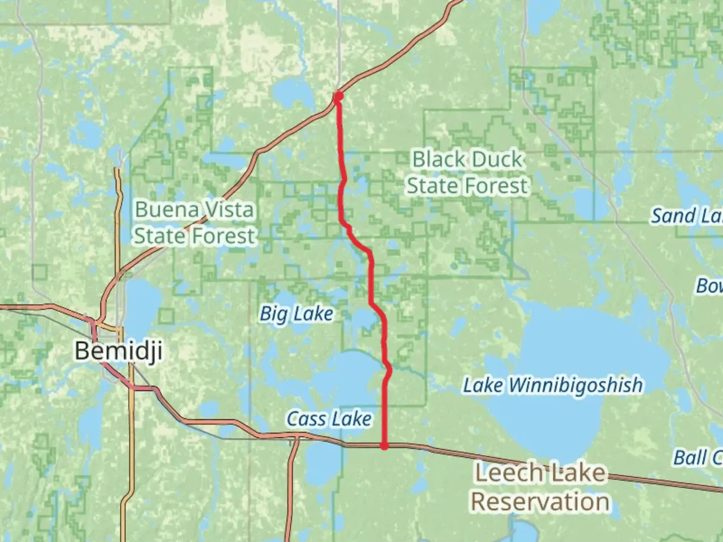
Embarking on the Scenic Highway Southeast Trail offers a delightful journey through the serene landscapes of northern Minnesota. This point-to-point trail stretches approximately 43 kilometers (about 27 miles) with virtually no elevation gain, making it an accessible adventure for hikers of all skill levels. The trailhead is conveniently located near Beltrami County, Minnesota, providing a perfect starting point for those eager to explore the natural beauty of the region.
Getting There
To reach the trailhead, travelers can drive to Beltrami County, which is well-connected by major roads. If you're using public transport, the nearest significant town is Bemidji, Minnesota. From Bemidji, you can take a local bus or arrange a taxi to the trailhead. For those driving, ample parking is available near the starting point, ensuring a hassle-free beginning to your hike.
Trail Highlights
As you set out on the Scenic Highway Southeast Trail, you'll be greeted by the lush greenery and tranquil surroundings that define this part of Minnesota. The trail meanders through dense forests, offering a peaceful escape from the hustle and bustle of everyday life. Keep an eye out for the diverse wildlife that inhabits the area, including deer, foxes, and a variety of bird species. Birdwatchers will particularly enjoy the opportunity to spot native species in their natural habitat.
Historical Significance
The region around the trail is steeped in history, with roots tracing back to the indigenous Ojibwe people who have lived in the area for centuries. As you hike, consider the rich cultural heritage that surrounds you, and take a moment to appreciate the land's historical significance. The trail itself follows a route that has been used for generations, offering a glimpse into the past as you traverse this timeless landscape.
Navigation and Safety
Given the trail's easy difficulty rating, it is suitable for families and novice hikers. However, it's always wise to be prepared. Use the HiiKER app to navigate the trail and ensure you stay on course. The app provides detailed maps and real-time updates, making it an invaluable tool for your journey. While the trail is well-marked, having a reliable navigation aid will enhance your hiking experience.
Points of Interest
Along the way, you'll encounter several notable landmarks. The trail passes by pristine lakes and streams, perfect for a refreshing break or a picnic. The clear waters reflect the sky and surrounding trees, creating picturesque scenes that are ideal for photography enthusiasts. Additionally, the trail offers occasional glimpses of the region's rolling hills, adding variety to the otherwise flat terrain.
Preparing for Your Hike
Before setting out, ensure you have adequate supplies, including water, snacks, and appropriate clothing for the weather. The trail's length requires a full day to complete, so plan accordingly. While the trail is generally safe, always inform someone of your plans and expected return time.
The Scenic Highway Southeast Trail promises a rewarding experience for those seeking to immerse themselves in Minnesota's natural beauty and historical richness. Whether you're a seasoned hiker or a beginner, this trail offers a memorable journey through one of the state's most picturesque regions.

What to expect?
Activity types
Comments and Reviews
User comments, reviews and discussions about the Scenic Highway Southeast Trail, Minnesota.
average rating out of 5
0 rating(s)