Download
Preview
Add to list
More
211.4 km
~77 hrs 21 min
21049 m
Loop
“The Union Street Loop - Cart Path challenges hikers with steep climbs and breathtaking natural and historical vistas.”
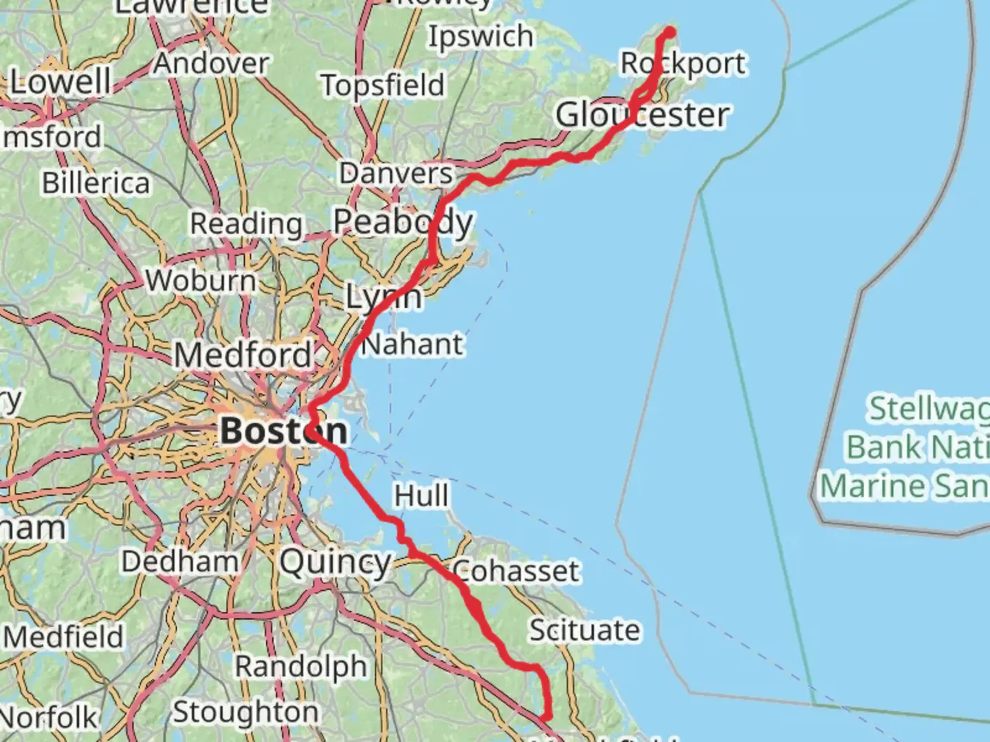
The Union Street Loop - Cart Path is a formidable challenge for any hiker, stretching approximately 211 kilometers (about 131 miles) with an elevation gain of around 21,000 meters (approximately 68,900 feet). This loop trail begins near Essex County, Massachusetts, and is renowned for its demanding terrain and breathtaking vistas.
Getting There
To reach the trailhead, you can drive or use public transportation. If driving, head towards Essex County, Massachusetts, and look for parking options near the trail's starting point. For those using public transport, the nearest major city is Boston. From Boston, you can take a commuter rail service to the North Shore area, followed by a local bus or taxi to the trailhead.
Trail Overview
The Union Street Loop - Cart Path is classified as extra difficult, making it suitable for experienced hikers who are well-prepared for its challenges. The trail's loop configuration allows for a continuous journey without retracing steps, offering a diverse range of landscapes and experiences.
Terrain and Elevation
The trail's elevation gain is significant, with steep ascents and descents that will test your endurance and strength. Hikers should be prepared for rugged paths, rocky outcrops, and potentially slippery conditions, especially after rain. The elevation gain of 21,000 meters (68,900 feet) is spread throughout the trail, with some sections featuring particularly steep climbs.
Landmarks and Nature
As you traverse the Union Street Loop - Cart Path, you'll encounter a variety of natural and historical landmarks. The trail winds through dense forests, open meadows, and along scenic ridgelines. Keep an eye out for local wildlife, including deer, foxes, and a variety of bird species. The area is also known for its vibrant fall foliage, offering a spectacular display of colors in the autumn months.
Historical Significance
The region around Essex County is steeped in history, with roots dating back to the early colonial period. As you hike, you'll pass through areas that were once significant in the development of the early American colonies. Look for remnants of old cart paths and stone walls, which tell the story of the area's agricultural past.
Navigation and Preparation
Given the trail's complexity, it's crucial to have reliable navigation tools. The HiiKER app is recommended for its detailed maps and real-time updates, ensuring you stay on course. Make sure to pack sufficient supplies, including water, food, and appropriate clothing for changing weather conditions. Due to the trail's difficulty, it's advisable to hike with a partner or group and inform someone of your plans before setting out.
The Union Street Loop - Cart Path offers a challenging yet rewarding experience for those who are prepared. With its combination of natural beauty, historical intrigue, and physical demands, it promises an unforgettable adventure for seasoned hikers.

What to expect?
Activity types
Comments and Reviews
User comments, reviews and discussions about the Union Street Loop - Cart Path, Massachusetts.
average rating out of 5
0 rating(s)