Download
Preview
Add to list
More
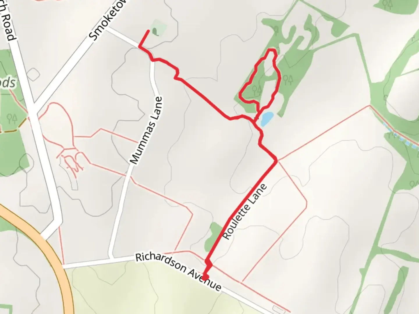
3.3 km
~45 min
61 m
Loop
“Explore history and nature on Maryland's accessible 3 km Roulette Lane and Bloody Lane Trail.”
Starting near Washington County, Maryland, the Roulette Lane and Bloody Lane Trail is a loop trail spanning approximately 3 kilometers (around 1.86 miles) with no significant elevation gain, making it accessible for a wide range of hikers. This trail is estimated to be of medium difficulty, suitable for those with some hiking experience.
Getting There To reach the trailhead, you can drive or use public transport. If driving, head towards Antietam National Battlefield, located near Sharpsburg, Maryland. The nearest significant landmark is the Visitor Center at Antietam National Battlefield, which provides ample parking. For those using public transport, the closest major city is Hagerstown, Maryland. From Hagerstown, you can take a bus or taxi to the battlefield.
Historical Significance The trail is steeped in history, as it traverses areas that were pivotal during the Battle of Antietam in the American Civil War. Bloody Lane, in particular, is a sunken road that became infamous for the intense fighting that occurred there. As you walk along this path, you can almost feel the weight of history, with interpretive signs providing context about the battle and its significance.
Trail Highlights - **Roulette Farm**: About 0.5 kilometers (0.31 miles) into the hike, you will come across the historic Roulette Farm. This farm served as a field hospital during the battle. The buildings and surrounding fields offer a glimpse into the past, and you can often see reenactors or guided tours providing additional information. - **Bloody Lane**: Approximately 1.5 kilometers (0.93 miles) into the trail, you will reach Bloody Lane. This sunken road is one of the most poignant landmarks on the trail. The road is lined with interpretive markers that detail the events of the battle, making it a somber but educational experience.
- Wildlife and Nature: The trail is not just about history; it also offers a chance to enjoy the natural beauty of the area. The fields and woodlands are home to a variety of wildlife, including deer, foxes, and numerous bird species. Keep an eye out for red-tailed hawks and other birds of prey soaring above.
Navigation and Safety For navigation, it is highly recommended to use the HiiKER app, which provides detailed maps and real-time updates. The trail is well-marked, but having a reliable navigation tool can enhance your experience and ensure you stay on the right path.
Preparation Tips - **Footwear**: Given the medium difficulty rating, sturdy hiking boots are advisable to provide good ankle support and traction. - **Water and Snacks**: Although the trail is relatively short, bringing water and some snacks is always a good idea, especially if you plan to spend time exploring the historical sites. - **Weather**: Check the weather forecast before heading out. The trail can be muddy after rain, and there is little shade, so sun protection is essential on sunny days.
By following these guidelines and being prepared, you can fully enjoy the rich history and natural beauty that the Roulette Lane and Bloody Lane Trail has to offer.

What to expect?
Activity types
Comments and Reviews
User comments, reviews and discussions about the Roulette Lane and Bloody Lane Trail, Maryland.
4.53
average rating out of 5
30 rating(s)