Download
Preview
Add to list
More
42.0 km
~3 days
1246 m
Multi-Day
“Embark on a scenic hike through Maryland's Catoctin Mountain, rich with wildlife and steeped in history.”
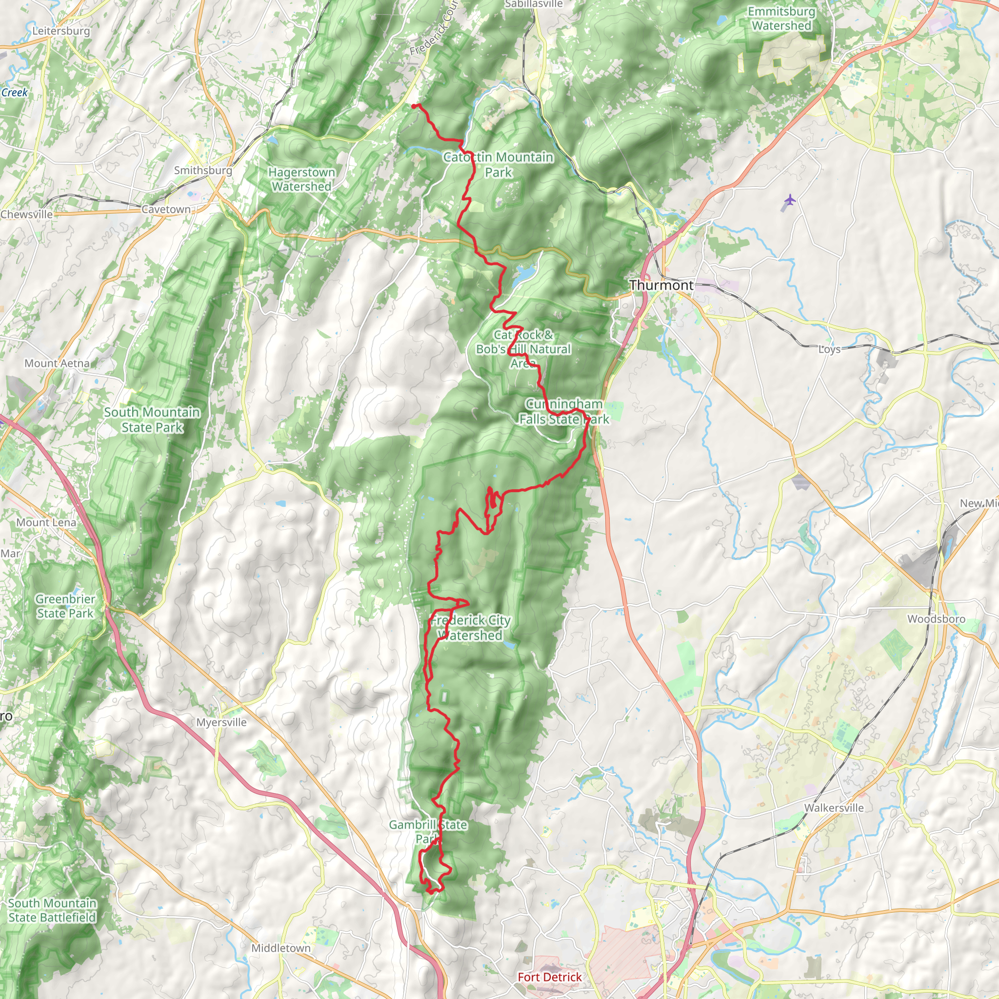
The Catoctin National Recreation Trail stretches approximately 42 kilometers (26 miles) through the picturesque terrain of Maryland's Catoctin Mountain Park. With an elevation gain of around 1200 meters (3937 feet), hikers can expect a moderately challenging journey that traverses through diverse landscapes, offering a rich blend of natural beauty and historical significance.
Getting to the Trailhead To embark on this point-to-point trail, hikers can access the northern trailhead near Gambrill Park Road in Frederick County, Maryland. For those driving, parking is available at the Gambrill Park trailhead area. Public transportation options are limited, so it's advisable to arrange a carpool or shuttle from nearby cities such as Frederick or Hagerstown.
Navigating the Trail As you set out from the northern end, the trail meanders through dense hardwood forests, occasionally opening up to reveal sweeping vistas of the Monocacy Valley. Hikers can utilize the HiiKER app to navigate the trail, ensuring they stay on the correct path and can anticipate upcoming changes in terrain or elevation.
Landmarks and Natural Features One of the first significant landmarks encountered is High Knob, about 8 kilometers (5 miles) from the start. This vantage point offers panoramic views that are particularly stunning during the fall foliage season. As the trail continues, it intersects with the famous Appalachian Trail near the 15-kilometer (9-mile) mark, providing an opportunity for a brief detour or a chance to meet long-distance hikers.
Further along, the trail passes through Cunningham Falls State Park, home to Maryland's highest cascading waterfall. The falls are approximately 23 kilometers (14 miles) into the hike and make for a refreshing rest stop. The park also features remnants of the historic Catoctin Iron Furnace, which dates back to the 18th century and played a role in America's industrial revolution.
Wildlife and Flora Throughout the journey, hikers will be immersed in an environment rich with wildlife. It's not uncommon to spot white-tailed deer, black bears, and a variety of bird species, including the pileated woodpecker and the scarlet tanager. The trail is also a haven for wildflowers and native plants, with the mountain laurel and rhododendron providing colorful displays in the spring and early summer.
End of the Trail The southern terminus of the trail is located near the Manor Area of Cunningham Falls State Park, close to the town of Thurmont. After completing the hike, visitors can explore the nearby Catoctin Wildlife Preserve and Zoo or the presidential retreat at Camp David, which, while not open to the public, adds to the historical aura of the region.
Preparation and Safety Hikers should come prepared with adequate water, food, and clothing for changing weather conditions. It's also wise to inform someone of your hiking plans and expected return time. Cell service can be spotty, so carrying a physical map in addition to using the HiiKER app is recommended.
The Catoctin National Recreation Trail offers a rewarding experience for those seeking to immerse themselves in nature while touching on important historical landmarks. Whether you're a history buff, a wildlife enthusiast, or simply looking to enjoy a day on the trail, this hike promises a memorable adventure through the heart of Maryland's wilderness.
What to expect?
Activity types
Comments and Reviews
User comments, reviews and discussions about the Catoctin National Recreation Trail, Maryland.
4.71
average rating out of 5
7 rating(s)

