17.0 km
~3 hrs 57 min
328 m
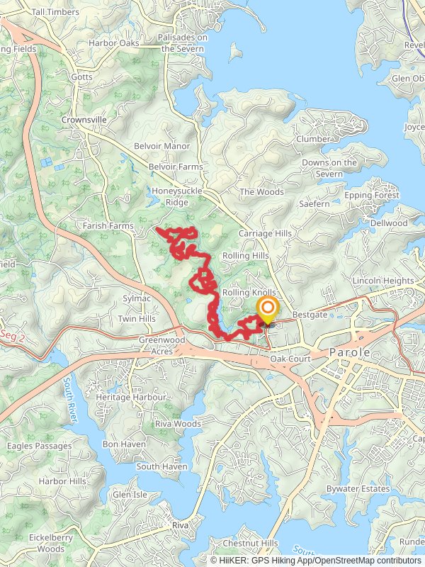
“Explore 17 km of lush forests, open fields, and historical sites on Maryland's Housley, Solar Park, and Silopanna Loops.”
Starting near Anne Arundel County, Maryland, the Housley Loop, Solar Park Loop, and Silopanna Loop offer a combined hiking experience of around 17 km (approximately 10.5 miles) with an elevation gain of about 300 meters (984 feet). This medium-difficulty trail is perfect for those looking to explore the natural beauty and historical significance of the region.
### Getting There To reach the trailhead, you can drive or use public transportation. If driving, set your GPS to the nearest known address: 2660 Riva Road, Annapolis, MD 21401. For those using public transport, the Annapolis Transit bus service has routes that stop near Riva Road, making it convenient to access the trailhead.
### Trail Overview The trail is a loop, meaning you'll start and end at the same point, making logistics simpler. The combined loops—Housley, Solar Park, and Silopanna—offer a diverse range of landscapes, from dense woodlands to open fields, and even some urban fringe areas.
### Housley Loop The Housley Loop is the first section you'll encounter. This part of the trail is characterized by its lush forested areas and moderate elevation changes. Expect to gain about 100 meters (328 feet) in elevation over the first 5 km (3.1 miles). Keep an eye out for local wildlife such as deer and various bird species. The trail is well-marked, but it's advisable to use the HiiKER app for navigation to ensure you stay on track.
### Solar Park Loop Transitioning into the Solar Park Loop, you'll notice a change in scenery. This section is more open and features several solar panel installations, a testament to the area's commitment to renewable energy. The elevation gain here is minimal, making it a relatively easy 6 km (3.7 miles) stretch. The open fields are perfect for spotting hawks and other birds of prey. Historical markers along this loop provide insights into the area's past, including its role in early American history.
### Silopanna Loop The final section, the Silopanna Loop, brings you back into a more wooded environment. This part of the trail is slightly more challenging, with an elevation gain of about 200 meters (656 feet) over 6 km (3.7 miles). The dense canopy provides ample shade, making it a pleasant hike even on warmer days. Look out for the Silopanna Oak, a massive tree that has stood for centuries and is a significant landmark in the area.
### Points of Interest - Historical Markers: Throughout the trail, you'll find markers that provide information about the region's history, including its role in the Revolutionary War. - Wildlife: The diverse habitats support a variety of wildlife, from deer and foxes to numerous bird species. - Scenic Views: Several vantage points offer stunning views of the surrounding countryside, especially during the fall when the foliage is at its peak.
### Preparation Tips - Footwear: Given the mixed terrain, sturdy hiking boots are recommended. - Water and Snacks: Ensure you carry enough water and snacks, as there are no facilities along the trail. - Navigation: Use the HiiKER app for real-time navigation and updates. - Weather: Check the weather forecast before heading out, as conditions can change rapidly.
This trail offers a well-rounded hiking experience with a mix of natural beauty, historical significance, and moderate physical challenge. Whether you're a seasoned hiker or someone looking to explore the outdoors, this trail has something for everyone.
Reviews
User comments, reviews and discussions about the Housley Loop, Solar Park Loop and Silopanna Loop, Maryland.
5.0
average rating out of 5
28 rating(s)


