Download
Preview
Add to list
More
85.2 km
~5 days
5892 m
Multi-Day
“Embark on the Alta Via Valmalenco for a breathtaking, challenging trek through Italy's alpine splendor.”
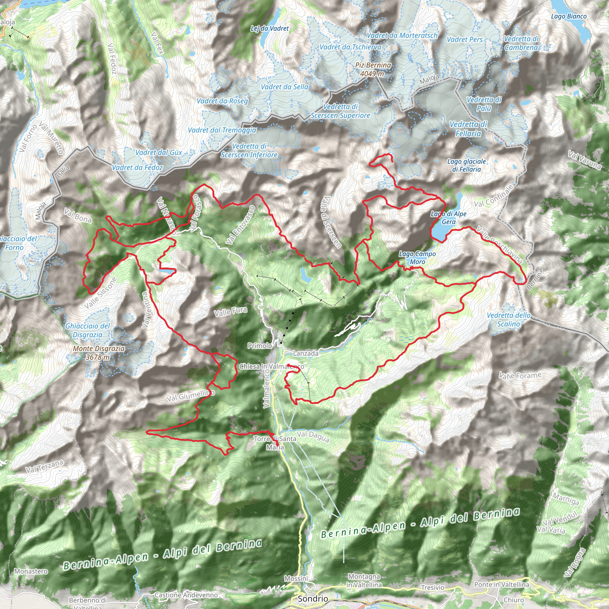
Embarking on the Alta Via Valmalenco trail, hikers will traverse approximately 85 kilometers (about 53 miles) of rugged terrain, ascending a total of around 5800 meters (approximately 19,000 feet) in elevation. This point-to-point journey begins near the town of Sondrio, nestled in the heart of the Italian Alps, and is considered to be a challenging endeavor suitable for experienced hikers.
Getting to the Trailhead To reach the starting point of the Alta Via Valmalenco, adventurers can either drive or use public transportation. The nearest significant landmark is the city of Sondrio, located in the Valtellina valley. From Sondrio, hikers can take local buses or taxis to the trailhead. For those driving, parking is available in areas close to the trail's commencement.
Navigating the Trail As you set out on the Alta Via Valmalenco, it's crucial to have a reliable navigation tool. HiiKER is an excellent resource for trail maps and navigation, ensuring you stay on the correct path throughout your journey.
Trail Highlights and Landmarks The trail offers a diverse array of landscapes, from lush valleys to towering peaks. Early on, hikers will encounter the enchanting Lago Palù, a glacial lake that's a perfect spot for a rest and to take in the serene beauty of the surrounding mountains.
As you progress, the path leads to the impressive Bernina Range, where the Pizzo Bernina stands as the highest peak in the Eastern Alps. The trail skirts this majestic mountain, providing awe-inspiring views.
Flora and Fauna The region is rich in biodiversity, with a variety of alpine flora, including colorful wildflowers in the spring and summer months. Wildlife enthusiasts may spot chamois, ibex, and marmots among the rocky outcrops, as well as eagles soaring above.
Cultural and Historical Significance The Valmalenco region is steeped in history, with trails that have been used for centuries by locals for trade and travel. Along the route, hikers will come across ancient stone-built villages and pastoral settlements that offer a glimpse into the traditional Alpine way of life.
Preparation and Safety Given the trail's difficulty, it's essential to be well-prepared with appropriate gear, including sturdy hiking boots, weather-appropriate clothing, and sufficient food and water supplies. The elevation gain is significant, so acclimatization to altitude is important to prevent sickness. It's also advisable to check the weather forecast regularly and be prepared for sudden changes in mountain conditions.
Accommodation and Resupply Points Throughout the Alta Via Valmalenco, there are several mountain huts (rifugios) where hikers can rest, resupply, and spend the night. These huts are spaced out along the trail, but it's important to plan your stops in advance and make reservations during the busy summer months.
Conclusion The Alta Via Valmalenco is a trail that promises an unforgettable adventure through some of the most breathtaking scenery in the Italian Alps. With careful planning and respect for the natural environment, hikers will find this trail to be a rewarding experience filled with natural beauty, cultural richness, and physical challenge.
Comments and Reviews
User comments, reviews and discussions about the Alta Via Valmalenco, Italy.
4.0
average rating out of 5
1 rating(s)

