26.5 km
~1 day 0 hrs
177 m
“The Trail of the Coeur d'Alene offers a scenic, historical, and wildlife-rich adventure through Northern Idaho.”
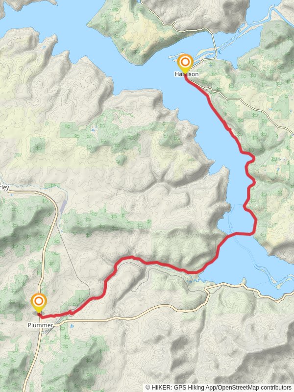
Starting near Benewah County, Idaho, the Trail of the Coeur d'Alene stretches approximately 26 kilometers (16 miles) with an elevation gain of around 100 meters (328 feet). This point-to-point trail is estimated to be of medium difficulty, making it accessible for a wide range of hikers.
### Getting There To reach the trailhead, you can drive or use public transportation. If driving, head towards Benewah County, Idaho, and look for parking near the trail's starting point. For those using public transport, the nearest significant landmark is the town of Plummer, Idaho. From Plummer, you can take a local taxi or rideshare service to the trailhead.
### Trail Overview The trail meanders through the scenic landscapes of Northern Idaho, offering a mix of paved paths and natural terrain. The relatively gentle elevation gain makes it suitable for both seasoned hikers and those looking for a leisurely walk.
### Landmarks and Points of Interest - Heyburn State Park: Located about 5 kilometers (3 miles) from the starting point, this park is one of the oldest state parks in the Pacific Northwest. It offers stunning views of Lake Coeur d'Alene and is a great spot for a short detour or picnic. - Chatcolet Bridge: Approximately 10 kilometers (6 miles) into the hike, you'll encounter this historic bridge. Originally built for railroad use, it now serves as a pedestrian and cycling bridge, offering panoramic views of the surrounding wetlands. - Medimont: Around the 20-kilometer (12-mile) mark, you'll pass through the small community of Medimont. This area is rich in wildlife, including various bird species and small mammals. It's an excellent spot for birdwatching and photography.
### Nature and Wildlife The trail is flanked by lush forests, wetlands, and the shimmering waters of Lake Coeur d'Alene. Keep an eye out for deer, elk, and a variety of bird species, including bald eagles and ospreys. The wetlands are particularly vibrant in the spring and early summer, offering a burst of wildflowers and lush greenery.
### Historical Significance The Trail of the Coeur d'Alene follows the path of the former Union Pacific Railroad, which played a crucial role in the region's mining and timber industries. The trail itself is a testament to the area's rich history, with several interpretive signs along the way that provide insights into the lives of early settlers and the indigenous Coeur d'Alene Tribe.
### Navigation and Safety For navigation, it's highly recommended to use the HiiKER app, which provides detailed maps and real-time updates. The trail is well-marked, but having a reliable navigation tool can enhance your hiking experience and ensure you stay on track.
### Final Stretch As you approach the end of the trail, you'll find yourself near the town of Harrison, Idaho. This charming town offers amenities such as cafes, restrooms, and a small marina, making it a perfect place to relax and reflect on your hike.
Whether you're drawn by the natural beauty, historical significance, or the opportunity for wildlife spotting, the Trail of the Coeur d'Alene offers a rewarding experience for all who venture its path.
Reviews
User comments, reviews and discussions about the Trail of the Coeur d'Alene, Idaho.
5.0
average rating out of 5
53 rating(s)


