Download
Preview
Add to list
More
20.2 km
~1 day 2 hrs
1860 m
Loop
“Challenge yourself on Idaho's Sheep Rock via Haley Ridge Trail, offering stunning views and rich history.”
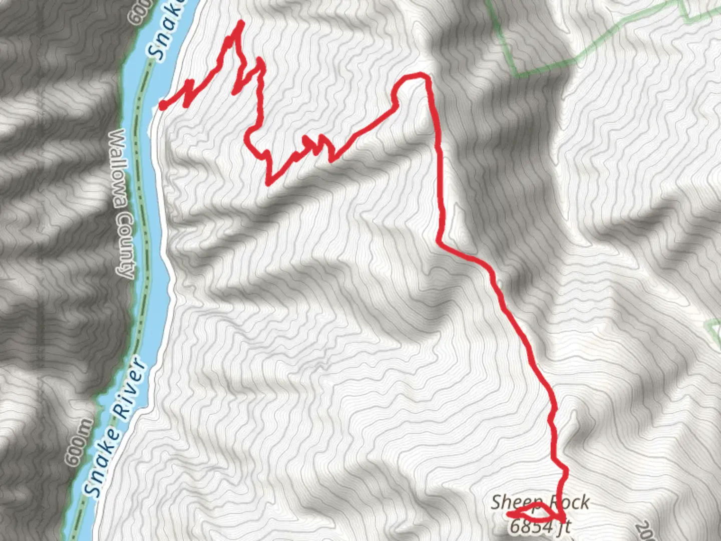
Starting your adventure near Adams County, Idaho, the Sheep Rock via Haley Ridge Trail offers a captivating 20 km (12.4 miles) loop with an elevation gain of approximately 1800 meters (5905 feet). This medium-difficulty trail is perfect for those looking to challenge themselves while enjoying the stunning landscapes of Idaho.
Getting There To reach the trailhead, you can drive or use public transport. If driving, head towards the nearest significant landmark, the town of Council, Idaho. From Council, take the Council-Cuprum Road (NF-002) northwest for about 30 km (18.6 miles) until you reach the trailhead. For those using public transport, the closest bus stop is in Council, Idaho. From there, you may need to arrange a taxi or rideshare to the trailhead.
Trail Overview The trail begins with a gentle ascent through dense forests of pine and fir, offering a cool and shaded start. As you progress, the trail becomes steeper, and the forest gives way to more open terrain, providing panoramic views of the surrounding valleys and mountains.
Key Landmarks and Sections - **Haley Ridge (5 km / 3.1 miles in)**: After about 5 km (3.1 miles) and an elevation gain of 600 meters (1968 feet), you'll reach Haley Ridge. This section offers breathtaking views of the Seven Devils Mountains to the west. It's a great spot for a short break and some photography. - **Sheep Rock Summit (10 km / 6.2 miles in)**: The trail continues to climb steadily until you reach the summit of Sheep Rock at around the 10 km (6.2 miles) mark. Here, at the highest point of the trail, you'll have gained approximately 1200 meters (3937 feet) in elevation. The summit provides a 360-degree view of the surrounding wilderness, including glimpses of Hells Canyon to the west.
- Descent and Loop Completion (last 10 km / 6.2 miles): The descent begins after the summit, taking you through alpine meadows filled with wildflowers in the spring and summer. Keep an eye out for local wildlife, including deer, elk, and various bird species. The trail loops back towards the starting point, gradually descending and offering a mix of forested and open sections.
Historical Significance The region around Sheep Rock has a rich history, with evidence of Native American presence dating back thousands of years. The Nez Perce tribe historically inhabited this area, and you may come across ancient petroglyphs and other archaeological sites. The trail also passes through areas that were once part of the early 20th-century mining boom, with remnants of old mining equipment and cabins visible along the way.
Navigation and Safety Given the trail's elevation gain and remote location, it's crucial to be well-prepared. Use the HiiKER app for accurate navigation and real-time updates on trail conditions. Ensure you have adequate water, food, and weather-appropriate clothing. The trail can be challenging, especially during inclement weather, so check forecasts and trail conditions before setting out.
Embark on this journey with respect for the natural and historical significance of the area, and you'll be rewarded with an unforgettable hiking experience.

What to expect?
Activity types
Comments and Reviews
User comments, reviews and discussions about the Sheep Rock via Haley Ridge Trail, Idaho.
4.55
average rating out of 5
11 rating(s)