Download
Preview
Add to list
More
52.5 km
~3 days
1222 m
Multi-Day
“Embark on Iceland's Laugavegur trail, a medium-difficulty, geologically rich trek through diverse landscapes and vibrant natural wonders.”
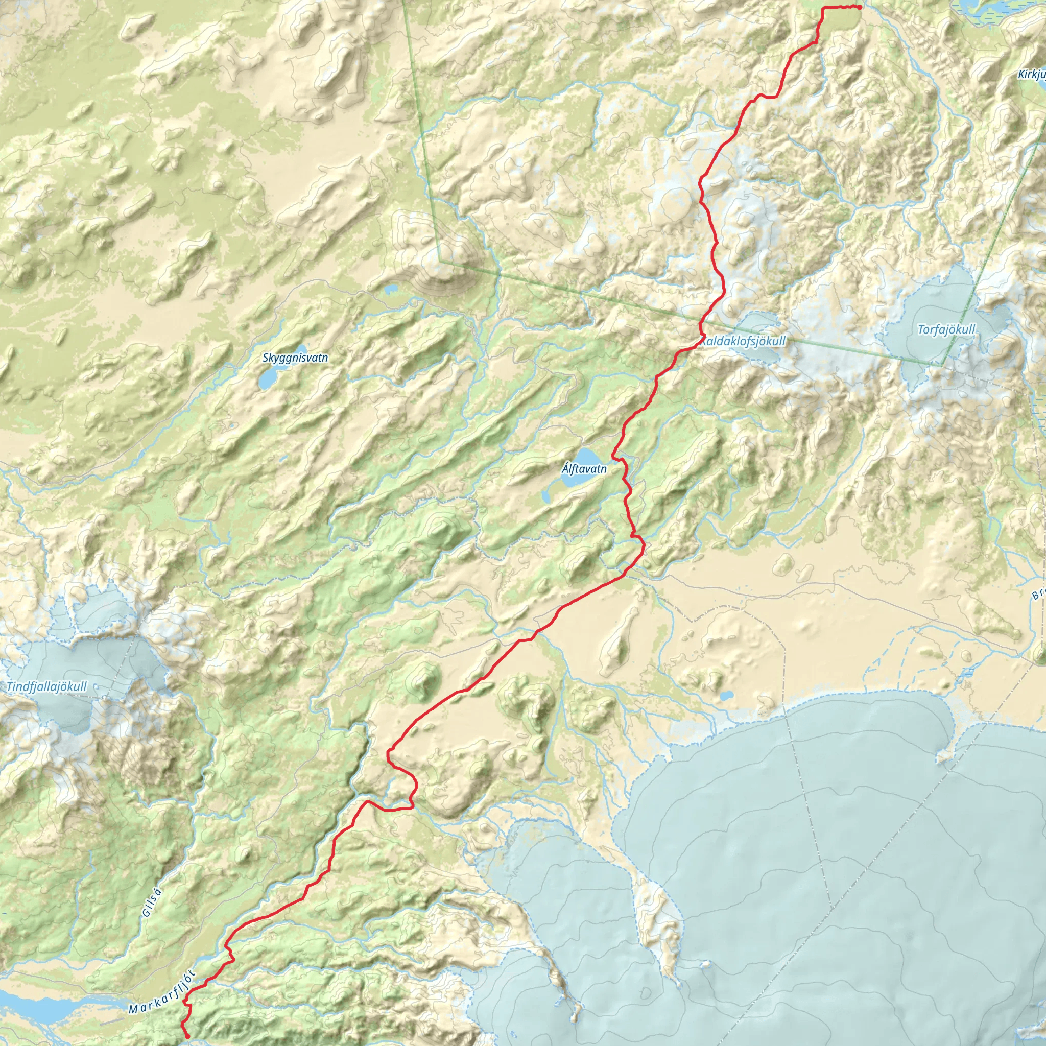
The Laugavegur trail, a renowned trek in the heart of Iceland, spans approximately 52 kilometers (about 32 miles) and features an elevation gain of around 1200 meters (nearly 3937 feet). This point-to-point trail begins near the small town of Rangárþing ytra, situated in the southern part of the country, and is considered to have a medium difficulty rating.
Getting to the Trailhead
To reach the starting point of the Laugavegur trail, hikers can either drive or use public transportation. If driving, the trailhead is accessible via the Icelandic Ring Road (Route 1) and then by taking Road 26 followed by F208 to Landmannalaugar, the usual starting point for the trek. During the summer months, buses run from Reykjavik to Landmannalaugar, which is convenient for those relying on public transport.
Trail Overview
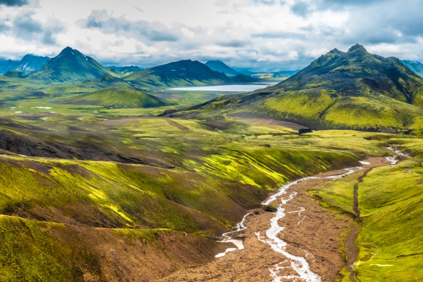
The journey begins in the geothermal wonderland of Landmannalaugar, characterized by its rhyolite mountains and steaming hot springs. Hikers can indulge in a warm soak before or after their trek. The initial segment of the trail ascends through a colorful landscape, with the first 12 kilometers (about 7.5 miles) bringing you to the first hut at Hrafntinnusker, where you'll experience an elevation gain of approximately 470 meters (1542 feet).
Landmarks and Terrain
From Hrafntinnusker, the trail descends into the Jökultungur area, where the geothermal activity creates a stark contrast with the surrounding glaciers. This section is about 12 kilometers (7.5 miles) long and leads to Álftavatn, a serene lake that's perfect for a rest stop.
The next 15 kilometers (about 9.3 miles) take you past another lake, Emstrur, where you can find a hut to stay overnight. The trail here is less steep, but the views of the surrounding glaciers and the Markarfljót canyon are breathtaking.
As you continue, the landscape transitions from the highlands to a lush green valley. The final stretch of the trail, about 15 kilometers (9.3 miles), leads to Þórsmörk, a valley named after the Norse god Thor. This area is a hiker's paradise, with multiple trails and stunning views of the surrounding mountains and glaciers.
Flora and Fauna
Throughout the hike, you'll encounter a variety of Icelandic flora and fauna. The highland areas are home to hardy mosses and lichens, while the valleys may feature birchwood forests and wildflowers in the summer. Birdwatchers may spot the Arctic Tern or the Golden Plover, and if you're lucky, you might catch a glimpse of the Arctic Fox.
Historical Significance
The Laugavegur trail traverses a region rich in geological and historical significance. The area has been shaped by volcanic activity over thousands of years, creating the unique landscapes you see today. The trail itself has been used for centuries by locals traveling between the coastal and highland areas.
Navigation
For navigation purposes, HiiKER is an excellent tool to use while treking the Laugavegur trail. It provides detailed maps and waypoints that can be invaluable, especially considering the rapidly changing weather conditions that can make visibility poor.
Preparation and Planning
Due to the trail's remote nature and Iceland's unpredictable weather, it's crucial to be well-prepared. Waterproof clothing, good hiking boots, and warm layers are essential. Hikers should also bring enough food and water for the duration of the trek, although there are huts along the way where supplies can be replenished.
The best time to hike the Laugavegur trail is from late June to early September when the huts are open, and the weather is most favorable. It's also important to book the huts in advance if you plan to use them, as they can fill up quickly during peak season.
Comments and Reviews
User comments, reviews and discussions about the Laugavegur, Iceland.
4.67
average rating out of 5
12 rating(s)

