Download
Preview
Add to list
More
16.4 km
~4 hrs 26 min
698 m
Point-to-Point
“Embark on a scenic Swabian Jura hike with rolling hills, historic landmarks, and panoramic vistas.”
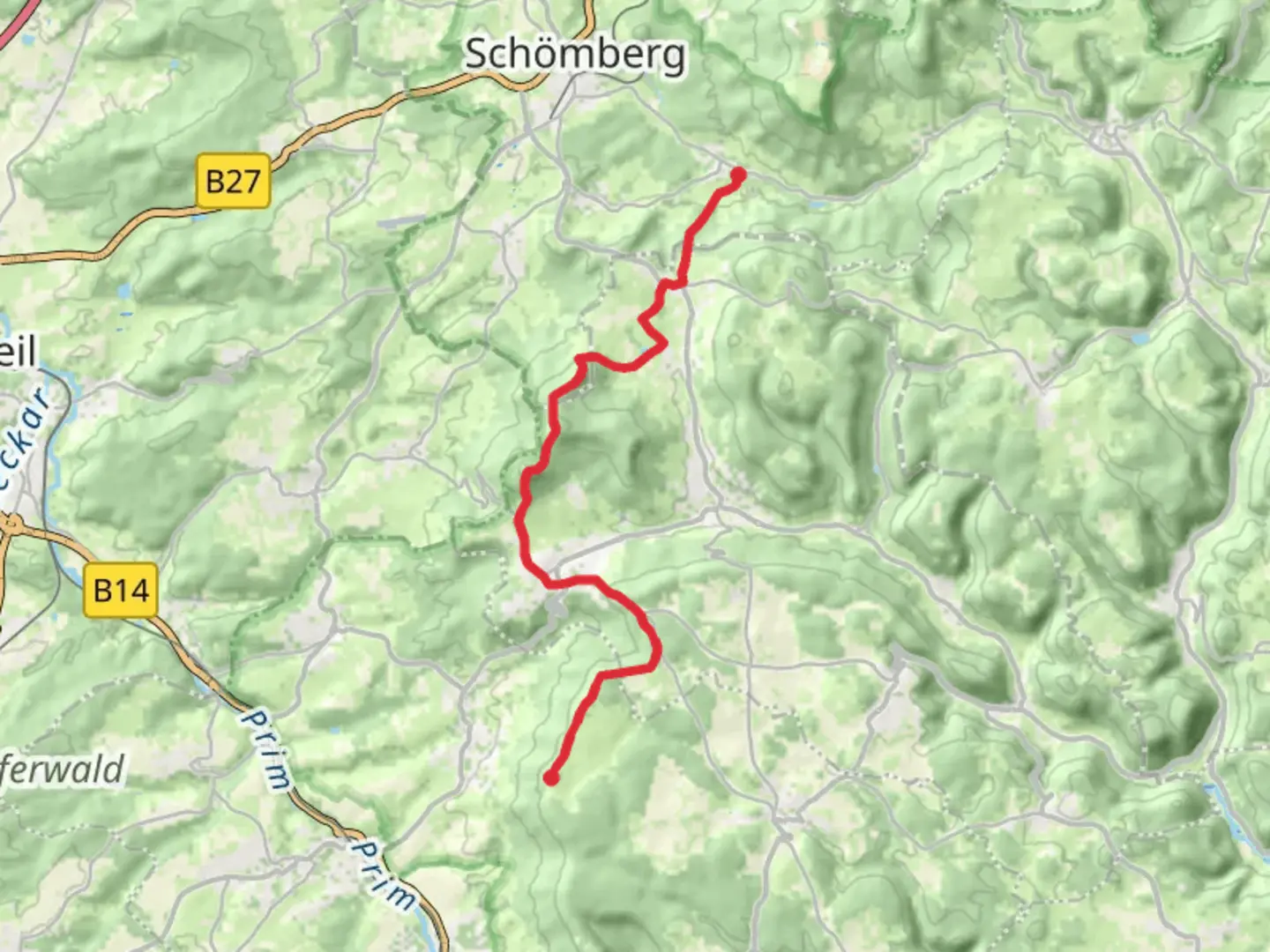
Starting your journey near Zollernalbkreis, Germany, the Ratshausen to Klippeneck Walk offers a captivating 16 km (approximately 10 miles) trek with an elevation gain of around 600 meters (about 1,970 feet). This point-to-point trail is rated as medium difficulty, making it suitable for hikers with some experience. ### Getting ThereTo reach the trailhead, you can drive to the vicinity of Ratshausen, which is accessible via the B27 highway. For those relying on public transport, the nearest major town is Balingen, from where you can catch a local bus to Ratshausen. Check local schedules for the most current routes and times.### Trail HighlightsAs you embark on this scenic hike, you'll traverse the Swabian Jura, a region known for its rolling hills, limestone cliffs, and dense forests. The trail offers a mix of open landscapes and shaded woodland paths, providing a diverse hiking experience.#### Nature and WildlifeThe Swabian Jura is home to a variety of flora and fauna. Keep an eye out for wildflowers in the spring and summer months, as well as native wildlife such as deer and various bird species. The forests are predominantly composed of beech and spruce trees, offering a lush canopy overhead.#### Significant LandmarksOne of the key highlights along the trail is the Aussichtsturm Hohenneuffen, a historic watchtower offering panoramic views of the surrounding landscape. This spot is perfect for a rest and some photography. As you continue, you'll pass through quaint villages that dot the region, each with its own unique charm and history.### Historical SignificanceThe Swabian Jura has a rich history, with evidence of human settlement dating back to prehistoric times. The area was once a strategic location during various historical conflicts, and remnants of ancient fortifications can still be found. The trail itself meanders through areas that have been traversed for centuries, offering a sense of walking through history.### Navigation and SafetyFor navigation, it's recommended to use the HiiKER app, which provides detailed maps and real-time updates. The trail is well-marked, but having a reliable navigation tool ensures you stay on track. Be prepared for changing weather conditions, as the elevation can lead to cooler temperatures and sudden rain showers. Carry sufficient water, snacks, and a first-aid kit for safety.### Final StretchAs you approach Klippeneck, the trail offers stunning views of the surrounding valleys and the distant Alps on clear days. Klippeneck is known for its gliding airfield, and you might catch sight of gliders soaring above as you complete your hike. The endpoint is accessible by road, making it easy to arrange transportation back to your starting point or onward to your next destination.

Comments and Reviews
User comments, reviews and discussions about the Ratshausen to Klippeneck Walk, Germany.
average rating out of 5
0 rating(s)