Download
Preview
Add to list
More
11.1 km
~2 hrs 31 min
178 m
Point-to-Point
“Journey through Taunus' scenic landscapes on a moderate 11 km trail rich with history and natural beauty.”
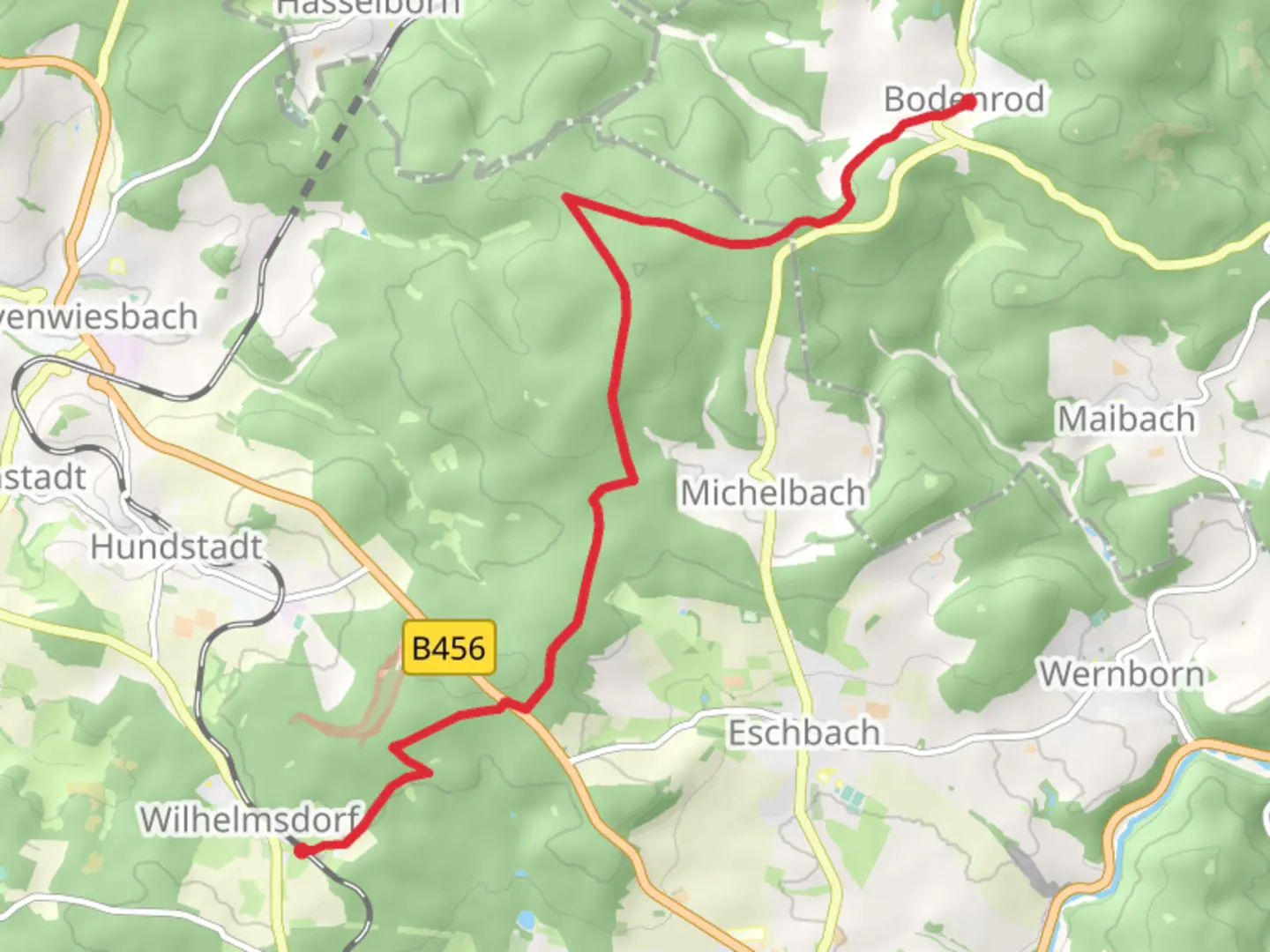
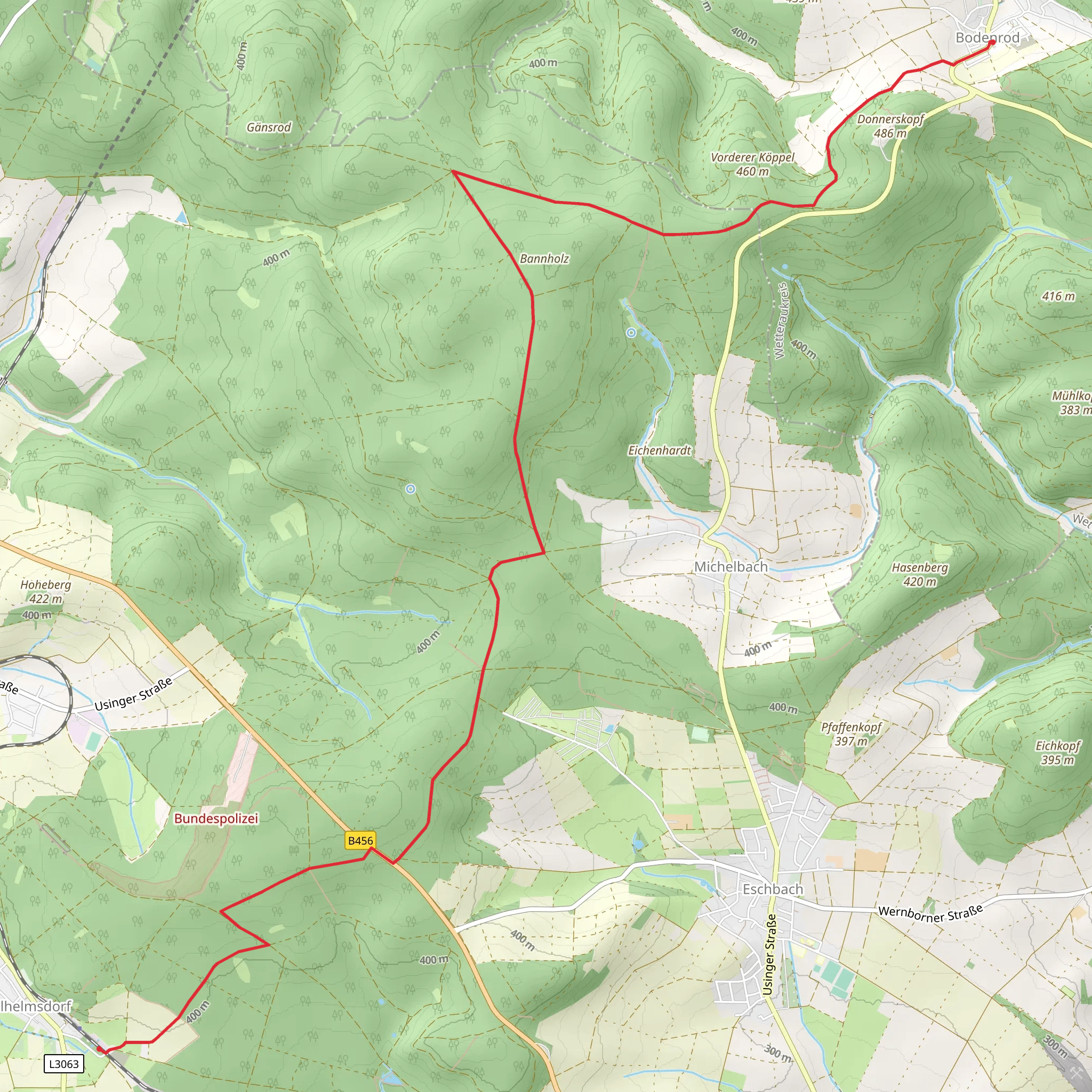
Starting near Wetteraukreis, Germany, this 11 km (approximately 6.8 miles) point-to-point trail offers a delightful journey through the scenic landscapes of the Taunus region. With an elevation gain of around 100 meters (328 feet), the trail is rated as medium difficulty, making it suitable for moderately experienced hikers.
Getting There
To reach the trailhead, you can either drive or use public transport. If you're driving, head towards Wetteraukreis and look for parking near the starting point. For those using public transport, the nearest significant landmark is the town of Bodenrod. From Frankfurt, you can take a regional train to Bad Nauheim and then a local bus to Bodenrod. The trailhead is conveniently located near the town center, making it easily accessible.
Trail Navigation
For navigation, it's highly recommended to use the HiiKER app, which provides detailed maps and real-time updates. The trail is well-marked, but having a reliable navigation tool will enhance your hiking experience.
Trail Highlights
#### Scenic Views and Natural Beauty
As you set off from Bodenrod, you'll be greeted by lush forests and rolling hills characteristic of the Taunus region. The first few kilometers are relatively flat, allowing you to ease into the hike. Keep an eye out for local wildlife such as deer and various bird species that inhabit the area.
#### Historical Significance
Around the 4 km (2.5 miles) mark, you'll come across remnants of ancient Roman fortifications. The Taunus region is rich in history, and these ruins are a testament to its strategic importance during the Roman era. Take a moment to explore and imagine the historical significance of this area.
#### Midpoint Rest Stop
At approximately 6 km (3.7 miles), you'll reach a small clearing with benches, making it an ideal spot for a rest. This area offers panoramic views of the surrounding countryside, perfect for a quick snack and some photos.
Flora and Fauna
The trail is abundant with diverse flora, including oak, beech, and pine trees. During spring and summer, the forest floor is carpeted with wildflowers, adding a splash of color to your hike. In autumn, the foliage transforms into a vibrant tapestry of reds, oranges, and yellows.
Final Stretch to Wilhelmsdorf
The last 5 km (3.1 miles) of the trail involve a gentle descent towards Wilhelmsdorf. As you approach the town, the landscape opens up to picturesque meadows and farmlands. The trail ends near the town center, where you can find local cafes and restaurants to relax and refuel.
Practical Tips
- Footwear: Sturdy hiking boots are recommended due to uneven terrain. - Weather: Check the weather forecast before you go, as the trail can become slippery in wet conditions. - Water: Carry enough water, especially during the warmer months. - Wildlife: Be mindful of local wildlife and maintain a respectful distance.
This trail offers a perfect blend of natural beauty, historical intrigue, and moderate physical challenge, making it a rewarding experience for any hiker.
Comments and Reviews
User comments, reviews and discussions about the Bodenrod to Wilhelmsdorf via Taunusklub Route, Germany.
4.5
average rating out of 5
2 rating(s)
