Download
Preview
Add to list
More
11.0 km
~2 hrs 37 min
259 m
Loop
“Embark on the Holzhausen Loop for a scenic, moderately challenging 11 km hike through Germany's serene countryside.”
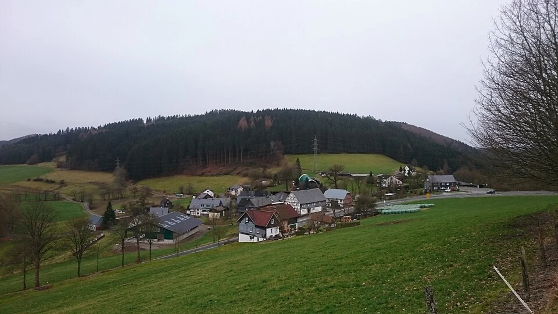
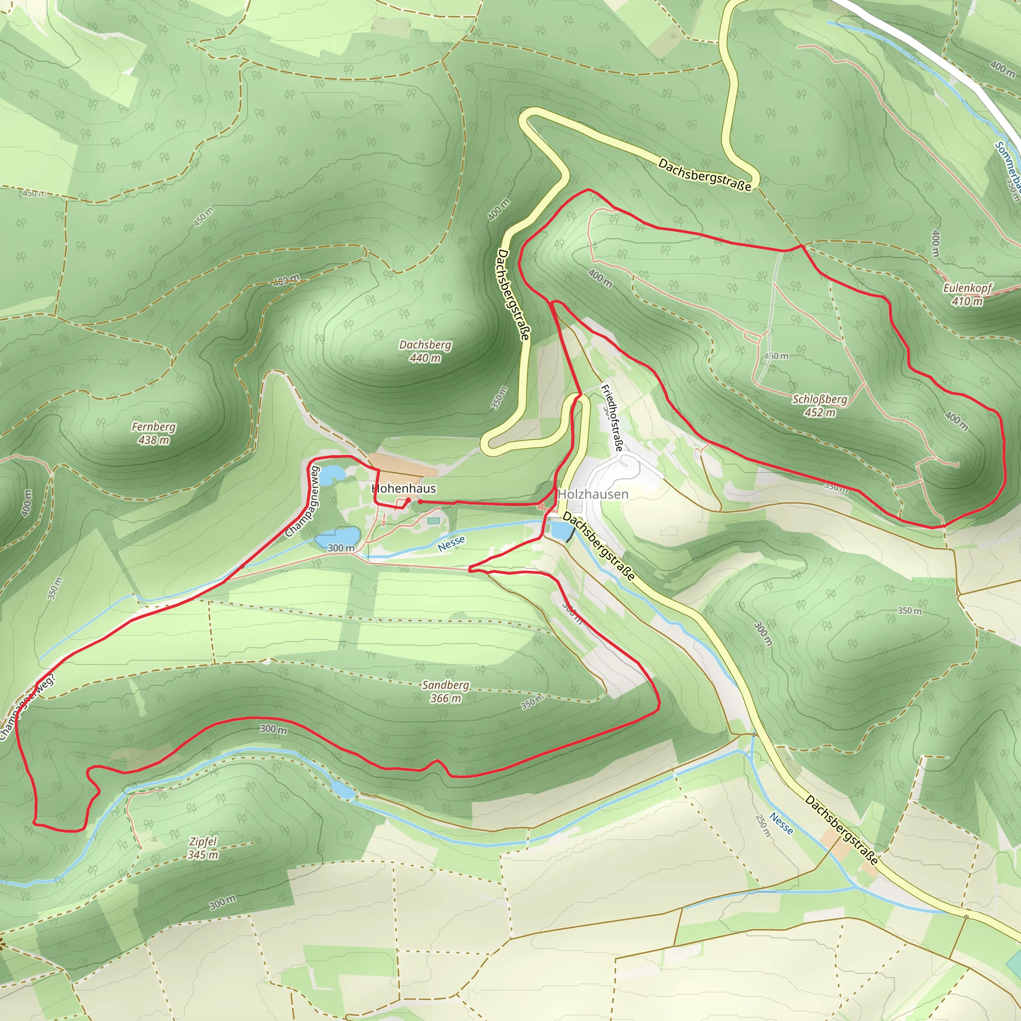
Starting near the picturesque region of Werra-Meißner-Kreis in Germany, the Holzhausen Loop is a captivating 11 km (approximately 6.8 miles) trail that offers a moderate challenge with an elevation gain of around 200 meters (656 feet). This loop trail is perfect for those looking to immerse themselves in the serene beauty of the German countryside while enjoying a moderately challenging hike.
Getting There
To reach the trailhead, you can either drive or use public transportation. If you're driving, set your GPS to Holzhausen, a small village near Werra-Meißner-Kreis. For those using public transport, the nearest significant landmark is the Eschwege train station. From there, you can take a local bus or taxi to Holzhausen.
Trail Overview
The trail begins in the quaint village of Holzhausen, where you'll find ample parking and clear signage marking the start of the loop. As you set off, the initial part of the trail meanders through lush meadows and gently rolling hills, offering a peaceful start to your hike.
Key Landmarks and Natural Features
Around the 3 km (1.9 miles) mark, you'll encounter the first significant landmark: the ruins of an old medieval watchtower. This historical site offers a glimpse into the region's past and provides a great spot for a short break and some photos.
Continuing on, the trail ascends gradually, leading you through dense forests filled with a variety of flora and fauna. Keep an eye out for deer and various bird species that inhabit this area. The forested section lasts for about 4 km (2.5 miles) and includes some steeper sections, so be prepared for a bit of a workout.
Midpoint and Scenic Views
At approximately 7 km (4.3 miles), you'll reach the highest point of the trail, offering panoramic views of the surrounding countryside. This is an excellent spot to rest, have a snack, and take in the breathtaking scenery. The elevation gain to this point is around 150 meters (492 feet), making it the most challenging part of the hike.
Descending and Completing the Loop
The descent begins shortly after the viewpoint, leading you through more open meadows and past small streams. The final 4 km (2.5 miles) of the trail are relatively flat and easy, allowing you to enjoy the natural beauty without much effort. You'll pass by several traditional German farmhouses, adding a cultural touch to your hike.
Historical Significance
The region around Werra-Meißner-Kreis is steeped in history, with many trails, including the Holzhausen Loop, passing by sites of historical significance. The medieval watchtower ruins you encounter early in the hike are a testament to the area's strategic importance in centuries past. Additionally, the traditional farmhouses you see along the way offer a glimpse into rural German life as it has been for generations.
Navigation and Safety
For navigation, it's highly recommended to use the HiiKER app, which provides detailed maps and real-time updates to ensure you stay on track. The trail is well-marked, but having a reliable navigation tool can enhance your hiking experience and provide peace of mind.
Whether you're a seasoned hiker or someone looking to explore the natural and historical beauty of Germany, the Holzhausen Loop offers a rewarding experience that combines moderate physical challenge with rich cultural and natural sights.
What to expect?
Activity types
Comments and Reviews
User comments, reviews and discussions about the Holzhausen Loop, Germany.
4.5
average rating out of 5
2 rating(s)

