Download
Preview
Add to list
More
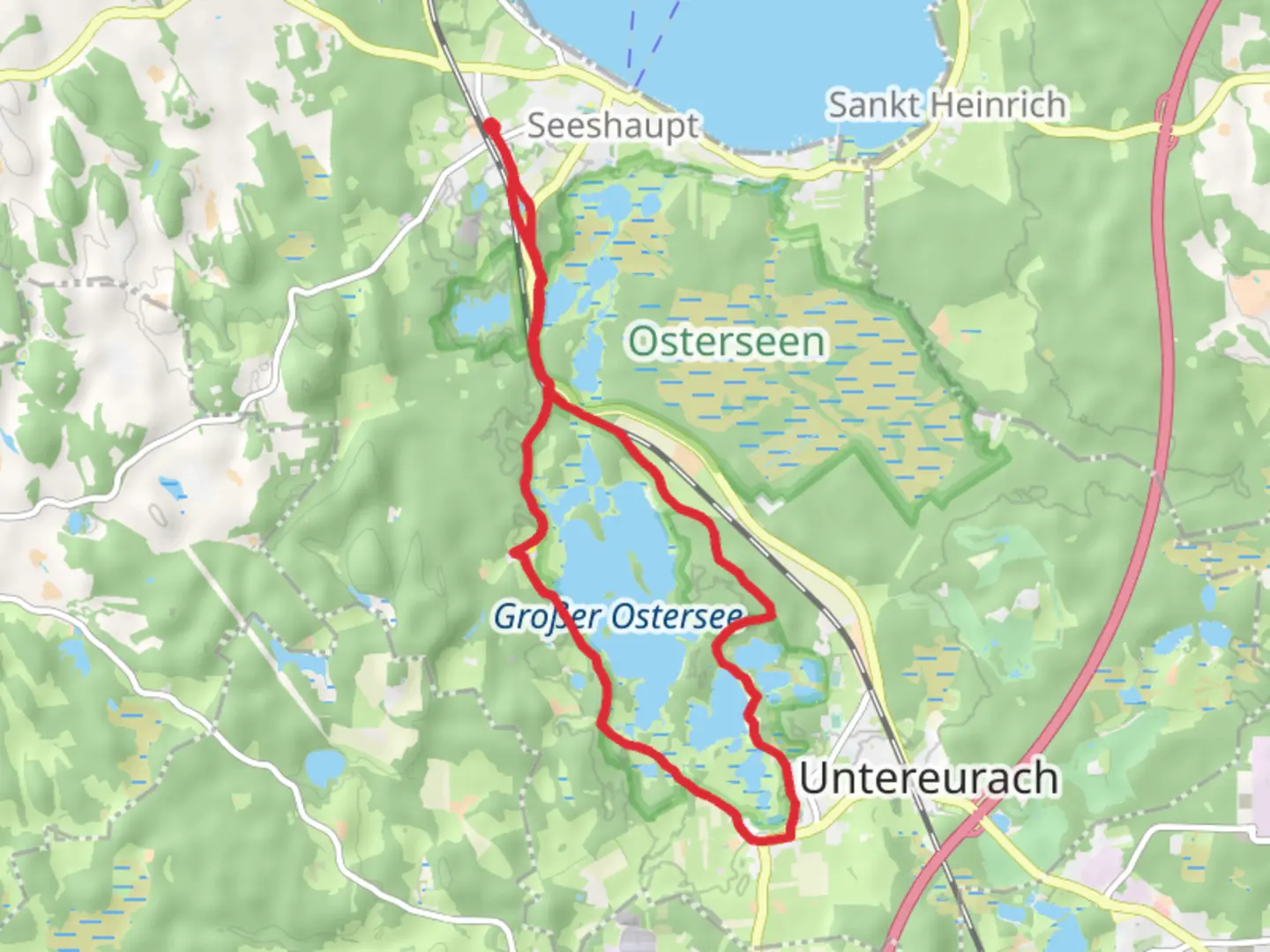
14.7 km
~3 hrs 33 min
376 m
Loop
“The Grober Ostersee Loop offers a scenic hike through lakes, forests, and historical Bavarian landscapes.”
Nestled in the picturesque region of Weilheim-Schongau, Germany, the Grober Ostersee Loop offers a delightful hiking experience that spans approximately 15 kilometers (about 9.3 miles) with an elevation gain of around 300 meters (approximately 984 feet). This loop trail is rated as medium difficulty, making it suitable for hikers with a moderate level of fitness.### Getting ThereTo reach the trailhead, you can drive or use public transportation. If driving, head towards the town of Weilheim in Oberbayern, which is well-connected by major roads. From there, follow the signs to the Osterseen area. For those opting for public transport, take a train to Weilheim (Oberbay) station. From the station, local buses or taxis can take you closer to the trailhead near the Osterseen lakes.### Trail HighlightsThe Grober Ostersee Loop meanders through a stunning landscape characterized by serene lakes, lush forests, and rolling hills. As you embark on this journey, you'll be greeted by the tranquil beauty of the Osterseen, a series of over 20 small lakes that are part of a protected nature reserve. These lakes are renowned for their crystal-clear waters and diverse ecosystems, providing a habitat for various bird species and aquatic life.### Nature and WildlifeThe trail offers an excellent opportunity to immerse yourself in the natural beauty of the Bavarian countryside. Keep an eye out for native wildlife, including deer and a variety of bird species. The forests along the trail are home to a rich diversity of flora, with towering trees and vibrant wildflowers adding to the scenic charm.### Historical SignificanceThe region surrounding the Grober Ostersee Loop is steeped in history. The nearby town of Weilheim has roots dating back to Roman times, and the area has been a significant cultural and trade hub throughout the centuries. As you hike, consider the historical context of the landscape, where ancient paths once connected communities and facilitated trade.### Navigation and SafetyWhile the trail is well-marked, it's advisable to use the HiiKER app for navigation to ensure you stay on track. The app provides detailed maps and real-time updates, which can be particularly useful in areas where the trail may intersect with other paths. Be prepared for varying terrain, including some steep sections, and ensure you have appropriate footwear and gear.### Points of InterestAround the halfway mark, you'll encounter a particularly scenic viewpoint offering panoramic vistas of the surrounding lakes and countryside. This spot is perfect for a rest and a picnic, allowing you to soak in the breathtaking views. Additionally, the trail passes through charming meadows and offers glimpses of traditional Bavarian architecture in nearby villages.Embarking on the Grober Ostersee Loop is a rewarding experience that combines natural beauty, wildlife observation, and a touch of historical intrigue. Whether you're a seasoned hiker or someone looking to explore the Bavarian landscape, this trail promises a memorable adventure.

Comments and Reviews
User comments, reviews and discussions about the Grober Ostersee Loop, Germany.
average rating out of 5
0 rating(s)