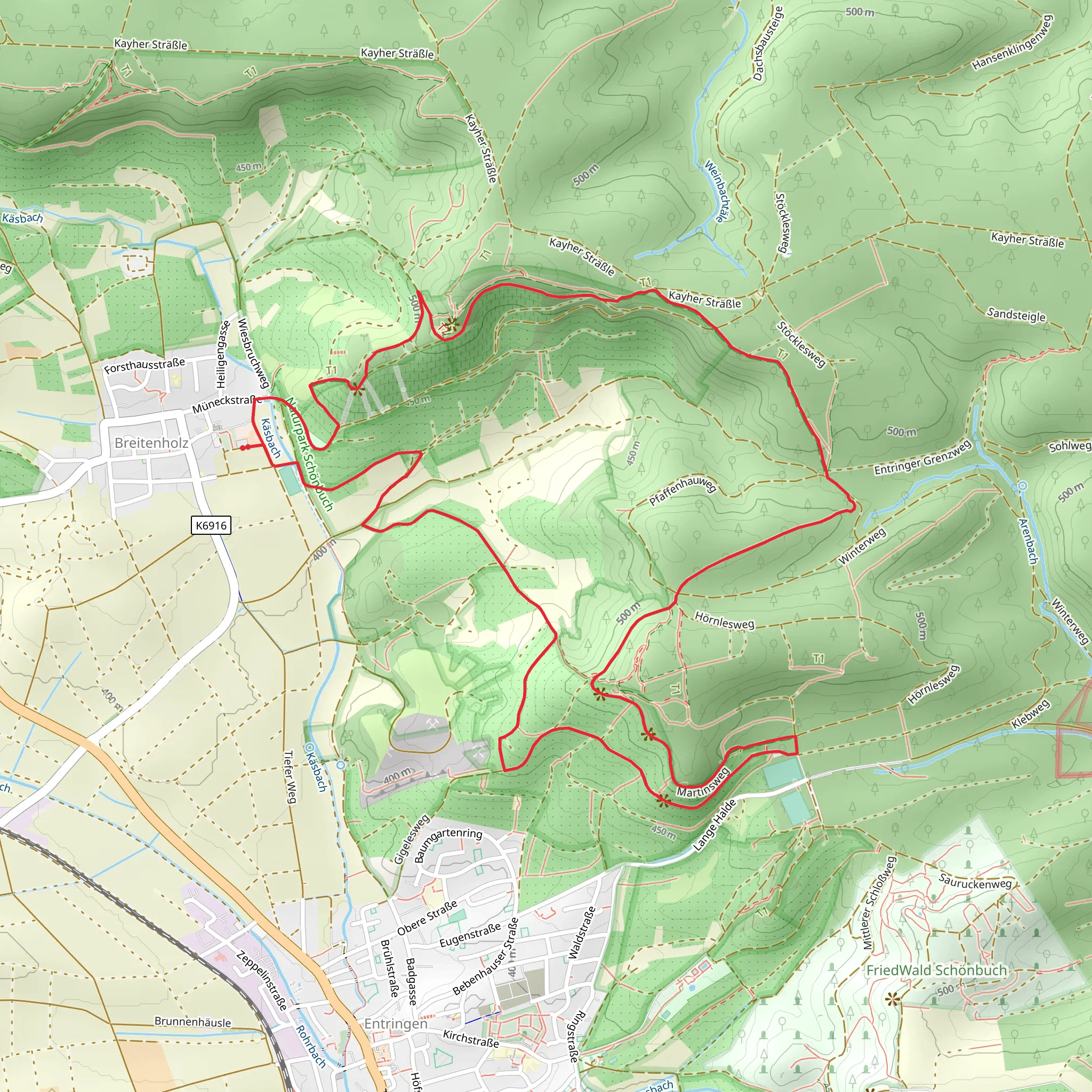
Schönbuch Westhang - Ammerbuch and Schönbuchspitz Loop via Schönbuchspitzrunde
Download
Preview
Add to list
More
8.3 km
~2 hrs 8 min
296 m
Loop
“Explore lush forests, panoramic views, and historical relics on this 8 km Schönbuch Nature Park trail.”
Starting near the picturesque town of Tübingen, Germany, the Schönbuch Westhang - Ammerbuch and Schönbuchspitz Loop via Schönbuchspitzrunde offers an 8 km (approximately 5 miles) journey through the lush landscapes of the Schönbuch Nature Park. With an elevation gain of around 200 meters (656 feet), this loop trail is rated as medium difficulty, making it suitable for moderately experienced hikers.
Getting There To reach the trailhead, you can either drive or use public transport. If driving, head towards Tübingen and follow signs to the Schönbuch Nature Park. There are parking facilities available near the trailhead. For those using public transport, take a train to Tübingen Hauptbahnhof (main station) and then a local bus towards Ammerbuch. The nearest bus stop is "Entringen," from where the trailhead is a short walk away.
Trail Highlights The trail begins with a gentle ascent through dense forest, offering a serene start to your hike. As you progress, you'll encounter a variety of flora, including ancient oak and beech trees, which are characteristic of the Schönbuch region. Keep an eye out for wildlife such as deer, foxes, and a variety of bird species that inhabit this protected area.
#### Schönbuchspitz Around the 3 km (1.9 miles) mark, you'll reach Schönbuchspitz, a notable high point offering panoramic views of the surrounding landscape. This is an excellent spot for a short break and some photography. The elevation gain to this point is gradual, making it accessible for most hikers.
#### Historical Significance The Schönbuch region has a rich history dating back to the Middle Ages. The forest was once a royal hunting ground, and remnants of this history can still be seen in the form of old hunting lodges and boundary stones. As you hike, you'll pass by several of these historical markers, providing a glimpse into the area's past.
Navigation and Safety The trail is well-marked, but it's always a good idea to have a reliable navigation tool. HiiKER is recommended for its detailed maps and real-time updates. The trail can be muddy after rain, so waterproof hiking boots are advisable. Also, carry enough water and snacks, as there are limited facilities along the route.
Final Stretch The last 2 km (1.2 miles) of the loop take you through open meadows and small clearings, offering a different but equally beautiful perspective of the Schönbuch Nature Park. The descent is gentle, making for a pleasant end to your hike. As you approach the trailhead, you'll pass by a few local farms and possibly encounter some friendly livestock.
This trail offers a perfect blend of natural beauty, historical intrigue, and moderate physical challenge, making it a rewarding experience for any hiker.
What to expect?
Activity types
Comments and Reviews
User comments, reviews and discussions about the Schönbuch Westhang - Ammerbuch and Schönbuchspitz Loop via Schönbuchspitzrunde, Germany.
4.33
average rating out of 5
6 rating(s)
