6.0 km
~1 hrs 39 min
266 m
“Immerse in Tübingen's natural beauty and history on the scenic Hirschauer Berg Loop's 6 km trail.”
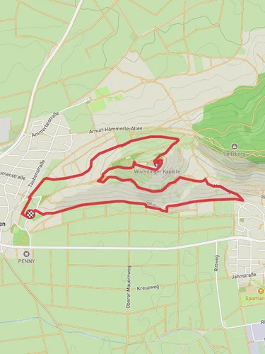
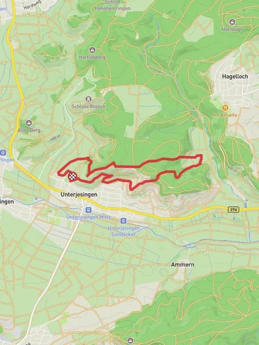
Starting near the picturesque town of Tübingen, Germany, the Hirschauer Berg Loop is a delightful 6 km (approximately 3.7 miles) trail that offers a moderate challenge with an elevation gain of around 200 meters (656 feet). This loop trail is perfect for those looking to immerse themselves in the natural beauty and historical richness of the region.
### Getting There To reach the trailhead, you can either drive or use public transport. If driving, head towards Tübingen and look for parking near the Hirschauer Berg area. For those using public transport, take a train or bus to Tübingen Hauptbahnhof (main station). From there, local buses can take you closer to the trailhead, with the nearest stop being at Hirschau, which is a short walk from the start of the loop.
### Trail Overview The trail begins near the outskirts of Tübingen, leading you through a variety of landscapes including dense forests, open meadows, and scenic viewpoints. The initial part of the trail is relatively flat, making it an excellent warm-up as you gradually ascend.
### Key Landmarks and Points of Interest - Hirschauer Berg Summit: At approximately 2 km (1.2 miles) into the hike, you will reach the summit of Hirschauer Berg. This point offers panoramic views of the surrounding Swabian Alps and the Neckar River valley. It's a great spot to take a break and enjoy the scenery. - Historical Sites: As you descend from the summit, you will come across several historical markers and ruins. The area is rich in history, dating back to medieval times. Keep an eye out for old stone walls and remnants of ancient settlements. - Flora and Fauna: The trail is abundant with diverse plant life, including oak and beech trees. In the spring and summer months, wildflowers add a splash of color to the landscape. Wildlife such as deer, foxes, and various bird species are commonly spotted along the trail.
### Trail Navigation The Hirschauer Berg Loop is well-marked with signs and trail markers. However, it's always a good idea to have a reliable navigation tool. The HiiKER app is highly recommended for this purpose, as it provides detailed maps and real-time tracking to ensure you stay on course.
### Elevation Profile The trail's elevation gain is gradual but steady. Starting at around 350 meters (1,148 feet) above sea level, you will ascend to the highest point at approximately 550 meters (1,804 feet). The descent is equally gradual, making it easier on the knees and allowing for a comfortable return to the starting point.
### Practical Tips - Footwear: Given the mixed terrain, sturdy hiking boots with good ankle support are recommended. - Weather: Check the weather forecast before heading out. The trail can be slippery after rain, and fog can reduce visibility at higher elevations. - Supplies: Bring enough water and snacks, as there are no facilities along the trail. A small first-aid kit is also advisable.
### Accessibility The trail is accessible year-round, but the best times to hike are during the spring and autumn months when the weather is mild, and the foliage is at its most vibrant.
By following these guidelines and being well-prepared, you can fully enjoy the natural beauty and historical significance of the Hirschauer Berg Loop.
Reviews
User comments, reviews and discussions about the Hirschauer Berg Loop, Germany.
0.0
average rating out of 5
0 rating(s)


