Download
Preview
Add to list
More
12.7 km
~3 hrs 22 min
496 m
Loop
“The Trierer Loop offers a 13 km journey through caves, forests, and Roman ruins near historic Trier.”
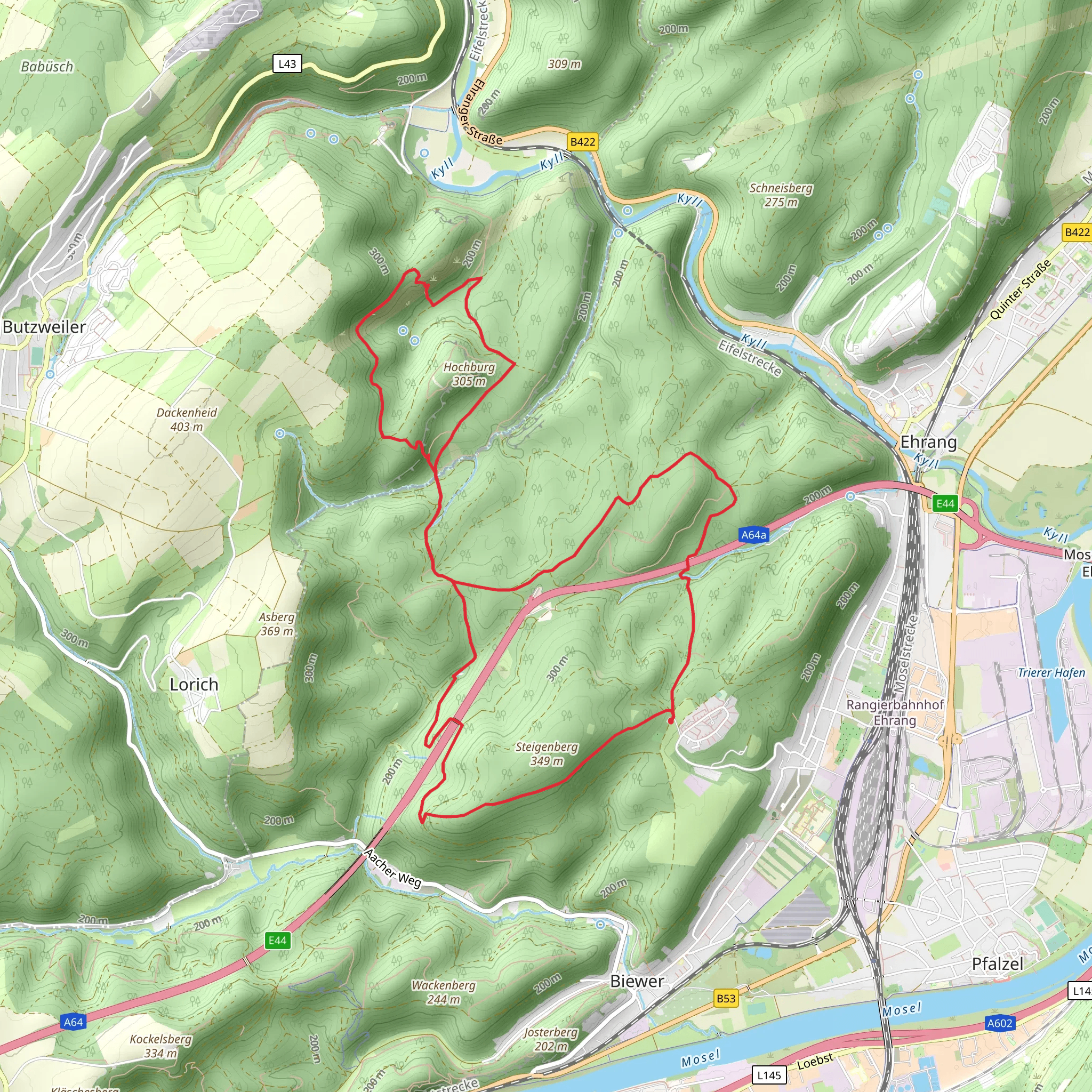
Starting near the historic city of Trier, Germany, the Trierer, Genoveva Hohle, Klausenhohle and Pfalzeler Wald Loop offers a captivating 13 km (8 miles) journey through a region rich in natural beauty and historical significance. With an elevation gain of approximately 400 meters (1,312 feet), this medium-difficulty loop trail provides a rewarding experience for hikers of various skill levels.### Getting There To reach the trailhead, you can either drive or use public transport. If driving, head towards the outskirts of Trier, where ample parking is available near the starting point. For those using public transport, take a bus or train to Trier Hauptbahnhof (Trier Central Station). From there, local buses can take you closer to the trailhead, with the nearest stop being at the Pfalzel district.### Trail Highlights
Genoveva Hohle
One of the first significant landmarks you'll encounter is the Genoveva Hohle, a fascinating cave steeped in local legend. According to folklore, the cave was named after Saint Genoveva, who sought refuge here. The cave's cool, damp interior offers a stark contrast to the surrounding forest, making it a unique spot to explore.#### Klausenhohle Continuing along the trail, you'll come across the Klausenhohle, another intriguing cave formation. This cave is smaller but equally captivating, with its narrow passages and mysterious atmosphere. Both caves are accessible and provide excellent opportunities for photography and exploration.### Nature and Wildlife The trail meanders through the Pfalzeler Wald, a dense forest teeming with wildlife. Keep an eye out for deer, foxes, and a variety of bird species. The forest floor is often carpeted with wildflowers in the spring and summer, adding a splash of color to your hike. The trail also offers several viewpoints where you can pause to take in panoramic views of the surrounding landscape.### Historical Significance Trier itself is one of Germany's oldest cities, founded by the Romans in 16 BC. As you hike, you'll notice remnants of this ancient history, including old stone walls and pathways that have stood the test of time. The trail also passes near several Roman ruins, offering a glimpse into the region's storied past.### Navigation and Safety Given the trail's moderate difficulty, it's advisable to use a reliable navigation tool like HiiKER to stay on course. The trail is well-marked, but having a digital map can provide added assurance. Wear sturdy hiking boots, as the terrain can be uneven and rocky in places. Carry enough water and snacks, especially during warmer months, and be prepared for sudden changes in weather.### Approximate Distances and Elevation - Start to Genoveva Hohle: 3 km (1.9 miles), gradual ascent - Genoveva Hohle to Klausenhohle: 2 km (1.2 miles), moderate ascent - Klausenhohle to Pfalzeler Wald: 4 km (2.5 miles), mixed terrain - Pfalzeler Wald to Trailhead: 4 km (2.5 miles), descentThis loop trail offers a perfect blend of natural beauty, historical intrigue, and moderate physical challenge, making it a must-visit for any hiking enthusiast exploring the Trier region.
What to expect?
Activity types
Comments and Reviews
User comments, reviews and discussions about the Trierer, Genoveva Hohle, Klausenhohle and Pfalzeler Wald Loop, Germany.
4.75
average rating out of 5
8 rating(s)

