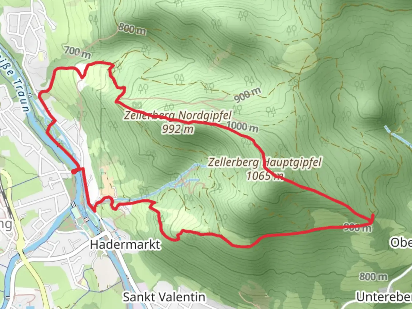
Wittelsbacher Hohe, Zellerberg Hauptgipfel and Zellerberg Nordgipfel Loop
Download
Preview
Add to list
More
6.3 km
~2 hrs 2 min
468 m
Loop
“Explore Traunstein's 6 km loop trail for stunning views, diverse wildlife, and rich historical landmarks.”
Starting near the picturesque town of Traunstein in Germany, this loop trail covers approximately 6 km (3.7 miles) with an elevation gain of around 400 meters (1,312 feet). The trailhead is conveniently located near Traunstein, making it accessible by both public transport and car. If you're traveling by train, the Traunstein station is well-connected to major cities like Munich and Salzburg. From the station, local buses or a short taxi ride will get you to the trailhead. For those driving, there are parking facilities available near the starting point.
Trail Overview
The trail begins with a gentle ascent through lush forests, offering a serene start to your hike. As you progress, the path becomes steeper, leading you to the first significant landmark, Wittelsbacher Hohe. This section is approximately 2 km (1.2 miles) into the hike and offers panoramic views of the surrounding Bavarian countryside. The elevation gain here is about 150 meters (492 feet), making it a moderate climb.
Wittelsbacher Hohe to Zellerberg Hauptgipfel
Continuing from Wittelsbacher Hohe, the trail meanders through a mix of dense woodland and open meadows. This part of the hike is particularly rich in flora and fauna, so keep an eye out for local wildlife such as deer and various bird species. After another 1.5 km (0.9 miles), you'll reach Zellerberg Hauptgipfel, the main peak of the Zellerberg. The elevation gain to this point is an additional 100 meters (328 feet), bringing you to a total of 250 meters (820 feet) so far.
Zellerberg Hauptgipfel to Zellerberg Nordgipfel
From the Hauptgipfel, the trail continues to the Zellerberg Nordgipfel, which is about 1 km (0.6 miles) away. This section is less steep but still offers a good workout, with an elevation gain of around 50 meters (164 feet). The Nordgipfel provides another excellent vantage point for taking in the scenic beauty of the region.
Return Loop
The return journey takes you through a different route, completing the loop. This part of the trail is more relaxed, descending gradually back to the trailhead. Along the way, you'll pass through charming clearings and small streams, making it a pleasant end to your hike. The final 1.5 km (0.9 miles) of the trail descends about 200 meters (656 feet), bringing you back to your starting point.
Historical Significance
The region around Traunstein has a rich history, with roots dating back to Roman times. The Wittelsbacher Hohe is named after the Wittelsbach family, a prominent Bavarian dynasty that played a significant role in the region's history. As you hike, you'll come across several informational plaques detailing the historical significance of various landmarks.
Navigation
For navigation, it's highly recommended to use the HiiKER app, which provides detailed maps and real-time updates to ensure you stay on the right path. The trail is well-marked, but having a reliable navigation tool can enhance your hiking experience.
This loop trail offers a balanced mix of natural beauty, moderate physical challenge, and historical intrigue, making it a rewarding experience for hikers of all levels.

What to expect?
Activity types
Comments and Reviews
User comments, reviews and discussions about the Wittelsbacher Hohe, Zellerberg Hauptgipfel and Zellerberg Nordgipfel Loop, Germany.
4.25
average rating out of 5
4 rating(s)