Download
Preview
Add to list
More
11.3 km
~3 hrs 39 min
837 m
Loop
“Explore the stunning 11 km Sonnwendköpfl and Taubensee Loop, featuring alpine views, diverse wildlife, and historical charm.”
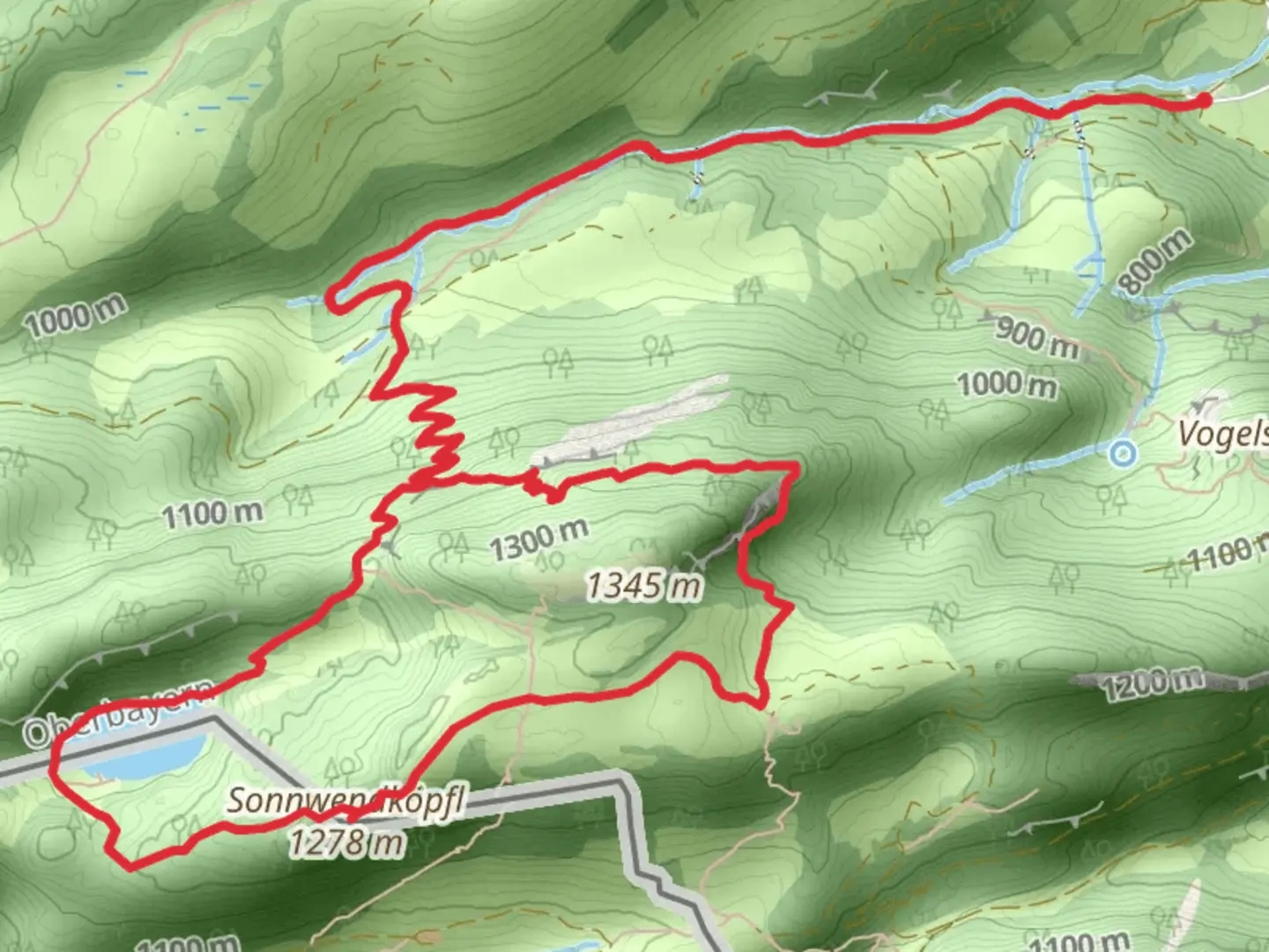
Starting near Traunstein, Germany, the Sonnwendköpfl and Taubensee Loop via Luftbodensteig is a captivating 11 km (approximately 6.8 miles) loop trail with an elevation gain of around 800 meters (about 2,625 feet). This medium-difficulty hike offers a blend of natural beauty, historical significance, and diverse wildlife, making it a rewarding experience for outdoor enthusiasts.### Getting There To reach the trailhead, you can either drive or use public transport. If driving, head towards Traunstein and look for parking options near the starting point. For those using public transport, take a train to Traunstein station and then a local bus or taxi to the trailhead. The nearest significant landmark to the trailhead is the town of Traunstein itself, which is well-connected by both road and rail.### Trail Overview The trail begins with a gentle ascent through lush forests, providing a serene start to your hike. As you progress, the path becomes steeper, leading you to the first significant landmark, the Sonnwendköpfl peak. This section covers approximately 3 km (1.9 miles) and involves an elevation gain of about 400 meters (1,312 feet). The peak offers panoramic views of the surrounding Bavarian Alps, making it a perfect spot for a short break and some photography.### Luftbodensteig Section Continuing from Sonnwendköpfl, the trail transitions into the Luftbodensteig section. This part of the hike is characterized by narrow paths and rocky terrain, requiring careful navigation. Using HiiKER for navigation is highly recommended here to ensure you stay on track. The Luftbodensteig section spans around 4 km (2.5 miles) and includes an additional elevation gain of 200 meters (656 feet). Along this stretch, you'll encounter diverse flora and fauna, including alpine flowers and possibly some local wildlife like chamois or marmots.### Taubensee and Historical Significance As you descend from the Luftbodensteig, you'll approach Taubensee, a picturesque mountain lake. This serene spot is ideal for a longer rest, perhaps even a picnic. The lake is steeped in local history, with legends suggesting it was a site of ancient rituals. The area around Taubensee is also known for its rich biodiversity, including various bird species and aquatic life.### Final Stretch The final 4 km (2.5 miles) of the loop take you through a mix of forested areas and open meadows, gradually descending back towards the trailhead. This section is relatively easier, allowing you to enjoy the natural beauty without much physical strain. Keep an eye out for traditional Bavarian farmhouses and grazing livestock, which add a cultural touch to your hike.### Wildlife and Nature Throughout the hike, you'll be immersed in the natural beauty of the Bavarian Alps. The trail is home to a variety of wildlife, including deer, foxes, and numerous bird species. The flora is equally diverse, with alpine flowers, dense forests, and open meadows providing a constantly changing landscape.### Preparation and Safety Given the medium difficulty rating, it's essential to be well-prepared. Wear sturdy hiking boots, carry sufficient water, and pack some snacks or a light meal. Weather in the Alps can be unpredictable, so bring a rain jacket and some warm layers. Using HiiKER for navigation will help you stay on course and avoid any potential hazards.This trail offers a perfect blend of natural beauty, historical intrigue, and physical challenge, making it a must-visit for any hiking enthusiast exploring the Bavarian Alps.

What to expect?
Activity types
Comments and Reviews
User comments, reviews and discussions about the Sonnwendköpfl and Taubensee Loop via Luftbodensteig, Germany.
5.0
average rating out of 5
2 rating(s)