Download
Preview
Add to list
More
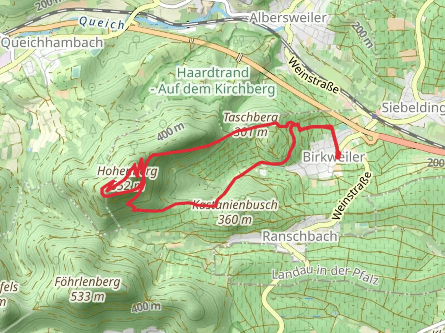
8.7 km
~2 hrs 37 min
528 m
Loop
“Explore a 9 km loop near Südliche Weinstraße, blending natural beauty, moderate challenge, and historical intrigue.”
Starting near the picturesque Südliche Weinstraße in Germany, this 9 km (5.6 miles) loop trail offers a delightful mix of natural beauty, moderate challenge, and historical intrigue. With an elevation gain of around 500 meters (1,640 feet), hikers should prepare for a moderately strenuous journey through varied terrain.
Getting There
To reach the trailhead, you can drive or use public transport. If driving, set your GPS to Südliche Weinstraße, Germany, and look for parking options near the trailhead. For those using public transport, the nearest significant landmark is the town of Annweiler am Trifels. From there, local buses or a short taxi ride can get you to the starting point.
Trail Overview
The loop begins with a gentle ascent through lush forests, where you'll be greeted by the serene sounds of nature. Early on, the trail meanders through dense woodland, offering ample shade and a cool, refreshing atmosphere. Keep an eye out for local wildlife, including deer and various bird species that inhabit the area.
Taschberg
Approximately 3 km (1.9 miles) into the hike, you'll reach Taschberg. This section involves a steeper climb, so be prepared for a bit of a workout. The effort is well worth it, as the summit provides stunning panoramic views of the surrounding countryside. On clear days, you can see for miles, making it an excellent spot for a rest and some photos.
Schuhmacherfelsen
Continuing on, the trail leads you to Schuhmacherfelsen, a notable rock formation that stands as a testament to the region's geological history. This area is particularly popular among rock climbers, so you might see some in action. The rock formations here are fascinating, and the vantage points offer another opportunity for breathtaking views.
Hohenberg
The final significant landmark on this loop is Hohenberg. This section of the trail is less steep but involves a steady climb. Hohenberg is historically significant, with remnants of ancient fortifications that date back to medieval times. Take a moment to explore these ruins and imagine the history that unfolded here centuries ago.
Navigation and Safety
Given the varied terrain and elevation changes, it's advisable to use a reliable navigation tool like HiiKER to stay on track. The trail is well-marked, but having a digital map can provide extra assurance. Wear sturdy hiking boots, bring plenty of water, and pack some snacks to keep your energy levels up.
Flora and Fauna
Throughout the hike, you'll encounter a diverse range of flora, from towering pines to delicate wildflowers. The forested areas are home to a variety of wildlife, so keep your eyes peeled for deer, foxes, and an array of bird species. The changing seasons bring different highlights, from vibrant autumn foliage to springtime blossoms.
Final Stretch
As you loop back towards the starting point, the trail descends gently, allowing for a relaxed finish. The final stretch offers more beautiful forest scenery and a chance to reflect on the diverse landscapes and historical sites you've encountered.
This 9 km loop is a rewarding hike that combines natural beauty, moderate physical challenge, and a touch of history, making it a must-visit for any hiking enthusiast.

What to expect?
Activity types
Comments and Reviews
User comments, reviews and discussions about the Taschberg, Schuhmacherfelsen and Hohenberg Loop, Germany.
4.0
average rating out of 5
2 rating(s)