EXPO Rundweg St Martin and Edenkoben Naturpark Pfaelzerwald 1
8.6 km
~2 hrs 33 min
506 m
“This 9 km trail near Südliche Weinstraße blends natural beauty, historical landmarks, and moderate hiking challenges.”
Starting near the picturesque Südliche Weinstraße in Germany, this 9 km (approximately 5.6 miles) loop trail offers a delightful mix of natural beauty and historical intrigue. With an elevation gain of around 500 meters (approximately 1,640 feet), the trail is rated as medium difficulty, making it suitable for moderately experienced hikers.
### Getting There To reach the trailhead, you can drive or use public transport. If driving, head towards the Südliche Weinstraße region, where ample parking is available near the starting point. For those using public transport, the nearest significant landmark is the town of Edenkoben. From there, local buses or a short taxi ride can get you to the trailhead.
### Trail Navigation For navigation, it's highly recommended to use the HiiKER app, which provides detailed maps and real-time updates to ensure you stay on track.
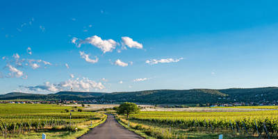
### Trail Highlights As you embark on the trail, you'll first encounter lush vineyards that are characteristic of the Südliche Weinstraße region. These vineyards are not only beautiful but also historically significant, as this area has been a wine-producing region for centuries.
### Flora and Fauna The trail winds through the Naturpark Pfälzerwald, a protected area known for its rich biodiversity. Keep an eye out for native wildlife such as deer, wild boar, and a variety of bird species. The forest is also home to numerous plant species, including oak, beech, and pine trees.
### Historical Landmarks Around the 3 km (1.9 miles) mark, you'll come across the ruins of an old castle, a testament to the region's medieval history. This spot offers a great opportunity to take a break and soak in the panoramic views of the surrounding landscape.
### Mid-Trail Elevation As you continue, the trail begins to ascend more steeply, gaining approximately 300 meters (984 feet) in elevation over the next 2 km (1.2 miles). This section can be challenging, so take your time and enjoy the serene forest surroundings.
### Scenic Overlook At around the 6 km (3.7 miles) point, you'll reach a scenic overlook that offers breathtaking views of the Pfälzerwald and the distant Rhine Valley. This is an ideal spot for a picnic or a rest before beginning your descent.
### Descent and Return The final 3 km (1.9 miles) of the trail involve a gradual descent back towards the starting point. This section is less strenuous and allows you to enjoy the tranquil forest atmosphere as you make your way back.
### Practical Tips - Wear sturdy hiking boots, as the trail can be rocky and uneven in places. - Bring plenty of water and snacks, especially if you plan to take breaks at the scenic spots. - Check the weather forecast before heading out, as conditions can change rapidly in the forested areas.
This trail offers a perfect blend of natural beauty, historical landmarks, and moderate physical challenge, making it a rewarding experience for any hiker.
Reviews
User comments, reviews and discussions about the EXPO Rundweg St Martin and Edenkoben Naturpark Pfaelzerwald 1, Germany.
5.0
average rating out of 5
2 rating(s)


