Download
Preview
Add to list
More
6.3 km
~1 hrs 26 min
107 m
Loop
“Explore the scenic 6 km Trevvel Route Loop via Kalltalsperre, blending natural beauty and historical landmarks.”
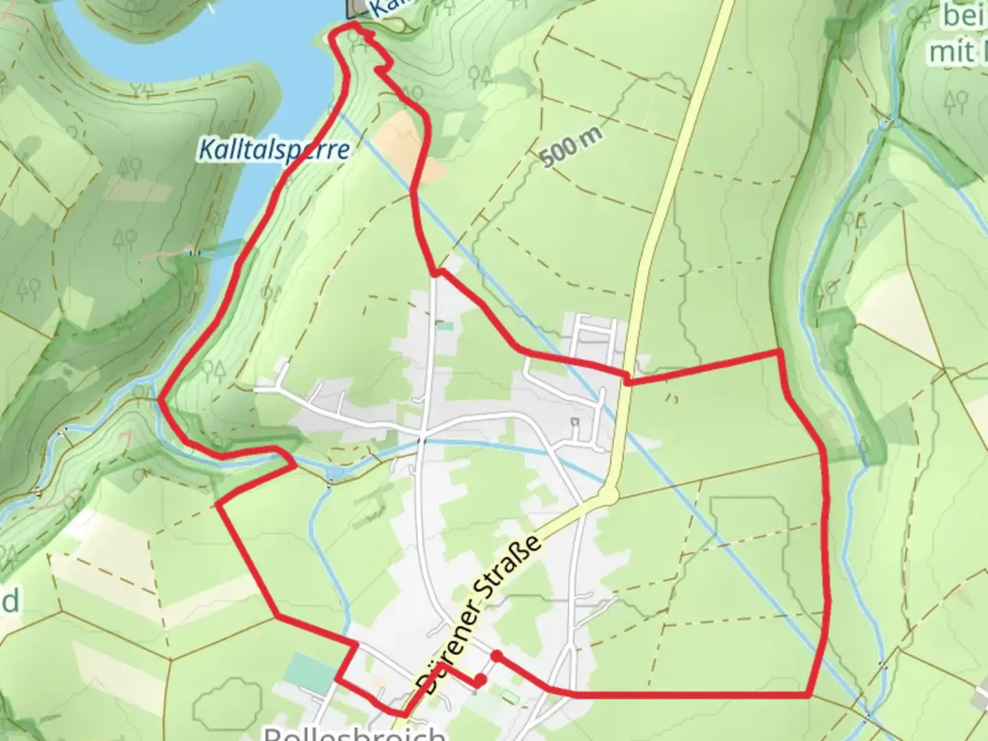
Starting near Städteregion Aachen, Germany, the Trevvel Route Loop via Kalltalsperre is a scenic 6 km (approximately 3.7 miles) loop trail with an elevation gain of around 100 meters (328 feet). This trail is rated as medium difficulty, making it suitable for hikers with some experience.### Getting There To reach the trailhead, you can either drive or use public transport. If driving, set your GPS to the nearest known address, which is near the Kalltalsperre dam. For those using public transport, take a train or bus to the nearest station in Aachen and then a local bus towards the Kalltalsperre area. The trailhead is easily accessible from there.### Trail Navigation For navigation, it is highly recommended to use the HiiKER app, which provides detailed maps and real-time updates. This will help you stay on track and make the most of your hike.### Trail Highlights The trail begins near the Kalltalsperre dam, a significant landmark in the region. The dam itself is an engineering marvel and offers a great starting point for your hike. As you proceed, you'll encounter a mix of forested areas and open landscapes, providing a variety of scenery.### Flora and Fauna The trail is rich in biodiversity. Keep an eye out for native wildlife such as deer, foxes, and a variety of bird species. The forested sections are home to oak, beech, and pine trees, offering a lush canopy that provides shade and a cool atmosphere.### Historical Significance The region around Städteregion Aachen has a rich history. During your hike, you may come across remnants of old structures and pathways that date back to medieval times. The Kalltalsperre dam itself has historical significance, having been constructed in the early 20th century to provide water supply and flood control.### Key Landmarks - Kalltalsperre Dam: Starting point and a significant landmark. - Forest Sections: Approximately 2 km (1.2 miles) into the hike, you'll enter a dense forest area. - Open Landscapes: Around the 4 km (2.5 miles) mark, the trail opens up, offering panoramic views of the surrounding countryside.### Elevation and Terrain The trail features a moderate elevation gain of around 100 meters (328 feet), spread out over the 6 km (3.7 miles). The terrain is a mix of well-maintained paths and some rocky sections, so sturdy hiking boots are recommended.### Safety and Preparation Given the medium difficulty rating, it's advisable to carry sufficient water, snacks, and a basic first-aid kit. Weather can be unpredictable, so check the forecast and dress in layers. Using the HiiKER app will also help you stay informed about any trail conditions or closures.### Final Stretch As you near the end of the loop, you'll return to the vicinity of the Kalltalsperre dam, completing your hike. This area offers picnic spots where you can rest and enjoy the views before heading back.This trail offers a balanced mix of natural beauty, historical landmarks, and moderate physical challenge, making it a rewarding experience for hikers.

What to expect?
Activity types
Comments and Reviews
User comments, reviews and discussions about the Trevvel Route Loop via Kalltalsperre, Germany.
4.75
average rating out of 5
4 rating(s)