Download
Preview
Add to list
More
4.9 km
~1 hrs 7 min
82 m
Loop
“Discover a scenic, historic 5 km loop near Aachen, offering lush forests, wildlife, and Charlemagne lore.”
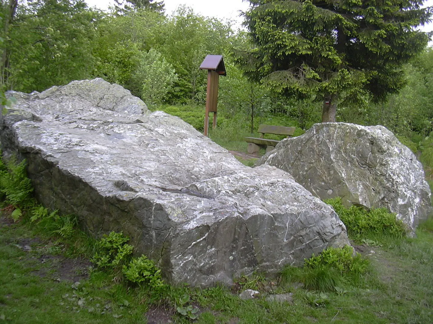
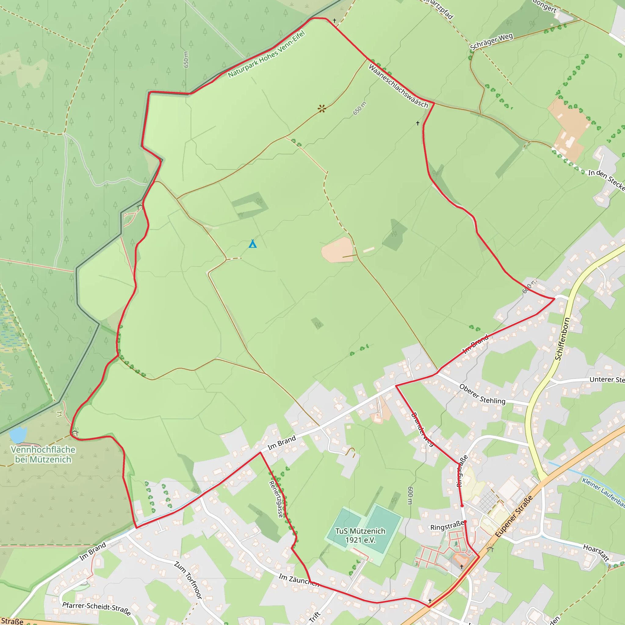
Starting near the Städteregion Aachen in Germany, this 5 km (approximately 3.1 miles) loop trail offers a delightful mix of natural beauty and historical intrigue. With no significant elevation gain, it’s accessible to a wide range of hikers, though it is rated as medium difficulty due to some uneven terrain and potentially muddy sections.### Getting There To reach the trailhead, you can drive or use public transport. If driving, set your GPS to the nearest known address: Monschauer Str. 55, 52076 Aachen, Germany. There is a small parking area nearby. For those using public transport, take a bus to the "Aachen, Kornelimünster" stop, which is a short walk from the trailhead.### Trail Highlights The trail begins with a gentle walk through lush, green forests. Early on, you’ll encounter the serene Vennbahn, a former railway line now converted into a popular cycling and walking path. This section is particularly picturesque, with dense foliage and the occasional glimpse of local wildlife such as deer and various bird species.### Historical Significance One of the most intriguing aspects of this trail is its historical significance. The name "Kaiser Karls Bettstatt" translates to "Emperor Charles' Bedstead," referring to Charlemagne, who is said to have rested in this area. As you hike, you’ll come across a large stone slab, believed to be the very spot where Charlemagne once slept. This landmark is approximately 2 km (1.2 miles) into the hike and is well-marked with informational plaques detailing its historical context.### Nature and Wildlife The trail meanders through a variety of landscapes, from dense forests to open meadows. Keep an eye out for the diverse flora, including wildflowers and ancient oak trees. The area is also home to a variety of wildlife, including foxes, badgers, and numerous bird species. The trail is particularly beautiful in the spring and autumn when the foliage is at its most vibrant.### Navigation Given the loop nature of the trail, navigation is straightforward, but it’s always wise to have a reliable map. The HiiKER app is an excellent tool for this purpose, providing detailed maps and real-time GPS tracking to ensure you stay on course.### Practical Tips - Wear sturdy hiking boots, as some sections can be muddy, especially after rain. - Bring water and snacks, as there are no facilities along the trail. - Check the weather forecast before heading out, as conditions can change rapidly. - If hiking in the summer, consider insect repellent to ward off mosquitoes and ticks.This trail offers a perfect blend of natural beauty and historical intrigue, making it a rewarding experience for any hiker.
What to expect?
Activity types
Comments and Reviews
User comments, reviews and discussions about the Ruf des Venns and Kaiser Karls Bettstatt Loop, Germany.
4.17
average rating out of 5
6 rating(s)

